Mystery Friday Foto #75 Solved: 1935 Aerial of Bethpage and Old Bethpage
In celebration of Independence Day, this week's Mystery Foto was a classic aerial of the Long Island Motor Parkway.
Mystery Foto questions:
-Identify the location and orientation of the aerial
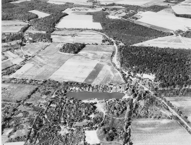
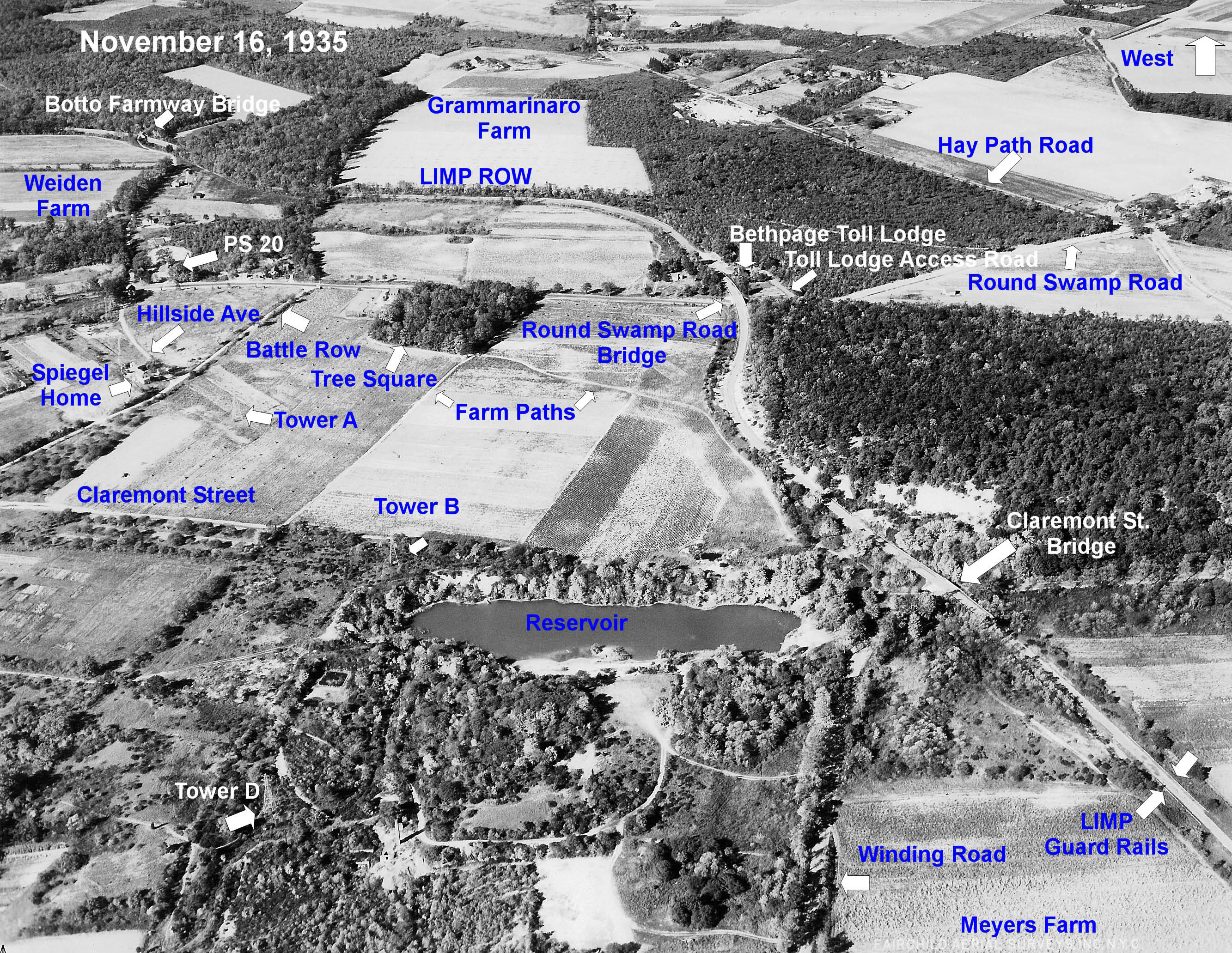
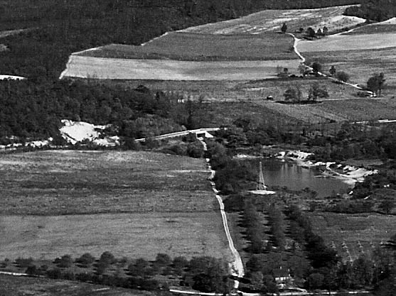
Bethpage and Old Bethpage looking west.
-What year was the aerial taken?
The aerial was taken on November 16, 1935. Note: Although the Motor Prkway was active, not a single car can be seen on the road.
-Identify the Long Island Motor Parkway landmarks
From top to bottom:
Botto Farmway Bridge
Round Swamp Round Bridge
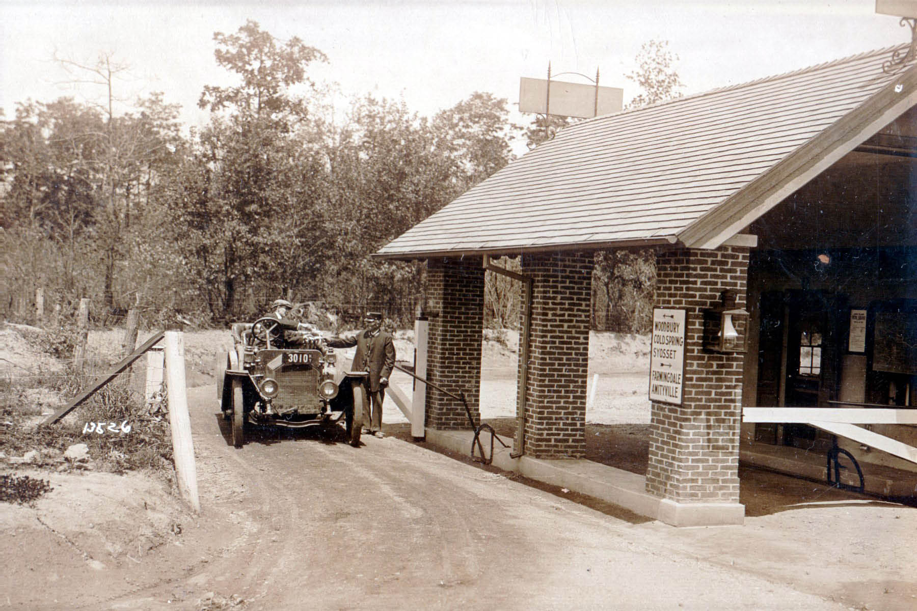
Bethpage Toll Lodge
Claremont Road Bridge
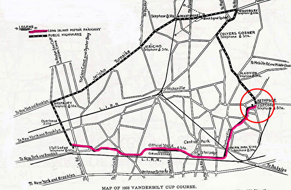
-What year(s) was this section of the Motor Parkway used for the Vanderbilt Cup Races?
The Motor Parkway section of the 1908 Vanderbilt Cup Race course ended at Round Swamp Road. For the 1909 and 1910 races , the Motor Parkway section of the course ended at Massapequa-Hicksville Road.
Congrats to Joe Oesterle, Steve Lucas, Ted, Tim Ivers, Harry Bell, Art Kleiner and Frank Femenias for correctly identifying the location.. Kudos to Joe O., Steve Lucas and Frank Femenias for correctly identifying this section as part of the 1908 Vanderbilt Cup Race course.,
Enjoy,
Howard Kroplick
Botto Farmway Bridge
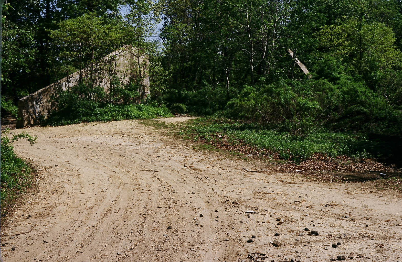
The abutments of the Botto Farmway Bridge as photographed in the 1980s by Ron Ridolph.
Bethpage Toll Lodge and Round Swamp Road Bridge
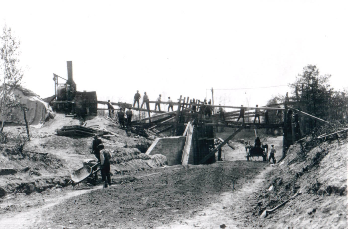
The Round Swamp Road Bridge under construction in April 1910, looking south.
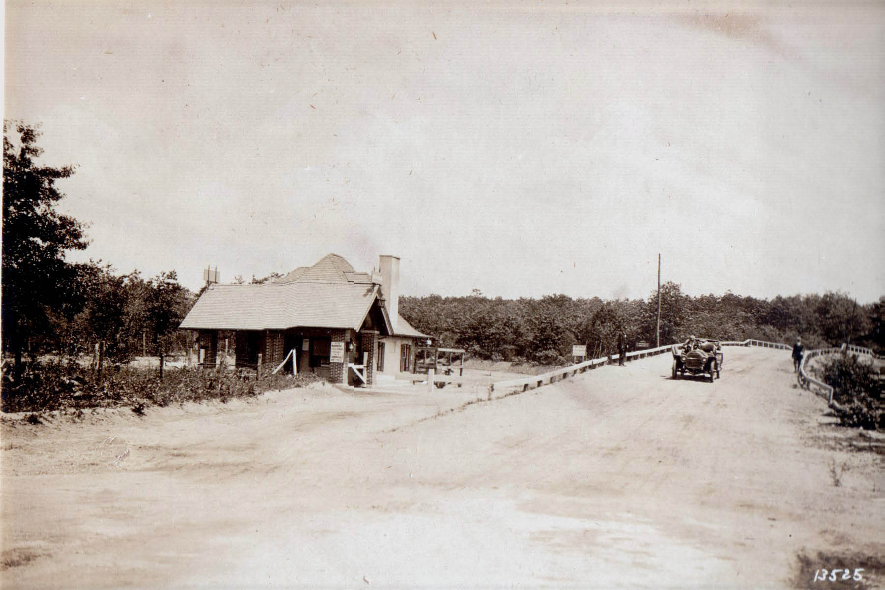
A view of the Bethpage Toll Lodge and the Round Swamp Road Bridge looking east.
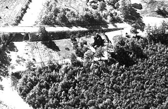
A 1935 aerial view of the Bethpage Toll Lodge and the Round Swamp Road Bridge. Note the entance road to the lodge and the Motor Parkway.
The Bethpage Toll Lodge circa 1911.
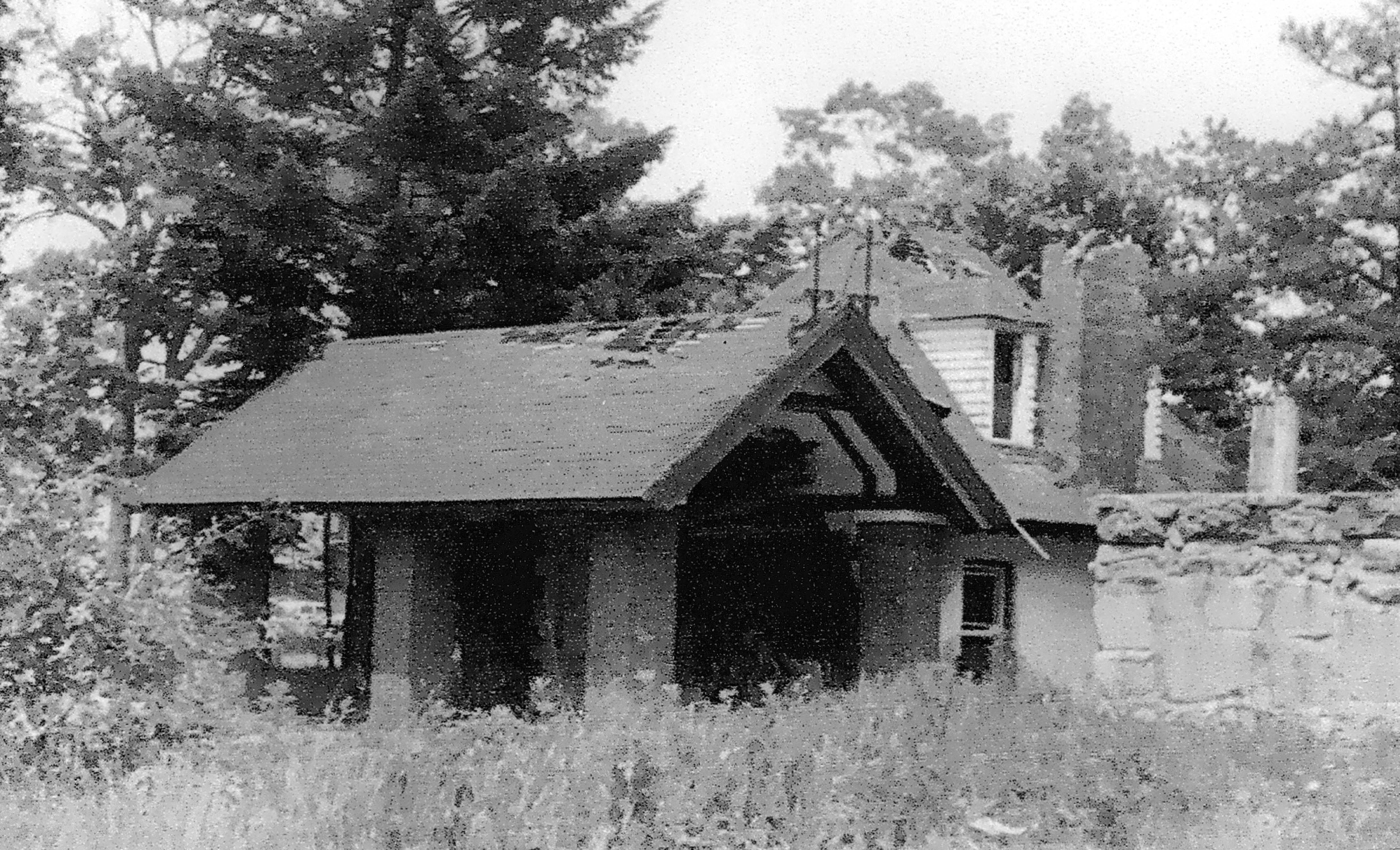
The Bethpage Toll Lodge in ruins in the early 1960s.
Claremont Road Bridge
The Claremont Road Bridge in 1927, looking north.
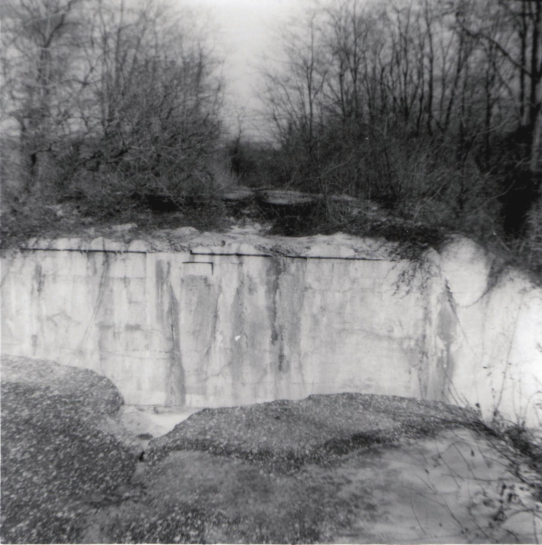
The bridge's abutments as seen in the 1960s.
1908 Vanderbilt Cup Race Course


Comments
Round Swamp. 1930ish. Part of 1908 Course. Bridge over Round Swamp Rd. Bethpage Toll Lodge. Botto Bridge.
Wild guess: where the parkway went through Melville, and across first Maxess Road and then Ruland Road, east of Route 110?
This 1935 photo is looking west in the vicinity of the northern section of today’s Bethpage State Park. The LIMP goes across the center of thephoto from left to right curving down to the lower right corner, with the bridge over Round Swamp Road. Also in the photo is the Bethpage Lodge and the Botto farmway bridge. 1908 was the only year that the Vanderbilt Cup Race (along with all the other sweepstakes races) used this section of the LIMP.
Don’t be shocked people, I got it this time. I had a lot of time today, with this rainy day. Here goes. It’s a few of the Botto Farmway in Bethpage, now the Bethpage State Park. The aerial was taken in 1935. This section of LIMP was used in 1908 and 1910. As for the landmarks, I’ll get back to that
That third close-up photo had me confused. It’s not in the actual “mystery photo” but shows a section of of the LIMP slightly east of where the mystery photo leaves off in the lower right corner. I think the Claremont Road and/or Foster farmway bridge(s) are in that close-up.
_______________________________
From Howard Kroplick
Steve, I updated the blog photo with the unedited version.
Looks a lot like Round Swamp Road, Old Bethpage, left to right across bottom, with the LIMP
snaking in a curve right bottom across to upper left, with Bethpage toll lodge and Round Swamp Road bridge at bottom right. Claremont Road bridge at upper left. Photo about 1927.
Used for 1910 Cup race.
At first glance it sure looks like we’re above today’s Rte. 110 looking LI west over Spagnoli (Bethpage-Sweet Hollow) Road, with the surviving farmway bridge in OBVR at lower right and the so-called second (northern) Deadman’s Curve at upper left. Sam, III
Hi Howard
This looks like Old Bethpage back in the early 20’s with its farms and very little development. Photo taken from theNassau/Suffolk line looking west. The triangle upper middle on the right would be formed by Old Bethpage Rd. and Round Swamp Rd. with Haypath Rd. capping off the triangle on the right. The second close shows the bridge over Round Swamp Rd. and the toll house now occupied by a fire house. The middle left road at a 45’ angle is Battle Row named for the tenants who worked the farms and did the sand mining. The sand mining was carried on toward the bottom of the photo. The road just above the water filled sand pit would be Claremont Rd.
Nice photo
Harry Bell
I know there has to be more landmarks than what I’m going to mention, Round Swamp Road and the Bethpage Lodge. I see lots of others things that I’m not sure of, maybe Powell Ave and Old Bethpage Rd. I think I did pretty good
let’s try this. Fairchild aerial photo of Bethpage, Round Swamp Road. 1935.
Bethpage lodge, Powell Ave. bridge. Used in the 1908-1910 Vanderbilt Cup Races.
Almost missed the Mystery train. Old Bethpage/Bethpage/Central Park looking West. I’m going with approximately 1915. At the bottom right is one of the three original toll houses by J.R. Pope, the Bethpage Lodge (1908-1938) and its access road off of Round Swamp Rd. The lodge remained abandoned until 1960, then destroyed! (I would’ve gladly moved in and fixed ‘er up). The Round Swamp Rd Pkwy Bridge, and the Botto Farm Hwy Bridge. The longer 1908 course was the only race using this area (besides the rumrunners) Battlegrounds at the bottom. While cheating for race years, I noticed the 1914 Vanderbilt Race used guardrails that were not made of humans. For a while I thought Botto’s rectangular farm and access road at the top left was today’s half of Bethpage Park parking lot, though same shape and vicinity, the parking lot is actually smaller and a bit more to the west. This site is packed with all sorts of goodies. Much thanks Howard and Dana.
Remind me to never be away on vacation while my favorite type of mystery photo gets posted!
So I did do good on this one, better than I thought I did. I’m surprised that there wasn.t more answering this one