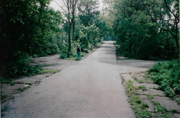
Mystery Foto #43 Solved: A 1996 of the Entrance and Exit Ramps to Springfield Boulevard at the Rocky Hill Lodge Site
My favorite co-author Al Velocci challenged you to solve this Mystery Motor Parkway Foto.
Answers to the Mystery Foto questions
Identify the following:
- The location of the Mystery Foto
On the Motor Parkway bike path at the site of the Rocky Hill Lodge in Oakland Gardens, Queens.
- The orientation of the photographer and bridge
Looking west toward the Springfield Boulevard Motor Parkway Bridge.
Comments (12)
Congrats to Greg O., Brian Hale, Joe Oseterle, Alan W, Frank Femenias, Michael LaBarbera, Art Kleiner, Steve Lucas, Roy M. Warner, Sam Berliner III, Dave Russo and Vincent Reale for identifying the Springfield Boulevard location.
Kudos to Greg O. and Frank Femenias for submitting jpegs.
Do you have a Mystery Foto? Please forward to [email protected] and get a kudo!
Enjoy,
Howard Kroplick
Close-Ups
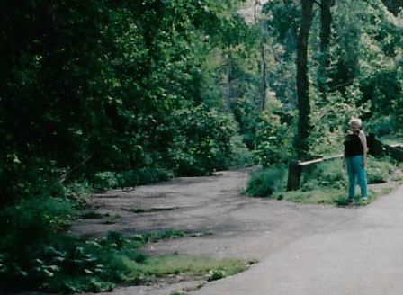

2020 View submitted by Greg and Dee O.
1940 Aerial of Rocky Hill Lodge and Oakland Gardens, Queens
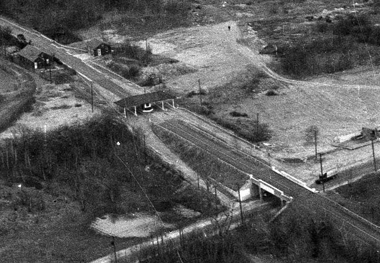
This amazing aerial confirms that the Mystery Foto photographer was standing on almost the exact location for the Rocky Hill Lodge. The lodgekeeper's residence can be seen behind the lodge.
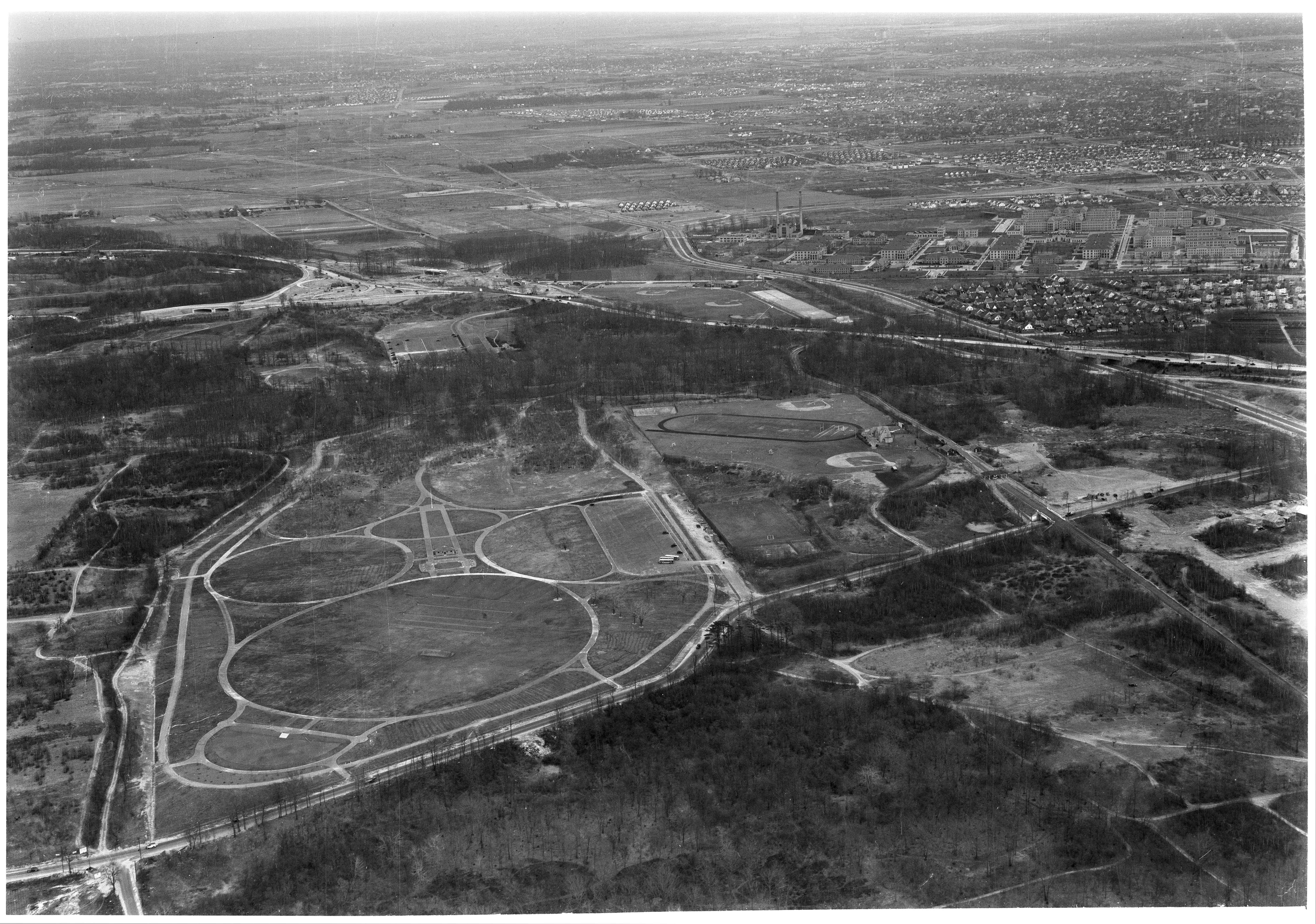
The aerial was taken to show the athletic fields of the Adelphi Academy. How many Motor Parkway bridges are in this aerial?


Comments
A softball!
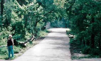
The entrance/exit ramps for the Rocky Hill Road lodge looking west. The Rocky Hill/Springfield Blvd bridge in the distance.
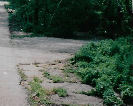
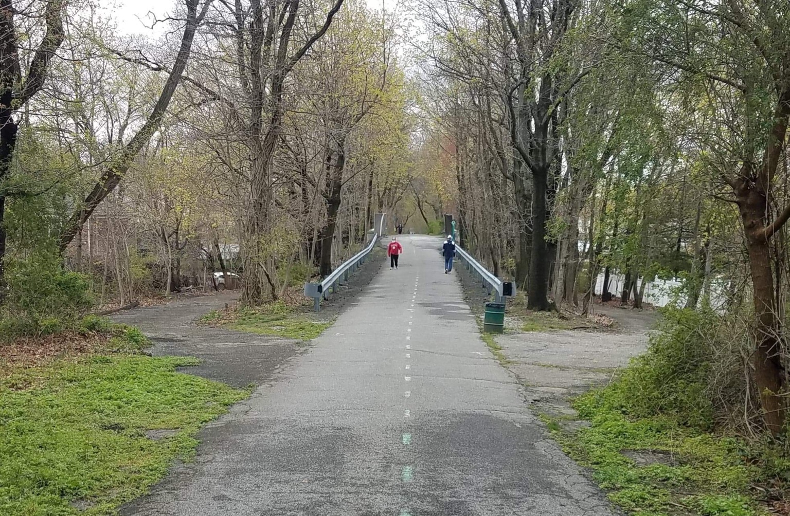
Below was the same location when Dee and I walked the Queens section in April.
Springfield Blvd entrance looking west.?
Springfield Blvd bridge. Looking west.
This is the approach to the Springfield Blvd. bridge,looking westward. The photographer is standing in the approximate location of the former toll booth and you can see the entrance and exit ramps on either side of the parkway. This was the western terminus for a period of time (Rocky Hill).
Toll Gatekeeper Sidney Jones’ view from inside the Rocky Hill Road booth/gate, awaiting motorists to approach him to access the Motor Parkway behind him. Not many motorists would approach but those who did would come from the nearby left ramp, an access ramp from Rocky Hill Road (Springfield Blvd today), or from further away down the straight roadway, from Nassau Blvd (Horace Harding Blvd, LIE). Adequate housing/garage was accommodated for Jones nearby the toll booth. We’re looking west down the Motor Parkway in Queens County. This was the Motor Pkwy western terminus in 1924, before the bridge (shown) was constructed. Hey, pedestrians not allowed on the parkway! Great photo Al, thank you!!
Springfield Blvd looking west from the entrance and exit toward Springfield Blvd. Took a walk there a few years ago it seems the same.
Rocky Hill Road, Queens
Looking west
Springfield Blvd. Motor Parkway Bridge
I believe we are looking west in Queens in the vicinity of Alley Pond Park and approaching the bridge over Springfield Blvd. (Rocky Hill Road).
Springfield Ave entrance looking west.
I might be wrong, but it looks familiar to me. If it’s the Springfield Blvd (formerly Rocky Hill Rd) bridge, then I rode on it hundreds of times as a kid growing up in Fresh Meadows and taking the “Motor Parkway” from Peck Avenue to the end (Creedmor). Orientation is looking westbound. The photographer is standing just east of the entrance (photographer’s left) and exit (photographer’s right).
Here goes nothing! I’d guess it’s Springfield Blvd., looking west, where the on-off ramps are still extant. Sam, III
Easy one!
Looking west at Springfield Blvd bridge. Exit ramps on both sides.
This looks like it’s in Oakland Gardens Queens, with the exit ramps to Springfield Blvd facing west.
Howard is being kind in not mentioning that when I supplied him with this photo I told him I thought we were looking west at the Bell Blvd. bridge and the cut on the left was the old ROW of the Parkway. in 1996 there still were traces of asphalt of the original Parkway row on the east side of Bell Blvd. Over a period of several weeks that year I cut a path on the old ROW from the new ROW to Bell Blvd. There were several broken posts lying about.
Al, a few years ago Brian and I investigated the same spot where the original RoW would’ve converged with today’s greenway. By then we could not find evidence of pavement/posts with the overgrowth having taken over. The existing short-path quickly drops down, serving as today’s Bell Blvd bridge abutment. I’ve yet to see a photo of the curved parkway as it heads towards and over the CRR bridge. I’m curious if Howard’s mystery #41 photo has an opposite facing sister showing the bridge.
I failed to mention motorists were also reaching the Rocky Hill toll booth from a temporary ramp created over time at 73 Ave. Also realized that cars stopping at the Rocky Hill booth had to stop again at the Great Neck kiosk just 3 miles down the road. Seems the frequent stops was an inconvenience on a road intended for uninterrupted flow.
Great Neck lodge stop sign, just 3 miles east of Rocky Hill lodge