Mystery Foto #35 Solved:Williston Park/East Williston/Albertson Section of the Motor Parkway in 1938
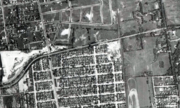
Master Mystery Foto detective Greg Oreiro submitted this Mystery Foto aerial of a section of the Long Island Motor Parkway.
Answers to Mystery Foto questions:
-Identify this section of the Motor Parkway
This is a 1938 aerial of the Motor Parkway located in Williston Park, Williston and Albertson. The aerial was discovered by Greg online at the Stony Brook University Libraries Digital Collection.
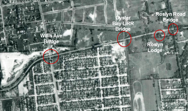
-Identify the Motor Parkway bridges in the aerial
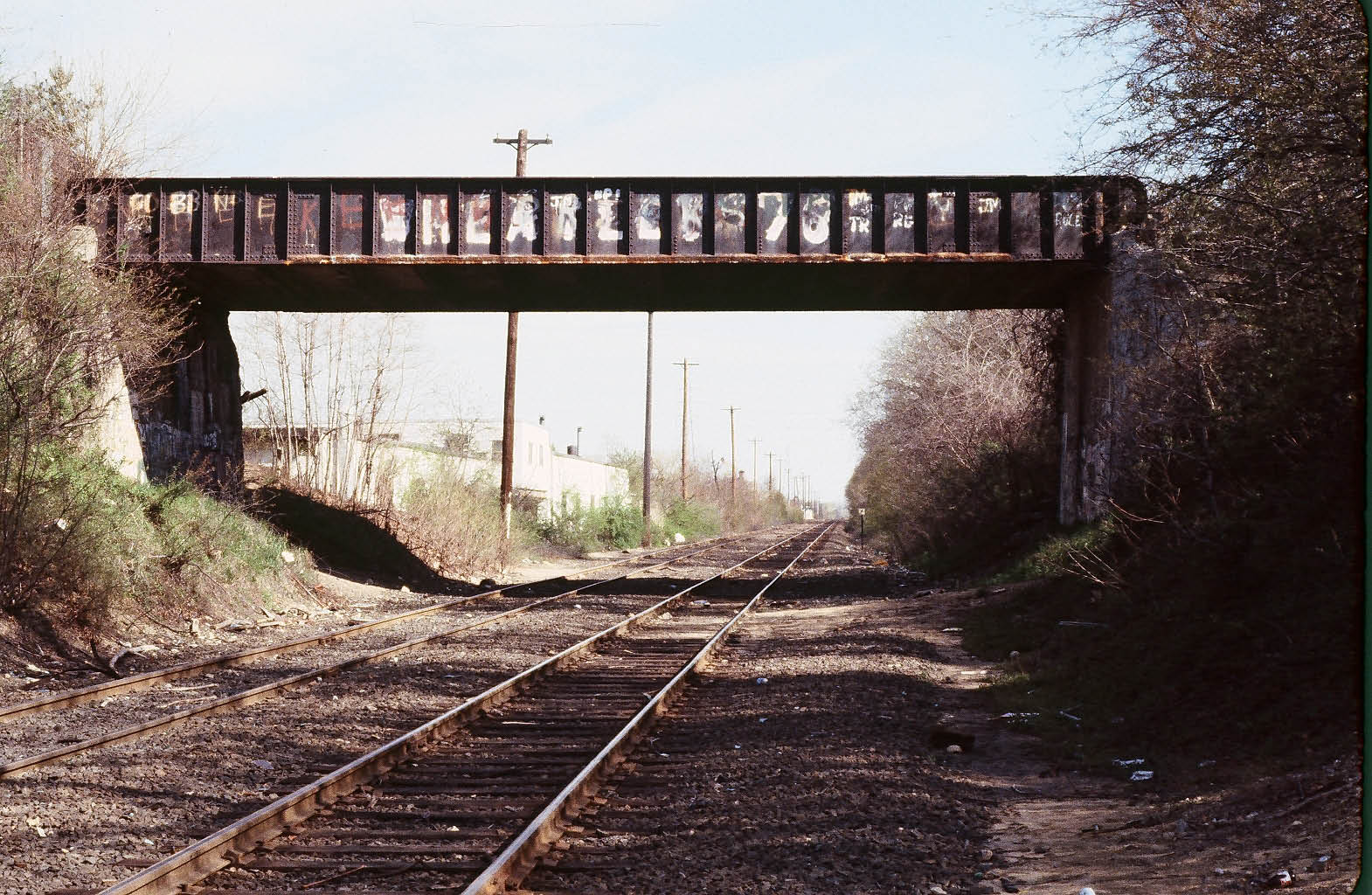
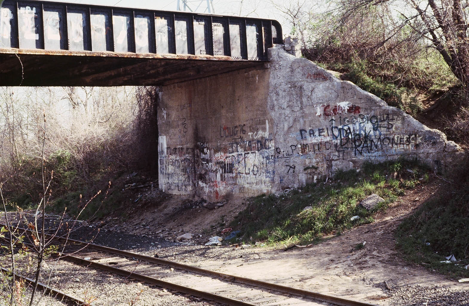
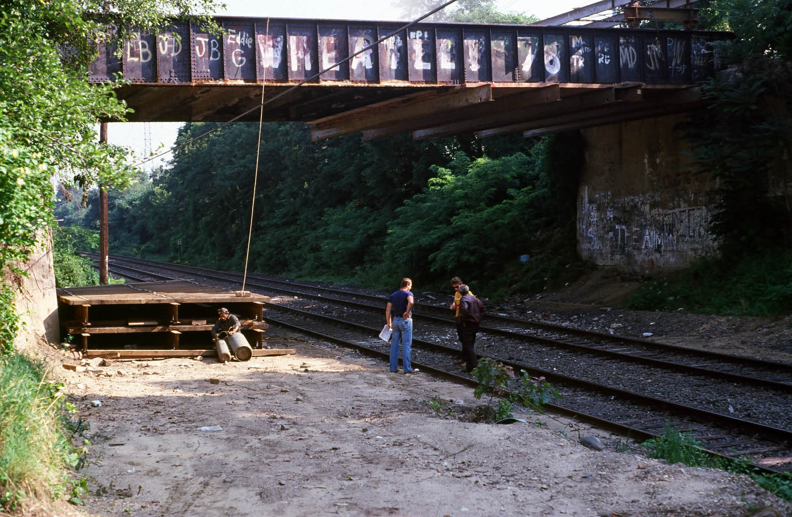
Three- Willis Avenue, Oyster Bay LIRR Branch and Roslyn Road
-What other Motor Parkway structure can be seen in the aerial?
Roslyn Lodge
Congratulations to Bill Clark, George Nossa, Joe Oesterle, Tim Gillane and Kevin Dunn for correctly identifying this section of the Motor Parkway.
If you have a suggested Mystery Foto, please send a jpeg to [email protected] .
Enjoy,
Howard Kroplick
Willis Avenue Motor Parkway Bridge (Courtesy of Bob and Ruth Valentine)
View looking north on the east side of Willis Avenue.
View looking north on the west side of Willis Avenue.
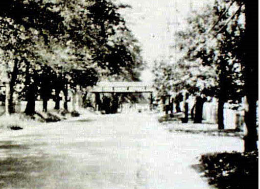
Oyster Bay Branch LIRR Motor Parkway Bridge (Courtesy of Ron Ridolph)
Roslyn Lodge
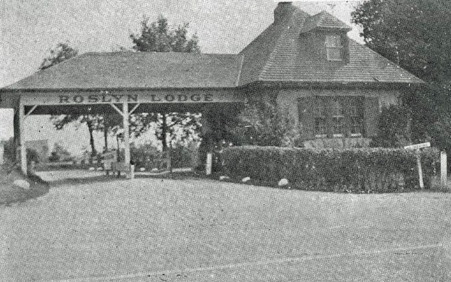
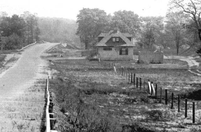
1927 view of the Roslyn Lodge looking east with the Roslyn Road Motor Parkway Bridge in the background.
Roslyn Road Motor Parkway Bridge (Courtesy of Sam Berliner III)
Today's Views Above New York City
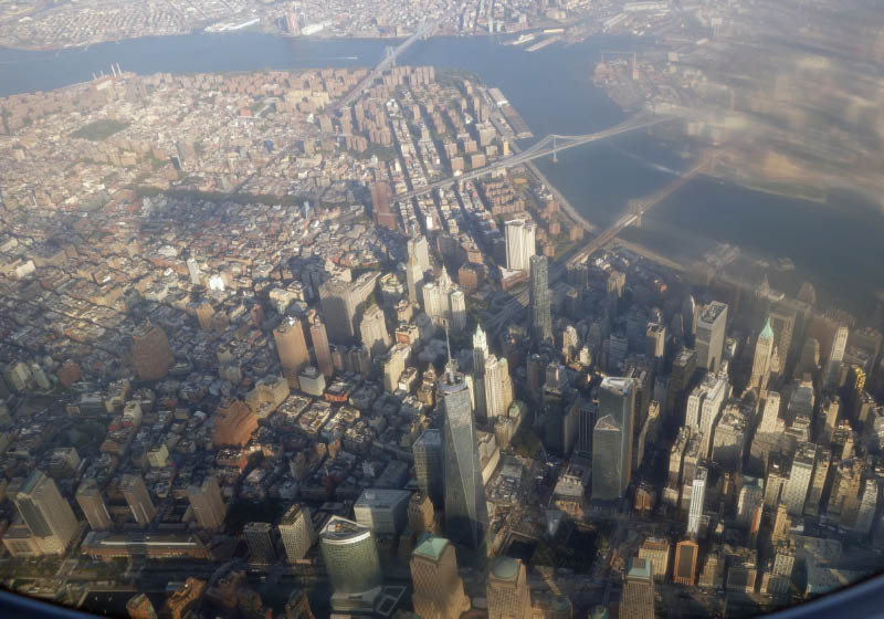
World Trade Center and the Financial District
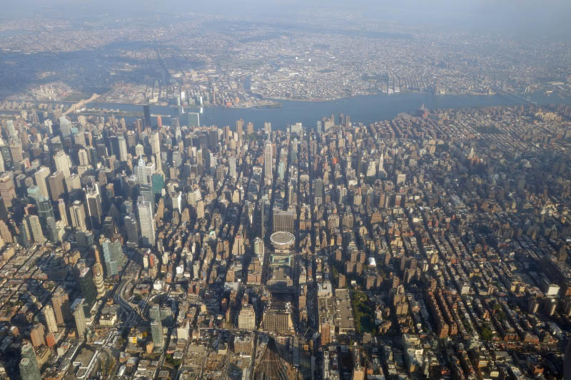
Madison Square Garden and the Empire State Building
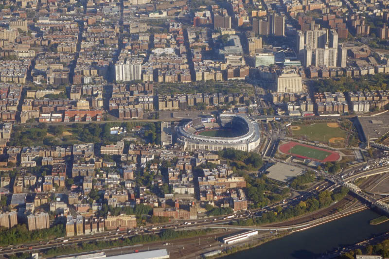
Yankee Stadium


Comments
This section looks like the section that separates Williston Park and Albertson. It looks like you can see the old Park Ave school. Also Willis Ave, the LIRR and Roslyn Rd.
I believe the aerial shows the Williston Park / Albertson / East Williston section of the LIMP The three bridges are the Willis ave, LIRR Oyster Bay branch, and Roslyn Road bridges. The other structure is the Roslyn Lodge just west of the Roslyn rd. on the south side. A few years ago, when I lived for a short time in Albertson on the north side of the LIMP just off Willis ave, I found a parkway post buried on its side behind my garage. I dug it out and now have it at the end of my driveway. My elderly neighbor still had a post upright in her yard she said was there when she bought her house new in 1950. Great photo, even better website!
Wow. Amazing Photo. It took me a few minutes, and I am surprised, since it is so close to my house. Albertson is to the north, Williston Park to the south. The bridges cross over Willis Avenue and the LIRR. The gravel pit in the northwest of the picture is now Albertson Park. The bridge over Roslyn Road is also there, as long as the toll house off Roslyn Rd. Not sure of the year of this photo, but the bridges look all intact. -joe
Mostly Williston Park, with Willis Avenue towards the left, the LIRR to the right of center, and Roslyn Road to the right, all with bridges over them. The Roslyn toll house is vaguely visible, as is the access road. The curve at the left is a stretch over towards where the public library is now; as the road moves east, it parallels Sigsbee Avenue in Albertson (behind the houses on the south side of the street) as it heads towards (through the current DPW site), and crosses over, Willis Avenue. Also shows sections of Albertson and East Williston.
The mystery photo is the section that ran through Williston Park and East Williston. With a bridge at Willis Ave and LIRR. I can’t make it out but I believe there was a toll house in East Williston.
You guys really know your stuff
Joe- click on the link Howard posted to see the full aerial. It was large enough to provide a few mystery photos! It’s a unique time period seeing a fresh, new Northern State coming in, and a still fully intact LIMP just going out…with the size of the aerial there’s also some great views of the surrounding Nassau county as well.
I checked out the link that Howard posted for the digital collections. The aerial photo is amazingly clear, even when you zoom in. I’ll have to figure how to “pan” east or west,etc. George….you don’t happen to live off of Holbrook Rd in Lake Ronkonkoma? I’ve noticed a LIMPish looking post at the end of a driveway on Holbrook Rd. I live nearby as well.