Updated: Mystery Foto #17 Solved: The Meadowbrook Polo Club Bridge over the Motor Parkway
Bill Cruickshank and Greg O. challenged you to identify this weekend's Mystery Foto taken by Bill's grandfather Otto McCamish.
Mystery Foto questions:
- Identify the location and orientation of photographer Otto McCamish
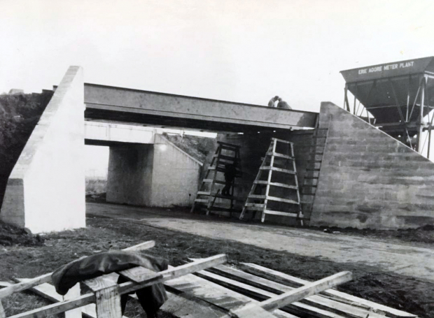
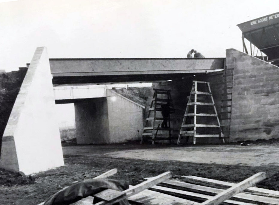
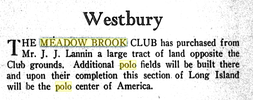
Otto was standing at the construction site for the Meadowbrook Polo Club Bridge adjacent to the Roosevelt Field Motor Parkway Bridge. in Westbury. He was looking southeast.
- Identify the two bridges
Meadowbrook Polo Club Bridge under construction and the Roosevlet Field Motor Parkway Bridge.
- What year was the Mystery Foto taken?
1928-1930
- Why was the second bridge being built?
A private bridge for Meadowbrook Polo Club members to reach their new field which was purchased in 1928.
Comments (11)
Congrats to Frank Femenias, Joe Oesterle, Brian McCarthy, Jason Cousins and Frank Mendyk for correctly identifying Otto's photo.
Kudos t Frank Femenias for his photo documentation.
Be Safe, Stay Healthy, Save Lives,
Howard Kroplick
Close-Ups

Another Bridge Photo Taken by Otto McCamish
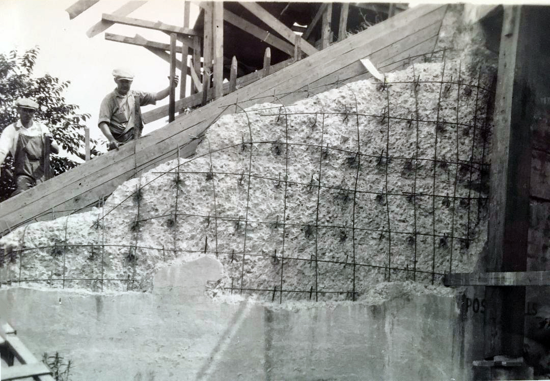
Likely this was also the Meadowbrook Polo Club Bridge being built.
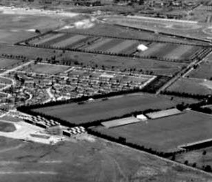
Then Meadowbrook Polo Club Property (Courtesy of Art Kleiner)
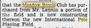
Brooklyn Daily Eagle, April 14, 1928
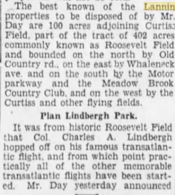
Brooklyn Daily Eagle, August 26, 1928
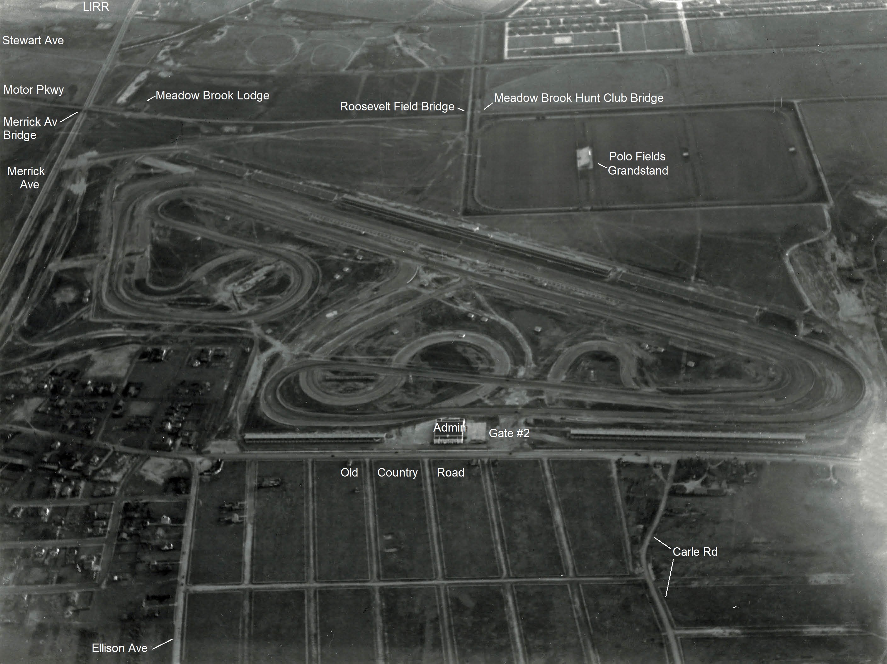
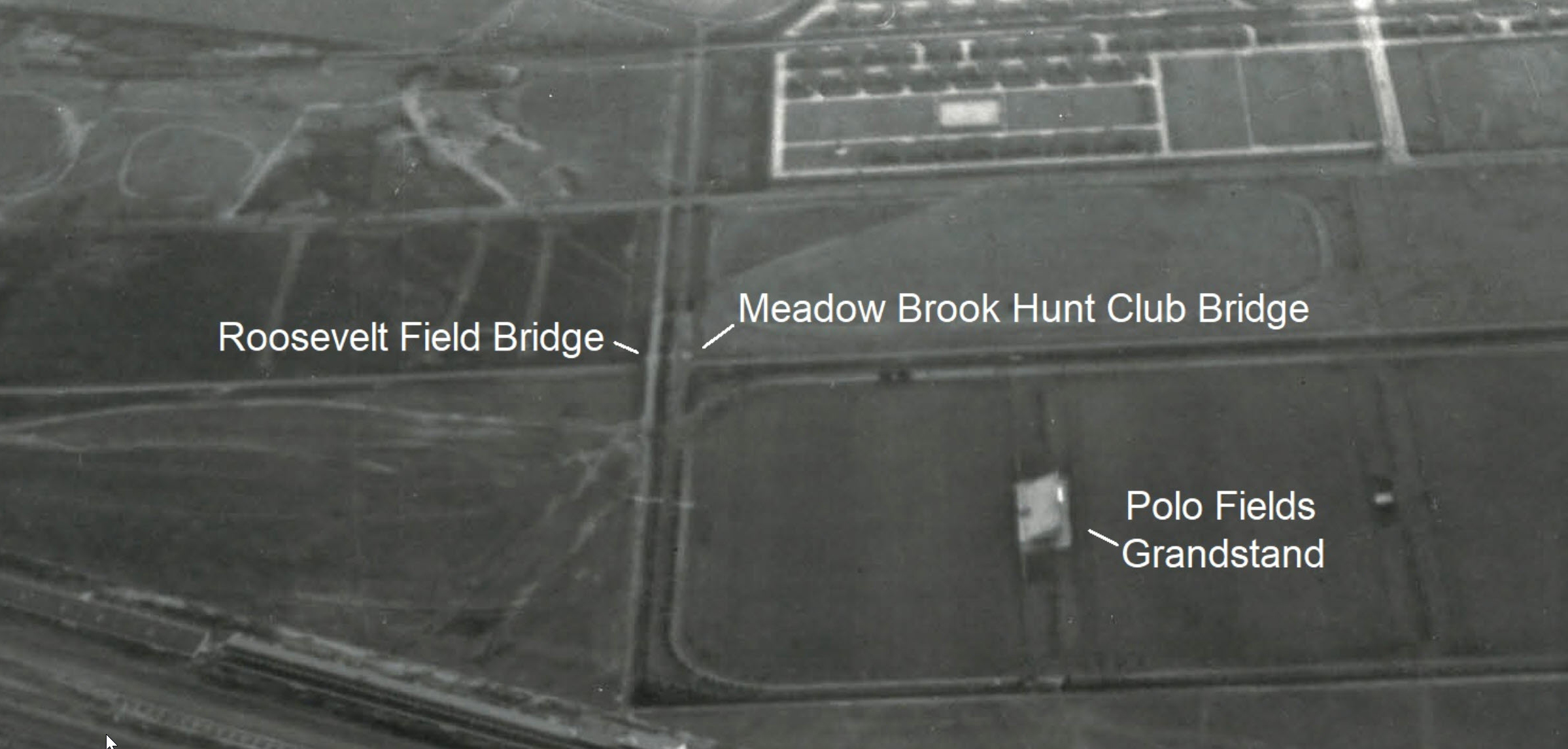
Location
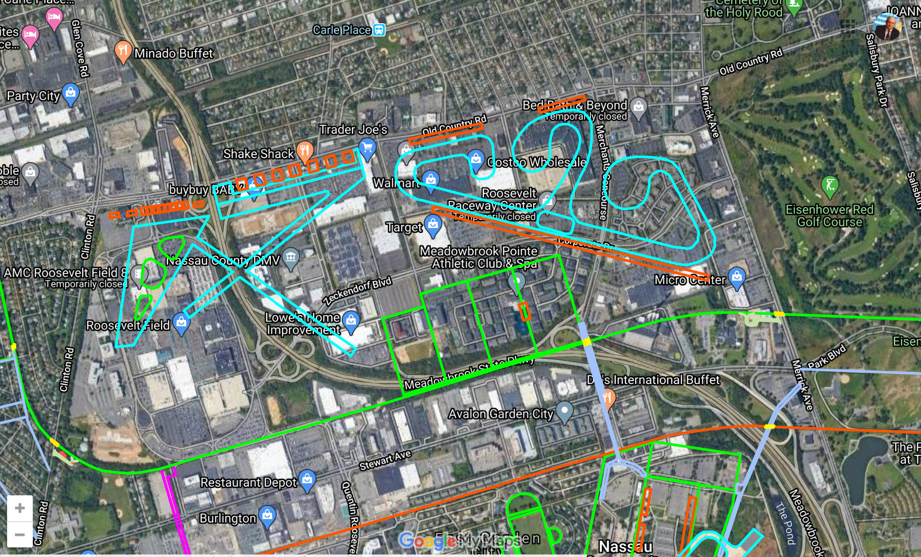
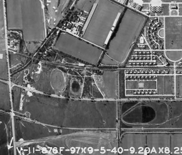
The twin bridges were within walking distance of Otot McCamish's Meadow Brook Lodge. Courtesy of master mapper Frank Femenias.
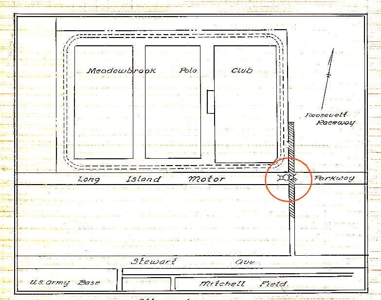
The Meadowbrook Polo Club Bridge was located to the west of the Roosevelt Field Motor Parkway Bridge. Courtesy of Art Kleiner.
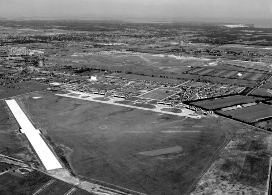
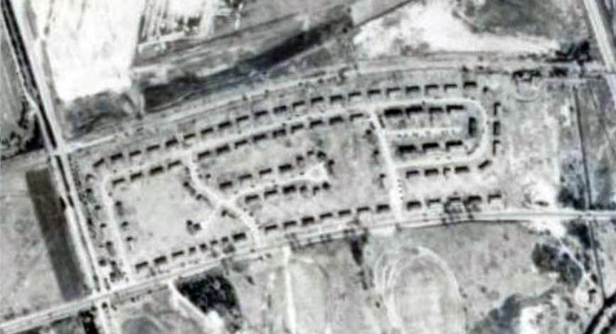
1926 Aerial
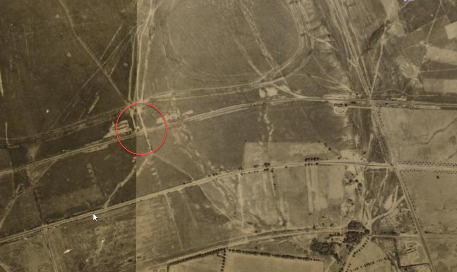
1927
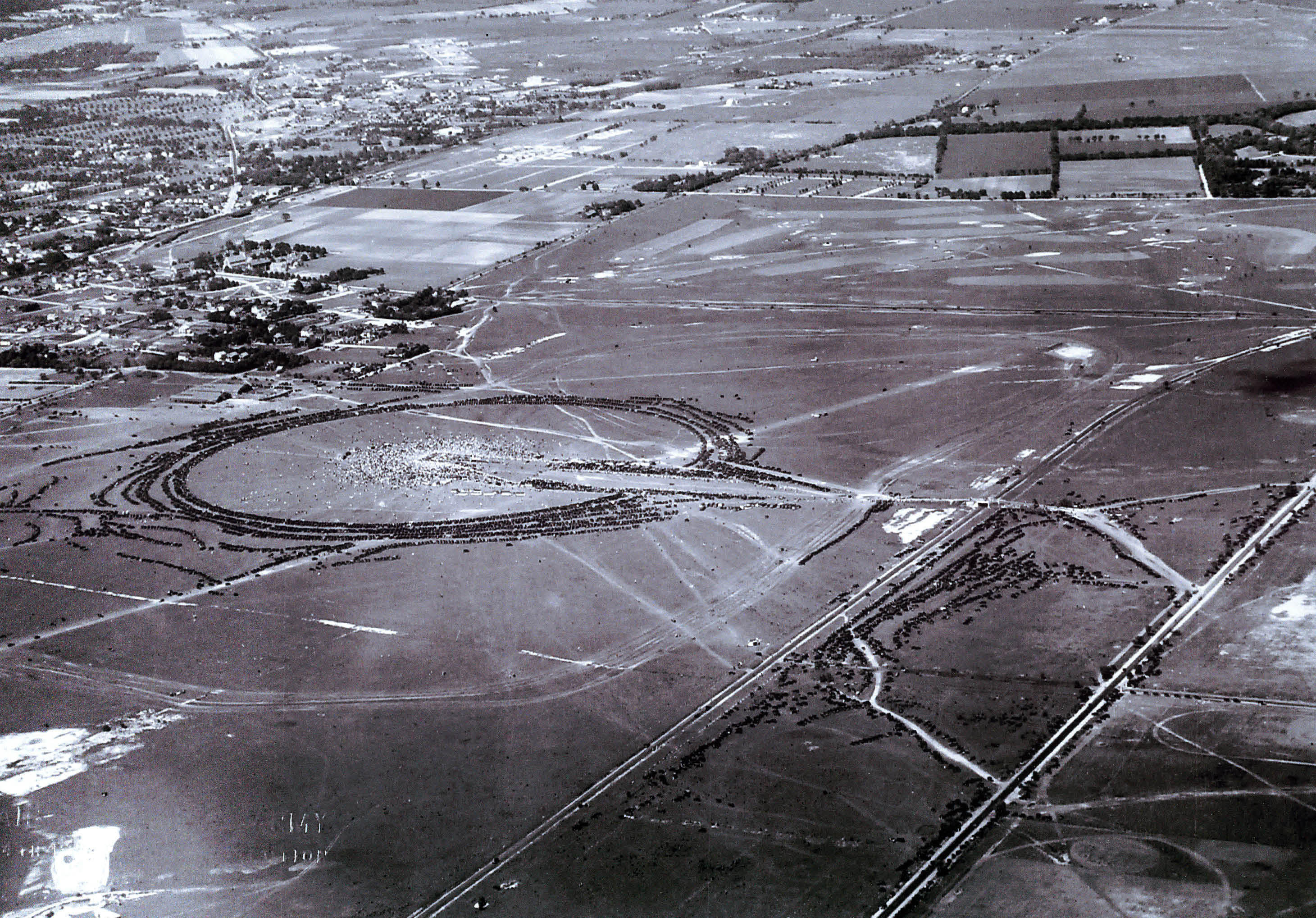
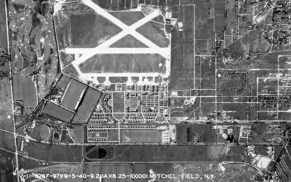
One of the busiest days on the Motor Parkway was June 16, 1927, when Charles Lindbergh returned to Roosevelt Field to celebrate his successful solo flight to Paris. Lindbergh had taken off from the Roosevelt Field east runway 27 days earlier. The Motor Parkway is the road in the middle of the image running parallel to Stewart Avenue on the right. The Roosevelt Field Motor Parkway Bridge can be seen in this aerial. The Meadowbrook Polo Club Bridge had not yet been built.
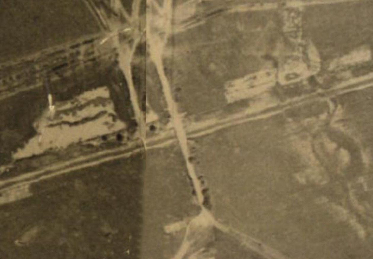
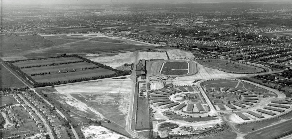
Views of the Twin Bridges
1936
Circa 1932 to 1938
1938
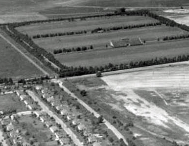
Circa 1938/1939. Courtesy of Frank Femenias.
1940
As documented by Art Kleiner, the bridge was taken down around 1944.
1950
1951
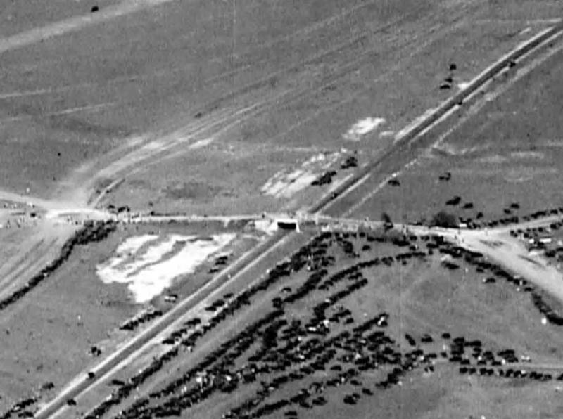
One of the bridges was still standing in 1951.


Comments
An amazing historical Motor Parkway photo never seen before! Otto McCamish was in the right place at the right time here. Thank you Mr. Cruickshank for sharing this gem to everyone.
The twin bridges! This is the most amazing shot I’ve seen yet of the two bridges. Thank you all for making this possible
Roosevelt Field bridge. The only spot I know with two bridges next to each other. And only a few hundred yards from where our photographer lived.
Thank you, Otto!
*Where was Otto capturing this bridge work?: He was on the north side of the LIMP, facing south east in East Garden City.
*ID bridges: Bridge under construction is for the Meadowbrook Polo Club, existing bridge is the Roosevelt Field Hwy Type.
*Year: I’ll say he captured this no later than 1930.
*Reason for this bridge: Meadowbrook Club purchased property just north of the LIMP and carved out another polo field in the late 1920’s. The bridge created a connection with their polo fields south of Stewart Ave.
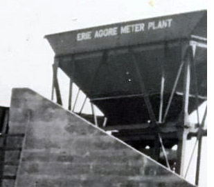
The answer would lie in the location of the “Erie Aggre Meter Plant.” Was this the original name of the concrete plant in Melville?
The twin bridge is the Roosevelt Field Meadowbrook bridges i believe.
Otto was standing on the north side of the LIMP looking east in what I believe is within the boundaries of Westbury today. This would have been a short walk west of the Meadowbrook Lodge. The bridge under construction was for direct access from Stewart Avenue to the recently constructed Meadow Brook Polo Club field and I believe was privately fund by club members. The bridge in the background had been built as the southern entrance to Roosevelt Field (airfield), also from Stewart Avenue. Since there are photos of the area in 1928 with only one bridge, and 1931 with two bridges, this photo must be between those two years. I’ll guess 1929.
Amazing never seen before ground view of the “twin bridges” in Westbury. Meadow Brook Hunt Club bridge (1920s-1944) under construction in the foreground (there’s a worker standing on the ladder under the bridge). Motor Parkway Roosevelt Field bridge (1909-1940s) in the background. Photo is looking SE in the 1920s. The bridge was built to link the Meadow Brook Polo Fields (just to the north), to the Hunt Club (just to the south). Motor Parkway motorists experienced a unique view passing under these bridges.
The Nov 1951 photo below (looking east) I believe was taken from the top of the Polo Field bridge, with the LIMP Roosevelt Field bridge already removed, from where it once stood where the car is parked. Is there any information on this?
Addendum: The Nov 1951 Newsday article showing the LIMP dirt roadway may have been used by Otto McCamish still living at the Meadow Brook Lodge in 1957. The Merrick Ave bridge was removed in the 1940s making this section of Motor Parkway a private roadway.
Another location where two bridges were almost this close to each other was in Bethpage’s Central Park, between the Powell Ave and Nibbe’s bridges
Location - East Garden City/Roosevelt field
Photo is facing towards the southeast
Bridges - Meadowbrook Polo bridge being built {foreground)
Roosevelt Field bridge (background)
Year built - 1929-1930
Purpose - access to the Meadowbrook Club’s north polo fields
Steve, The bridge adjacent to the Meadow Brook Club bridge was not built as an entrance to Roosevelt Field. It was built by the Parkway in 1908. It was constructed over a lightly used Hempstead Town road known as Sheep’s Pen Road.
New aerials have been added.
Howard. Great mystery photo. It stumped me. But, those respondents who said the view is to the south east got it wrong. MaCamish took the photo from the south side of the Parkway. The view is actually to the north west. Take a look at the 1936 aerial view. Only the east bridge has a roadway that reaches Stewart Ave. Then look at Frank Femenias circa 1938/1939 photos, they also show that only the east bridge has a roadway to Stewart Ave.
Even more aerials added to the post.
I’m not figuring on what you mean, Al. I understand that the 1936 aerial is viewing northeast ( Polo Bridge left/west of LIMP HWY Bridge ) I see perhaps a dirt road north & south of the polo bridge. A paved road south of the LIMP HWY bridge from Stewart Ave, north would lead to Sheep Pens Rd you know about. The 1938/39 aerial is viewed south, roads are the same.
If Otto snapped the photo on the south side of the LIMP, then that would mean the Polo bridge being built was EAST of the LIMP HWY bridge. This doesn’t figure in my mind. Aerials show the Polo Bridge WEST of the LIMP HWY bridge.
The 1951 aerial I see here still shows the polo bridge existing, look closely. Sincerely, Brian
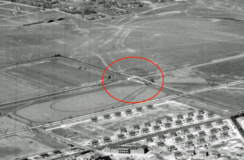
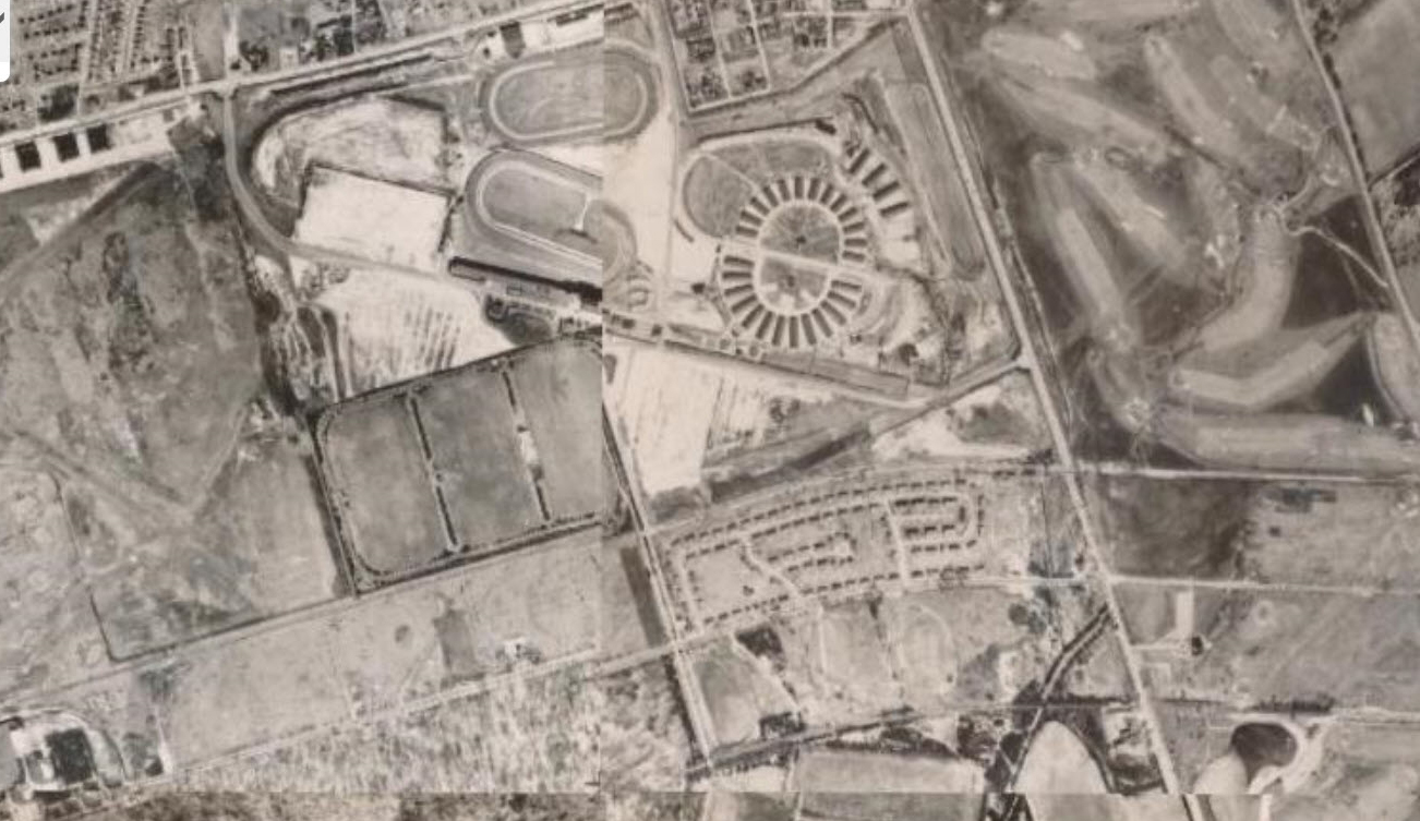
Al - Attached aerials below show a darker roadway extending to Stewart Ave from the west bridge, perhaps dirt instead of concrete for horse use. The same dark roadway then extends further south of Stewart towards the south Polo Fields by Mitchel Field. Gate 6 on the Roosevelt Raceway map appears to be an entry point after crossing the east bridge. FREE PARKING for those who entered thru this gate if they purchased a Grandstand or Clubhouse ticket!
Brian - Great 1951 aerial. I also see the dirt jug handle going around the road barricade, just as in the Nov 1951 Newsday article below. Someone over time carved out that jug handle. The distance from the barricade to the Meadow Brook Lodge entrance was 0.4 miles. Could it have been our photographer/lodge keeper, Otto McCamish?
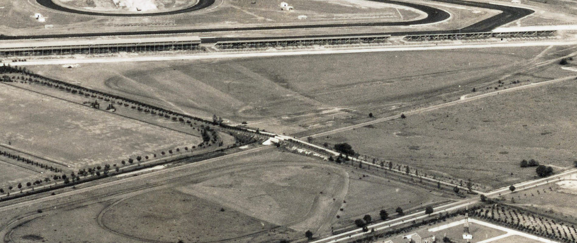
Frank, The 1936 aerial clearly shows a well defined roadway from Stewart Ave. north that goes over the east bridge It also appears the roadway is paved as it is the same color of Stewart Ave. The international polo matches were held on these fields,drawing crowds as large as 30,000 spectators. The only access to these fields was from Stewart Ave. Which approach to the polo fields from Stewart Ave. was in better condition to handle the crowds. Also, the horses used in these matches were brought in by trucks and trailers. Another also. The Parkway had a special one way 50 cent ticket from the west to the matches exiting at the Meadow brook Lodge. The same was the case for motorists heading west from the Meadowbrook Lodge.
Brian, On April 8th 1944, Newsday reported Nassau County authorized the removal of the “steel and concrete bridge” over the Motor Parkway with the Meadowbrook Land Co. agreeing to it’s removal. I’m sure it happened quickly. At the time some of the old Motor parkway bridges were taken down for their war time scrap metal value. Regarding the Sheep’s Pen Road. It got it’s name for the many sheep farms in the Westbury area a couple hundred years ago. The road ran from the Old Country Rd and Merrick Ave vicinity in a southwest direction to Hempstead Village. Though lightly used, Hempstead Town required the Parkway to bridge it which they did in 1907/08. During WWI the Govt. closed down the dirt road south of Stewart Ave. After that, it was hardly used at all. Part of the road still exists today, it is now called Westbury Road, it’s eastern terminus at Oak St., Garden City. Also, take a look at the two 1927/Lindbergh photos, south of the Parkway there’s no road heading straight south from the Motor Parkway bridge.
Frank, You were on target about the probability of horses using the west bridge to access the fields, a friend who is a polo fan pointed out that the horse stables were located on the south side of Stewart Ave. He also pointed out that in 1930, the first time the fields were used for the International polo matches, the first match drew 45,000 spectators
I absolutely see 1 bridge over the former LIMP in Howard’s 1951 aerial. My best answer is that it belonged to the Polo Club. The elevated image viewing East within the 1951 Newsday article had to be captured from the still remaining bridge, the “cheat/jug handle path” on the northside of the barricade is evident in both images. I recall a 1950 elevated image viewing west from the still remaining bridge. Art Kleiner submitted this image as a Mystery Foto a while back.
Great info as always Al, that show many inconveniences back then that we take for granted today (lack of roads for one). Motor Pkwy offering a traffic alternative for a $0.50 toll ($9.10 today), I believe would’ve been too costly for most, where one still had to maneuver their way towards the Merrick Ave entrance to fulfill the quest. I’m not sure where 45k spectators were permitted to park, but with the separate polo field entrances being 0.35 miles apart, I wonder if they walked in the dirt after parking at the Hunt Club, or perhaps walked the concrete path towards the east bridge, then crossed over the west bridge for access?
Frank, Newspapers of the day reported the grandstand was fully occupied (mostly society folks) and spectators around the field were five deep Not all visitors came by autos, most came out from the city by train. That day the LIRR ran trains from Brooklyn and Manhattan on an as needed basis, sometimes only 10-15 minutes apart. The trains after unloading, were parked on nearby spurs ready to take passengers back west. A good analogy regarding parking, crowd control ,the LIRR etc. today would be the Belmont Stakes and the major golf events at Bethpage.
Brian, I am now convinced that the 1951 photo was definitely taken from the bridge built by the Parkway in 1907/1908 to carry the Sheeps Pen Road over the Parkway. I could not uncover anything regarding the removal of the bridge prior to when the photo was taken. There was no pressure on Nassau County to take down the bridge since the Sheeps Pen Rd. road in that area was officially abandoned 1933. I am further of the opinion that the bridge did not come down until a little later when Moses built that section of the Meadowbrook Parkway in the bed of Motor Parkway ROW.
Good catch Brian! On top of Polo Field bridge looking west down Motor Parkway, towards the Garden City lodge (1.4 miles) Aug 1950. As Frank Mendyk once commented, many trees planted to surround the Polo Grounds! Credit: Newsday, Howard Edwards via Art Kleiner.
Al - I forgot to mention regarding photographer’s position of the mystery photo (likely 1928-30), shows the west bridge in the foreground (Polo bridge) under construction, with the east bridge in the background (Sheeps Pen Road) already built in 1908. The mystery photo also shows the left embankment wall brightly lit (facing the south sky), with the right wall shaded (facing the north sky). You are correct about the unimportant removal of any of these bridges, being in their remote location.
I have a vaguely related question. Into the 1990s, there was a building that could be seen from Merrick Avenue sort of near Stewart Ave. and the Meadowbrook Parkway interchange. It may also have been vaguely visible from the Meadowbrook parkway. It appeared to be abandoned, and seemed to be made of brownish yellow brick and maybe tile. Does anyone know what it was? Was it connected somehow to the Polo Club? I had the impression that it was an old nightclub, but I may be mistaken. It was torn down sometime in the 1990s, I think.
______________________________________________________________________
Howard Kroplick
Tim, is it one of these buildings: https://www.vanderbiltcupraces.com/blog/article/mystery_friday_foto_33_yet_another_spectacular_aerial_of_the_long_island_mo
Frank,The reasoning for my opinion that the east bridge is the Meadow Brook Club bridge is based mostly on the 1936 photo and the 1929 Lindbergh photo. The 1936 photo clearly only one well defined, paved, and new looking road to Stewart Ave. Yes, in that photo there is an unpaved pathway on the west side of the paved road also leading to Stewart Ave. But in the 1929 Lindbergh photo that road doesn’t go straight to Stewart Ave. I believe that path, north from Stewart Ave to the west bridge, was created by the horses and their handlers walking from the stables that were located on the Meadow BrooK Club property south of Stewart Ave ,. to the new polo fields. When the Meadow Brook Club purchased the polo field property and the strip south to Stewart Ave., they also purchased from Lannin, property south of Stewart Ave reaching to the LIRR tracks This gave the Club a straight direct approach over the tracks to the fields. While typing this, it occurred to me that approach is probably today, without any research, today’s Endo Blvd. Anyone ?
Howard, While we are still on the Otto McCamish family photos. Regarding the second bridge photo taken by Otto McCamish. I think it’s a photo of the demolition of one of the embankments. Note the wire reinforcing is visible and attached to a jagged angled edge of concrete The wire reinforcing is not visible during the pouring of cement. That’s only possible with demolition. Note the exterior of the embankment wall at the bottom of the photo. not exactly a good pour.
Al, as promised after our discussion, I looked into this further, but like you, didn’t come up with any conclusive documentation, but the more I look at various photos, I do see a little more evidence to help your theory. Honestly, I was a bit skeptical when you first said it, but here’s my 2 cents since at the moment, there’s no definite conclusion.
As I mentioned when we spoke, I had doubts about the Erie paving hopper being on the North side of the bridge. I also noticed that the hopper looked like it was beyond the existing bridge behind the new bridge being built in the photo. Also, looking at photos and aerials from 1936ish, the new VCR racetrack is on the East side and the polo fields are to the West side, logic would say it just doesn’t make sense to place the new bridge intended for the polo fields that are to the East side of the old Roosevelt Field bridge. Also, a grass/dirt path from the stables to the polo fields seemed more appropriate than a paved road for the horses. In the blow up of the twin bridges below, I noticed the West bridge was slightly wider and had much taller sides which also seemed more appropriate for horses as well. Looking at the next photo below, it also looked like a straight paved road to the VCR racetrack, and the dirt path from the West bridge came off the bridge and curved slightly right into the parameter road of the polo fields. Initially, I theorized that they paved a new road leading to the old bridge, (replacing the split path/road seen in the 1927 Lindbergh photo), to update the old 1908 bridge into a new entrance for the new VCR racetrack. The hopper for paving materials being closer to the older, existing bridge supported that thought in my mind. (Thereby placing that hopper on the South side of the LIMP in the McCamish photo) However, a few things popped up that further support your narrative and not mine. I think some of the most conclusive evidence can be found on the demo plans that Art had dug up below. See my next post with further photos…
Your theory of the the new polo fields bridge to the East side of the old Roosevelt Field bridge would dictate that there had to be some sort of worn path crossing the dirt path leading to, and away from the Roosevelt bridge. Horses could walk the dirt path to the West of the new paved road, then, just before the rise of the South embankment, or just after the rise of the North embankment, they cross over the dirt Roosevelt Field pathway towards the polo fields. Below are two spots I have identified them possibly doing just that. See below in my photos, the spots where this could have been are crudely marked by my arrows.
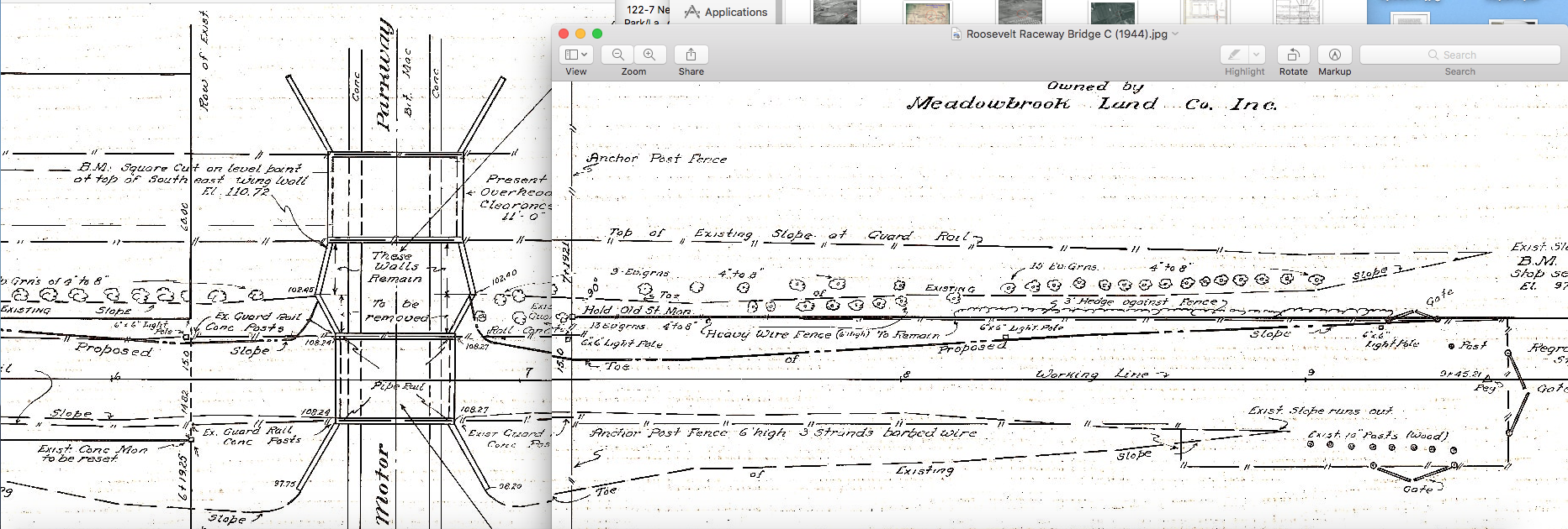
But I think the most conclusive are the demo plans;
You can see the differences in sizes of the bridges on the plans as well as the blown up aerial I posted in my last comment above. On the plans of the proposed bridge to demolish, the smaller of the two bridges shows horse gates at the end of the North embankment of the East bridge. Interestingly, there are are gates leading out to the East, North, and yes, to the West towards the polo fields. Property ownership marked on the plans determines direction.
So, I think this may the most proof of your theory that we have so far. While illogical to place the bridges on the opposite sides of where their destinations are, I am now leaning towards your thinking.
Al, I also now agree with your assessment of the second bridge photo being demolition and not construction.
Aside from your comments on the visible reinforcing wire, the lower, smooth part of the abutment looks to be weathered with even some mature foliage at the very lower edge of the photo. There also appears to be something painted on the abutment on the lower right but partially obscured by a wooden post. My best guess is that it original wording was ‘post no bills’, which of course would not already be painted on a partially constructed abutment. The wooden scaffolding in the background were not forms as originally thought, but probably placed to avoid the embankment soil from collapsing once the abutment is completely removed
Greg O. What a tremendous amount of detailed research you have done, thanks for sharing. Regarding your comments about the horses moving between the dirt path and the east bridge, first, i never picked it up. My first thought was…Nah, why would they do that, horses don’t like hard solid surfaces. Thinking more about it I now believe you have it right. In April 1933 the Town of Hempstead officially abandoned the Sheep’s Pen Road after BEING FENCED OFF FOR SEVERAL YEARS ! It makes sense that the approaches to the the Sheep’s Pen Road bridge would blocked off as the bridge was the Town’s responsibility. Your scenario makes absolute sense. Again, great digging and enlightenment
Agreeing with Al & Greg, that 1 image is the demolition of a bridge, possibly the LIMP HWY BRIDGE in 1944 ( above sketch ). Glad Otto took an interest with it all.
Great closeup Greg, didn’t realize the high walls for the POLO BRIDGE. Makes sense with the horses. Wish I could make out these walls on the BRIDGE still remaining in Howard’s 1951 image.
Thought the 3 images below would be interesting to see. Years 1919 & 1928 show the LIMP HWY BRIDGE, prior to the POLO BRIDGE being constructed. Then 1937, those high walls are evident.
Al - You bring up great points. Construction or demolition? The photo showing exposed rebar is likely demolition, but it is unknown if this series of photos were all taken at the same time. In my opinion they were. The photo properties/quality are all the same, likely taken at the same time. So we’re likely witnessing the demolition of a bridge. I’m almost certain the mystery photo is looking southeast towards the west bridge, with different light accent on each abutment wall, providing photo orientation. It is still unclear which bridge was removed first; neither one had an urgency to be removed, being in their remote location. With the aerial that Greg presented (below), you can see the west bridge descending into the newly built east polo field area. I love this great detective work. We’ll get it solved soon!
I believe now it was destruction, not construction of the west bridge. Thanks Al.