Mystery Friday Foto #46 Solved: A 1936 Long Island flyover surveying the Hempstead Plains by the Braman-Johnson Flying Service

Did you solve this weekend's Mystery Aerial?
Answers to Mystery Foto questions:
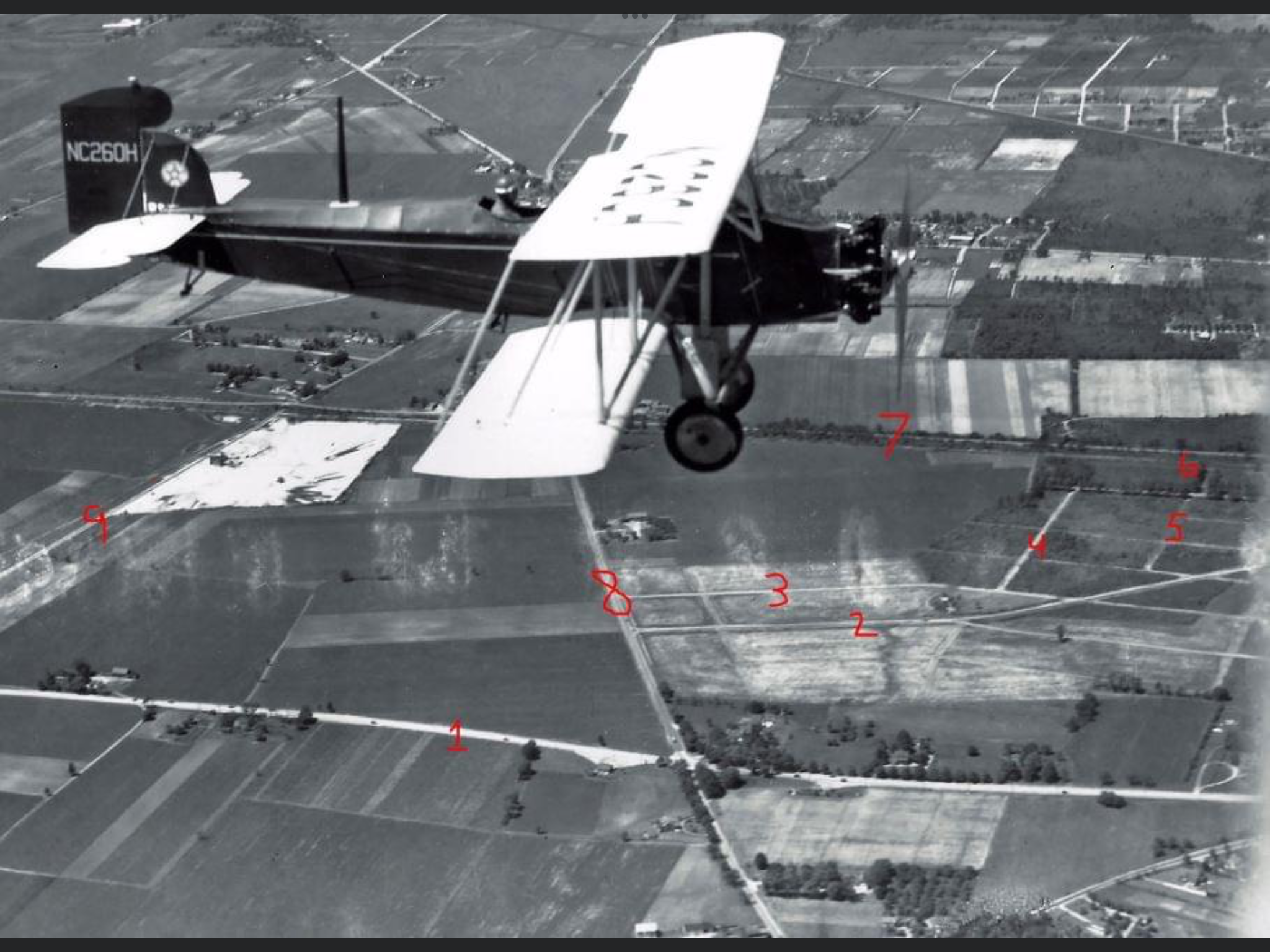
- Identify the location of the airplane What is the orientation of the photographer?
The airplane is flying east over Hicksville Road in the Hempstead Plains, now Bethpage. The photographer is looking north.
- Identify as many of the red numbered roads as possible including the Motor Parkway
1. Hempstead Turnpike
2. Lincoln Boulevard
3. Roosevelt Drive
4. Lowell Street
5. Rose Street
6. Motor Lane (Named for the Long Island Motor Parkway!)
7. Long Island Motor Parkway
8. Hicksville Road (Route 107)
9. North Wantagh Avenue
- Identify Motor Parkway structure(s)
Wantagh Avenue Motor Parkway Bridge
- What is the date of the Foto
The photo was taken in June 1936. It is the same airplane and likely flight featured in the 2019 Mystery Foto #16.
Kudos question: What is the reason for the flight and the flying service operating the plane?
The survey plane was the 1929 Curtiss Fledgling B-37 Reg. # NC260H flown by the Braman-Johnson Flying Service based at Roosevelt Field Hangar B.
Comments (6)
Congrats to Art Kleiner, Frank Femenias, Steve Lucas and Brian McCarthy for correctly identifying the Hempstead Plains.
Kudos to Art Kleiner who identified the Braman-Johnson Flying Service on a survey flight.
Enjoy,
Greg O.- Guest Mystery Foto Researcher & Howard Kroplick
Close-Up
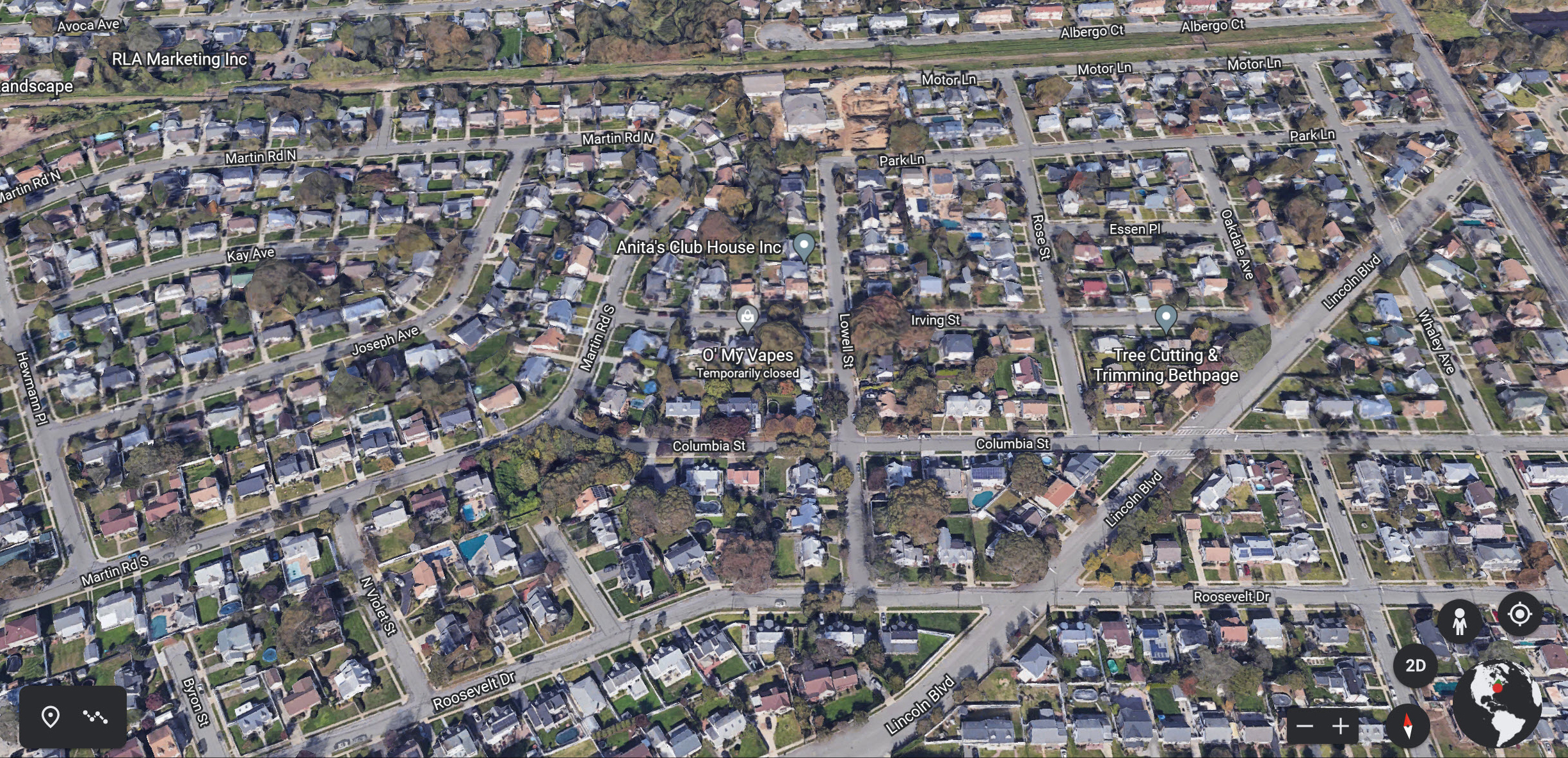
Current roads seen in the Mystery Foto.
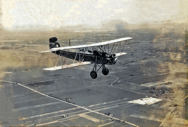
Mystery Foto #16 Solved: A 1936 Braman-Johnson Survey Flyover Over the Hempstead Plains


Comments
Over the Hempstead Plain, Island Trees/Levittown. Plane is heading west.
7 is the Motor Parkway.
Plane was owned by the Braman-Johnson Flying Service and used to make aerial surveys.
So far all I got is a guess on the plane. The “N” may identify this plane as U.S. Navy and the “C” indicates it is of “standard airworthiness”. This identifier was valid from 1919 to 1950. But I’ll guess maybe this picture was taken in the early 1930’s. Brush fires were an issue for a while, so maybe he’s out patrolling for that. Maybe this pilot is somewhere close to Mitchell field but so far I can’t get my bearings on the roads and landmarks on this picture. I hope to submit another comment if I can figure more out.
Always welcome a new perspective Greg. Thanks for sharing this gem!
Bethpage (Central Park) looking north, close to 1910 (early bi-plane)
1 Hemp Tpke
2 Lincoln Blvd
3 Roosevelt Dr
4 Lowell St/Park Ln
5 Rose St
6 Rose St towards the Barnes’ Tract (1908 LIMP Ground Breaking Ceremony Site)
7 Long Island Motor Parkway
8 Hicksville Rd Rt 107 (Massapequa Rd)
9 N Wantagh Av (Jerusalem Av)
LIMP structures:
N Wantagh Ave bridge (Jerusalem Ave) 1908 - 1940s visible. The Massapequa Toll Lodge and Hicksville Rd bridge (Massapequa Rd) hidden under the plane’s right wing.
Grumman Airport will eventually occupy the space just above the plane’s propeller, decades later.
History in the making. Great photo!
The location of the airplane, which is a Curtiss Fledgling B-37, is over the Hempstead Plains (today’s Levittown) with the photographer looking north. The roads are as follows: 1-Hempstead Tpke, 2-Lincoln Blvd., 3-Roosevelt Dr., 4-Lowell St., 5-Rose St., 6-Motor Lane, 7-the LIMP, 8-Massapequa-Hicksville Rd., 9-Wantagh Ave. The LIMP structures are the Bloomingdale Rd. bridge and the Wantagh Ave. bridge with the Massapequa lodge and nearby bridge hidden by the plane’s wing. The date should be around 1936. The reason for the photo is probably to document topography, land use, and structures, maybe in preparation for the soon to be acquisition of the LIMP by Nassau County in 1938.
This plane is flying above Bethpage, NY in a east direction. Photographer in the plane that would be above and to the south snapped this image looking north. The Wantagh Ave LIMP bridge is seen. The Massapequa Lodge and Hicksville Rd LIMP bridge is obscured by the airplane. I’m figuring this is dated 1936 - 1937. Grumman in Bethpage was established in 1937. Property for Grumman looks to be in it’s early stages. Grumman Building is visible on a 1938 aerial, on this image only the footprint. Photographer’s plane and the plane seen might be capturing aerial images of Nassau County. I marked the roads on the map below.
Always welcome a new perspective Greg. Thanks for sharing this gem!
Bethpage (Central Park) looking north, close to 1920; early bi-plane design flying over a landscape missing many present roadways and dwellings.
1 Hempstead Tpke
2 Lincoln Blvd
3 Roosevelt Dr
4 Lowell St/Park Ln
5 Rose St
6 Rose St towards the Barnes’ Tract (1908 LIMP Ground Breaking Ceremony Site)
7 Long Island Motor Parkway
8 Hicksville Rd Rt 107 (Massapequa Rd)
9 N Wantagh Av (Jerusalem Av)
LIMP structures:
N Wantagh Ave bridge (Jerusalem Ave) 1908 - 1940s is visible. The Massapequa Toll Lodge and Hicksville Rd bridge (Massapequa Rd) are hidden under the plane’s right wing.
Grumman Airport will eventually occupy the space just above the plane’s propeller, some decades later.
History in the making on early Long Island, great mystery post!
Before and after (2020)