Kleiner’s Kolumn: Part I-Mapping the Motor Parkway, Mitchel Field & Mitchel Gardens
Recently received documents from the Nassau County Dept. of Public Works (NCDPW) highlight the Motor Parkway and Mitchel Field in Garden City. The maps shown here and those to be shown in the near future provide a glimpse of the plans for Mitchel Field after World War II up to and including its use by Nassau County, Nassau Community College and Hofstra College (originally a college, not a University at that point). First a look at Mitchel Gardens.
Art Kleiner
Mitchel Gardens: 1941-1962
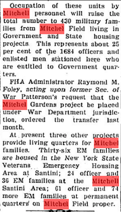
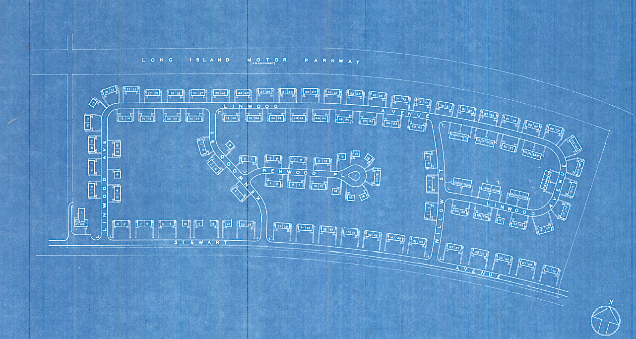
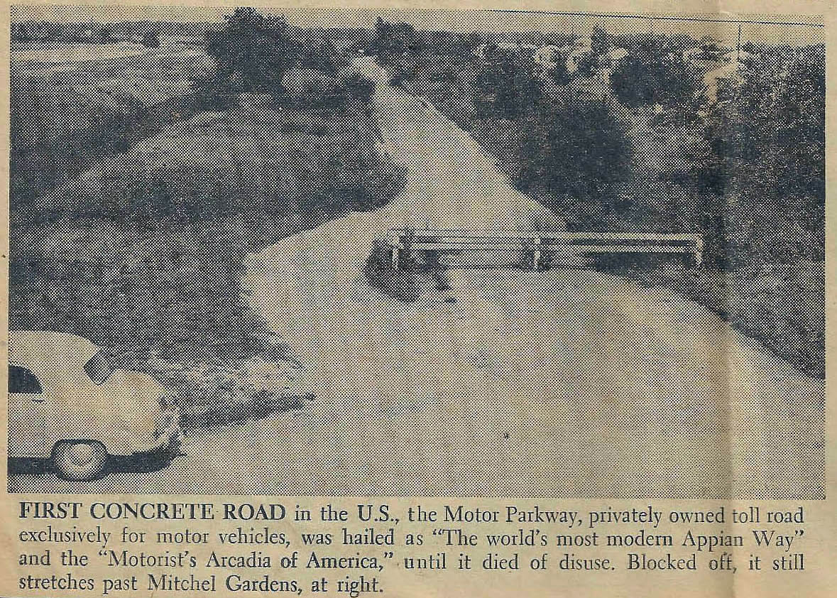
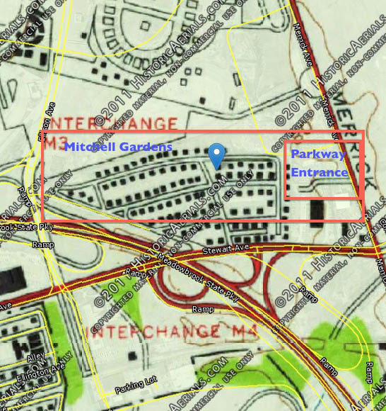
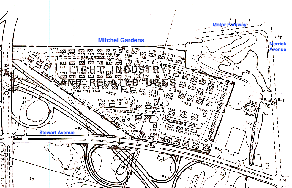
Mitchel Gardens was built in 1941 as a FHA project to house military personnel and was constructed between Stewart Avenue and the Motor Parkway. It was transferred to the War Dept. in 1947. (NCDPW)
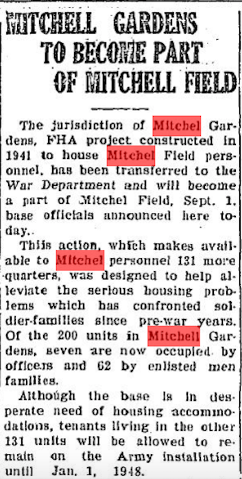
The Long-Islander, August 14, 1947
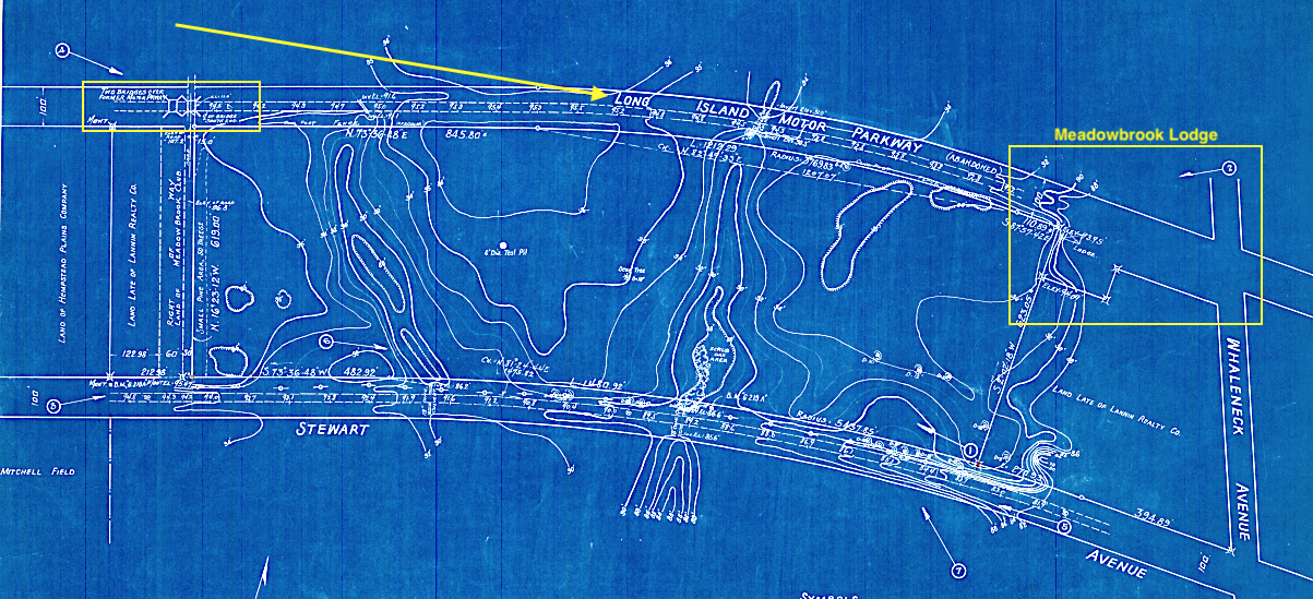
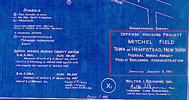
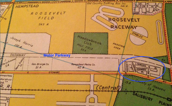
1941: The Roosevelt Field Motor Parkway Bridge and the Meadow Brook Club Bridge are shown on this topographical map as is the outline of the Meadowbrook Lodge off of Whaleneck (Merrick) Avenue. (NCDWP)
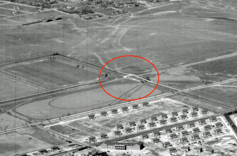
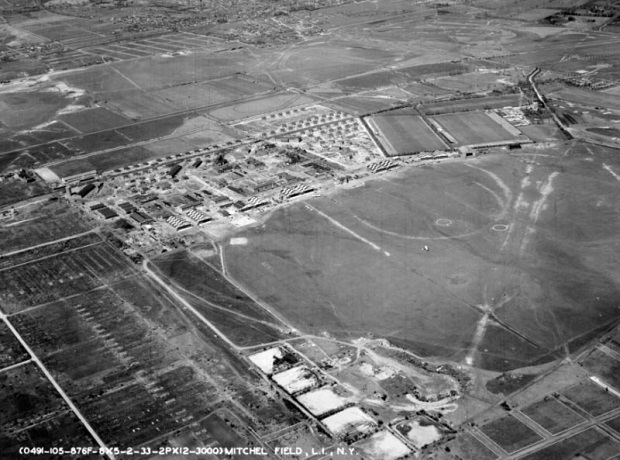
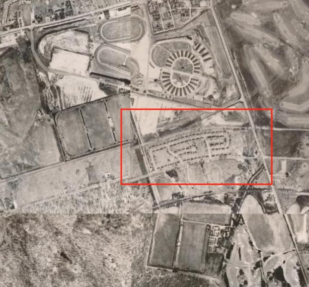
Back a few years in 1938. Revision: Based on information provided by Lee Chambers (see comments below), the date of this photo may by 1932 or 1933.
Anyone know what the building on the lower left corner would be: the M and Mr Building? (NCDPW)
1947
1950 (Hagstrom)
1950 Courtesy of MyNassauProperty.com
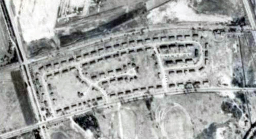
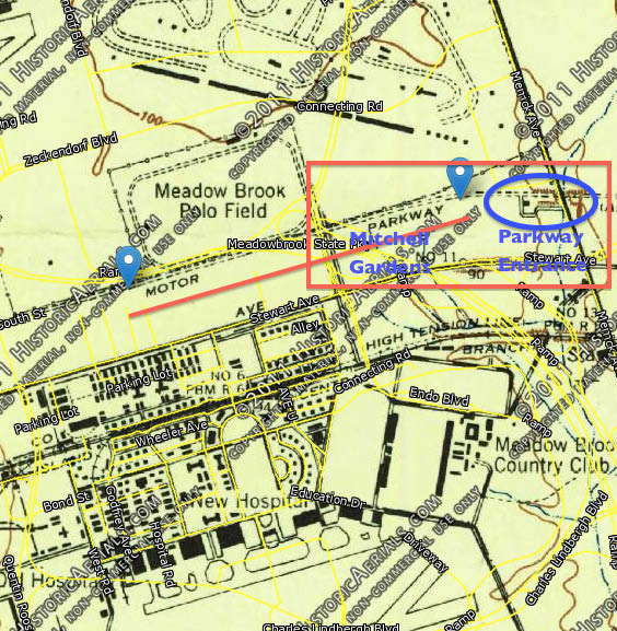
Mitchel Gardens can be seen in the lower left corner.
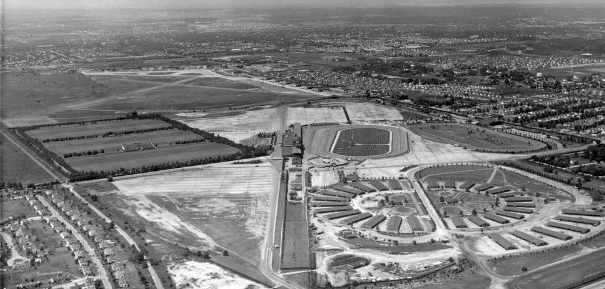
Roosevelt Raceway for harness racing can be seen in the middle of the photo with the original Vanderbilt Cup Race grandstands still being utilized. Circa 1950.(Courtesy of Lee Chambers)
Newsday, November 15,1951
1957
1962: At the time when the US was debating how best to dispose of land not needed anymore at Mitchel Field. More on this in the near future.
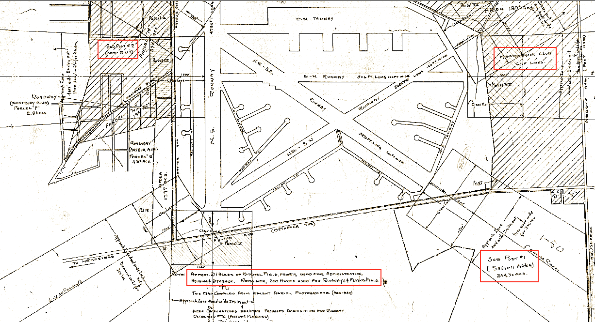
1946: Post WWII Development of Mitchel Field (All courtesy NCDPW)
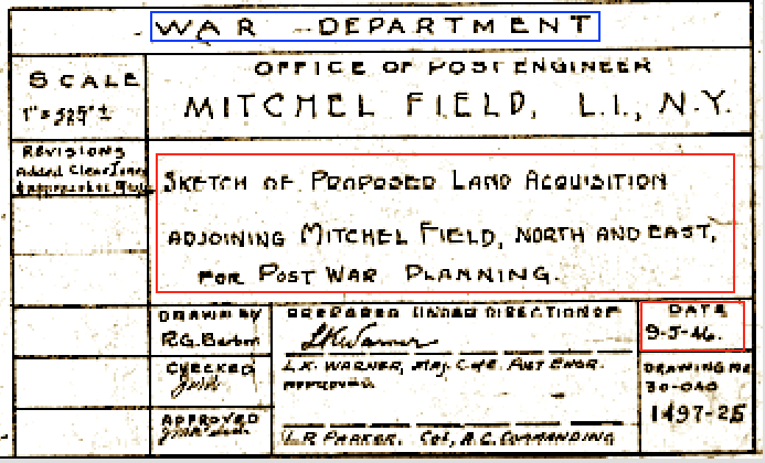
As these plans show the War Dept. required additional land beyond the original Mitchel Field "for Post War Planning" and as such proposed acquiring adjacent parcels in 1946.
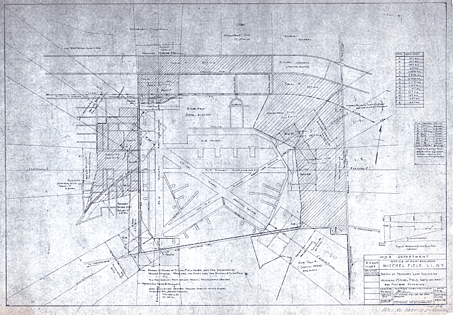
Areas in cross-hatching are those proposed for War Dept. purchase. The next two maps provide close-ups as the digitized document provided by the Public Works Dept. is to large to clearly display.
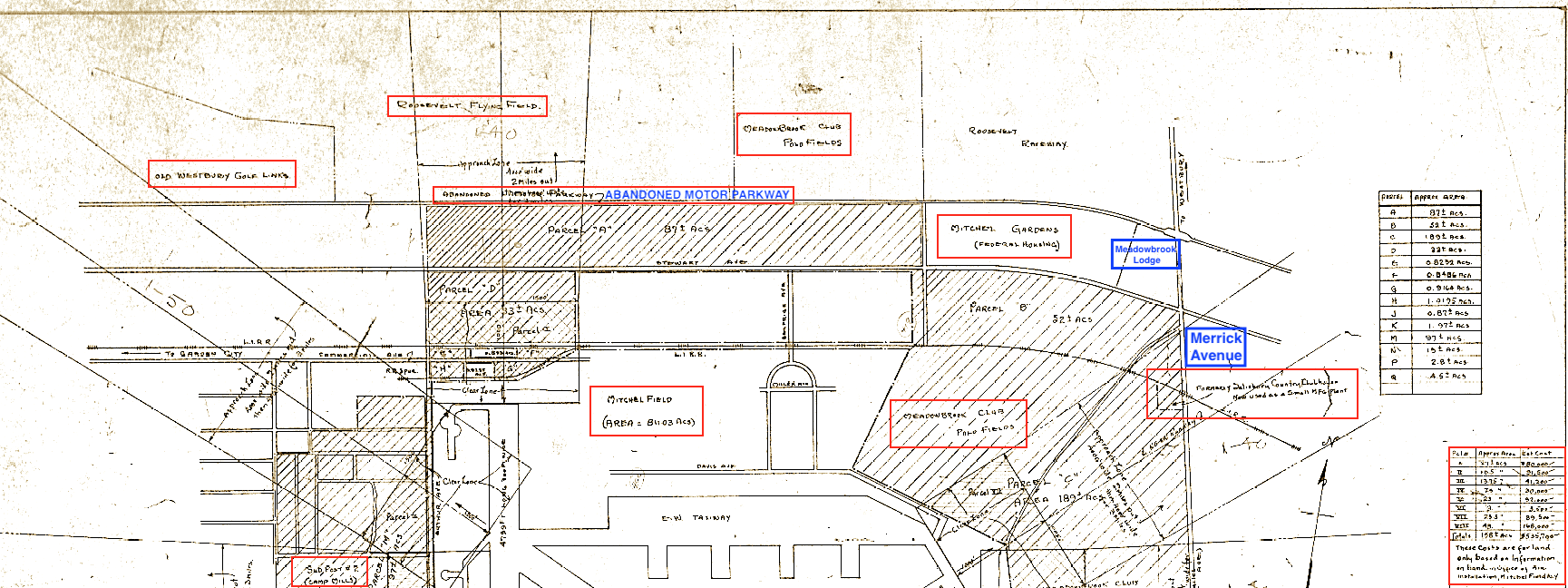
The area proposed to be purchased included a section adjacent to the Motor Parkway consisting of 87 acres ("Parcel A"). Note the Salisbury Country Clubhouse on the right (east) and Camp Mill on the left (west).
Note the Santini area on the lower right, Meadowbrook Club Golf Links top right and Camp Mills top left.
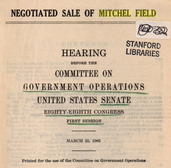
A follow-up post will provide additional details pertaining to the use of Mitchel Field property disposed of by the War Dept. in 1962/63. (Courtesy Stanford University)


Comments
I remembered the below 2 “stub roads” on my 1994 Hagstrom. At the time, I didn’t know what these roads were about. ‘Willow’ may have become the entrance way to the substation, and ‘Kenwood’ could be the old entrance just west, before the overpass.
What happened to Kleiner’s Korner?
When did this change to Kleiner’s Kolumn?
Ralph wouldn’t be happy.
Maybe we can do a poll of the readership.
I have had the same thought RE: Kleiner’s Corner vs. Kleiner’s Kolumn.
Brian, When the Mitchell Gardens complex was laid out there were three entrances from Stewart Ave. From west to east they were, Linwood Ave., Kenwood St. and Willow St. Based on your map, it appears Linwood Ave. was the first to go because of the Meadowbrook ROW.
Art,
I believe the aerial photograph of Mitchel Field and environs attributed as being in 1938 may be the wrong date.
The Base Reconfiguration which resulted in the creation of the Parade Grounds (aka, Quadrangle) occurred between 1927 - 1932. Close inspection of the photo reveals remnants of wooden buildings (or at least their foundations) left over from the WW1 era of Camp Mills still covering the Quad. All would be removed shortly after completion of the brick buildings populating the Base.
Further evidence is provided by the Main entrance on Stewart Avenue. Notice how the roadway runs south and comes within a few yards of the westernmost home on Ellington Ave. EAST. This road is NOT Selfridge Ave., and before creation of the Quad, extended as far south as the flight line.
Soon afterwards, the Main entrance was realigned slightly to the west to its present day location. When that occurred, the road running south from Stewart Ave. now named Selfridge, bordered the easternmost home on Ellington Ave. WEST, explaining why to this very day, there is a large patch of empty space adjacent to the westernmost home on Ellington Ave. EAST where an additional home could easily have been built but wasn’t because the original road once existed there.
Concurrent with the realignment of the Main entrance running south to line up with the top center of the Quad, the crossing of the Central Line of the LIRR was also shifted slightly to the west where it still stands today (though has been thoroughly rebuilt in recent years).
(See attached photo from 09/19/31 illustrating the original and realignment of the Main entrance).
My best guess as to the actual date of the photo may be around 1932-1933.
Thanks Lee. I probably pulled the photo from a previous post which might have been incorrect or I misread the date. In any case, thanks for your input which I’ll note in the post. Happy Holidays!
Caught off guard, I quickly misidentified Selfridge Ave on the old aerial. Thanks Lee for clarifying the history of this area.
Art Kleiner
Thanks to Motor Parkway friend, Dave, Mitchell Gardens is remembered by the name of a PSE&G substation on the site. A new substation named Lindbergh is (or is planned) to be built nearby to accommodate increased local energy demands that Mitchell Gardens and another one on Stewart Avenue couldn’t support.
Acknowledgement by the Nassau Board of Supervisors of an incorrect tax assessment for 1919 for the property that was conveyed by the Hempstead Plains Company to the US Government for Mitchel Field. The tax was cancelled and the property termed exempt.
The address on the PSEG sign is incorrect and revisionist history! Stewart Avenue (including Mitchel Gardens) is and always has been in Garden City, NOT Uniondale! It extends as far eastward as Merrick Ave. where it meets the border of East Meadow. In fact, that area had its own Zip Code of 11533 when we moved to Mitchel Field in 1965, separate and apart from the main Garden City Zip Code of 11530.
Just goes to show once again - you can’t believe everything you read! Thanks Lee.