Kleiner’s Kolumn: Documenting the Ezekiel Smith Farmway Bridge in Melville Over Time
In a new Kleiner's Kolumn, Art Kleiner further explores the farmway bridge in Melville.
Enjoy,
Howard Kroplick
Kleiner's Kolumn: The Ezekiel Smith Farmway Bridge in Melville
By Art Kleiner
I believe one of the most fascinating aspects of researching a particular part of the Motor Parkway is the ability to compile and compare locations over time (hence the "Then and Now" pictures widely used in the Blog). Today's technology makes this easier than ever before.
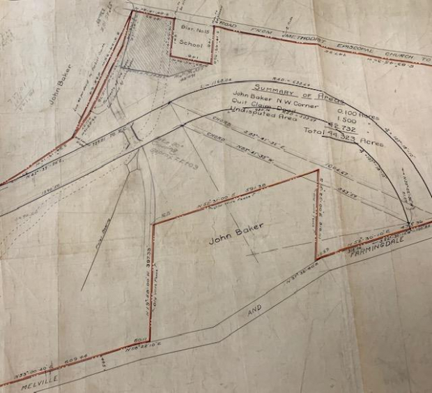
In this post I've shown surveys, maps and aerials of what I believe to be one of the Motor Parkway's "Wonders of the World" - the Ezekiel Smith Farmway bridge abutments off Maxess Road in Melville. Most of us have been there, but if you haven't you should.
The attached documentation begins in 1907 and continues thru how the bridge abutments look today (graffiti and all, unfortunately). I know there are probably other pics previously shown in the Blog, if any are of particular interest to you include it and why in the comment section.
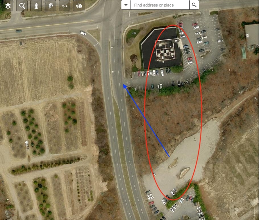
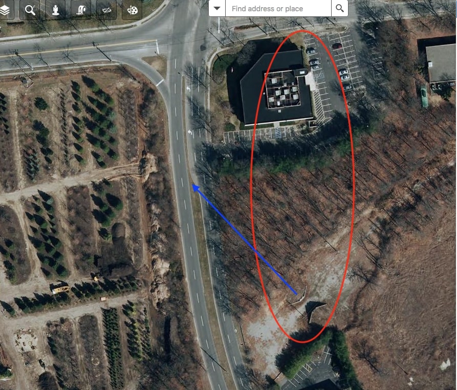
Look for old and new and let others know of any aspects of the bridge location that are of most interest to you. I've been interested in the purpose of the bridge, to connect both sides of the farm as well as to provide a way for children to safely get to the school (indicated as SD 15 on the survey). And also the direction of the bridge in relation to Maxess Road (very clearly seen in the later year aerials). And while you're at it, how about we start compiling other "Wonders of the World" locations pertaining to the Motor Parkway. Send in your lists and I'll compile a final list over the next few months and will use this to produce similar posts showing each location over the past 100 years. Contact me at [email protected] and please indicate LIMP in the subject line.
1910
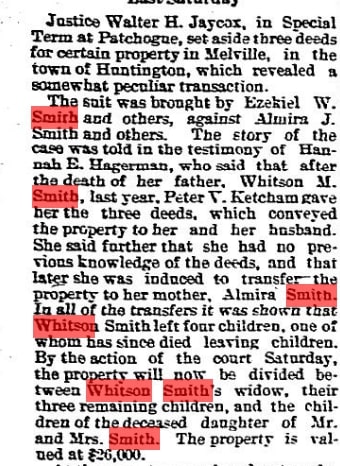
Sept., 1907 article from "The Suffolk County News" discussing a law suit brought by the Smith family heirs and how the property was to be divided.
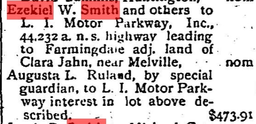
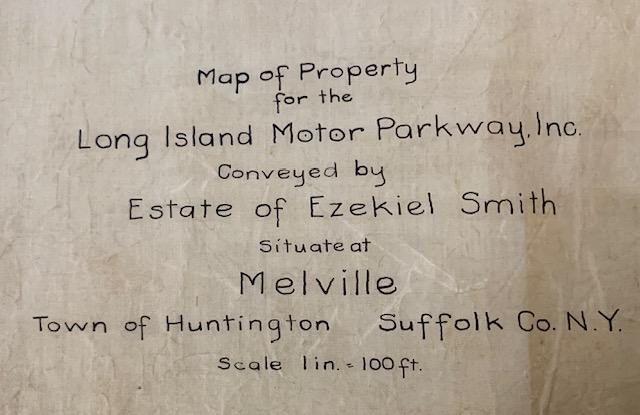
June, 1910 article from "The Long Islander" conveying the property to the Long Island Motor Parkway.
Maps
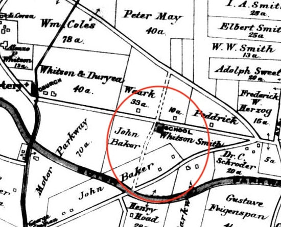
1909
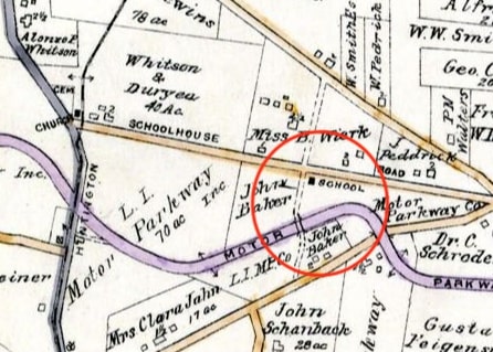
1917
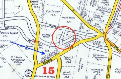
1941
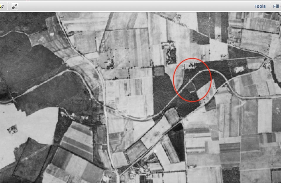
Aerial Photos
1930

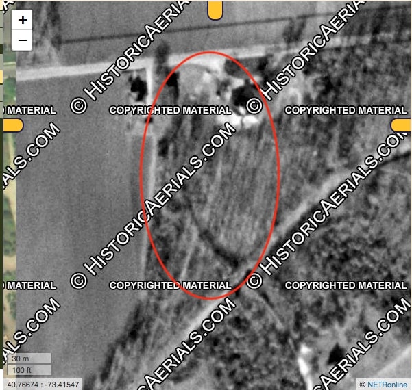
1947
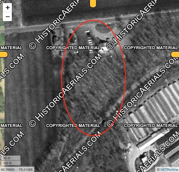
1953
1966
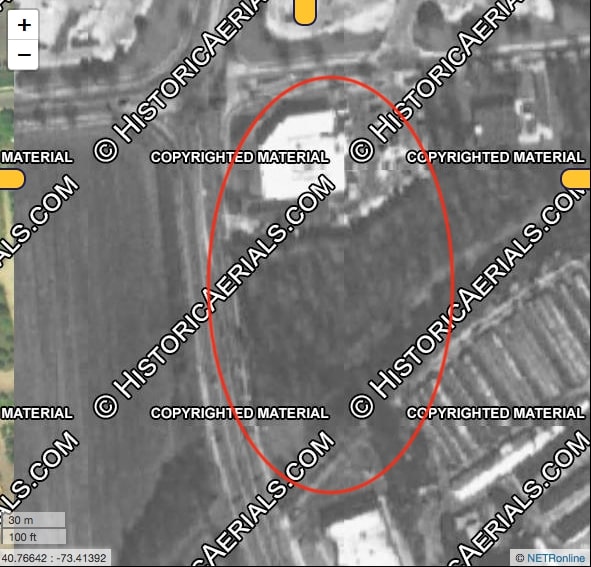
1994
2004
2006
2010
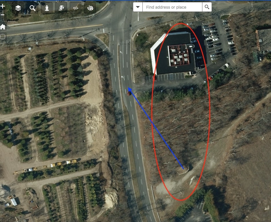
2013
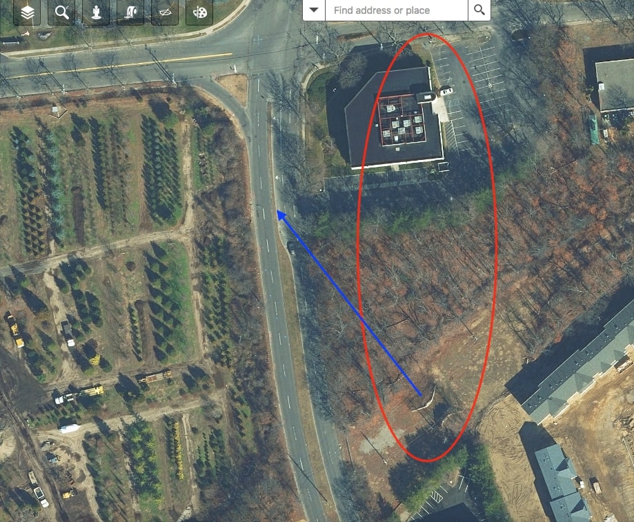
2016
2019 Photos
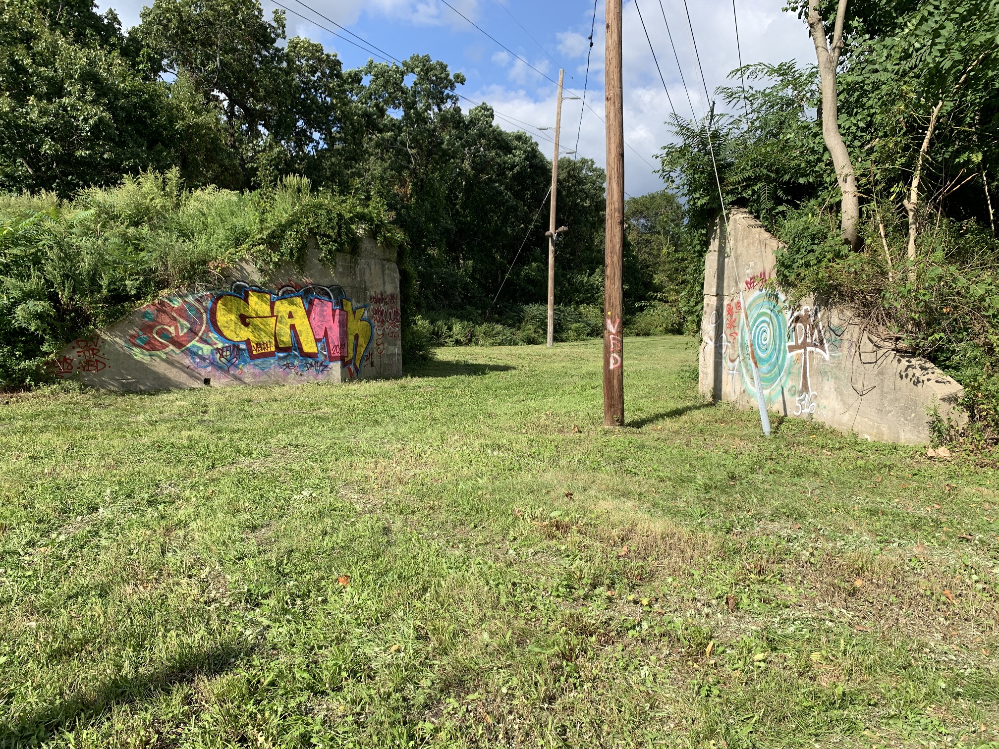
Here are the bridge abutments as they stand today.
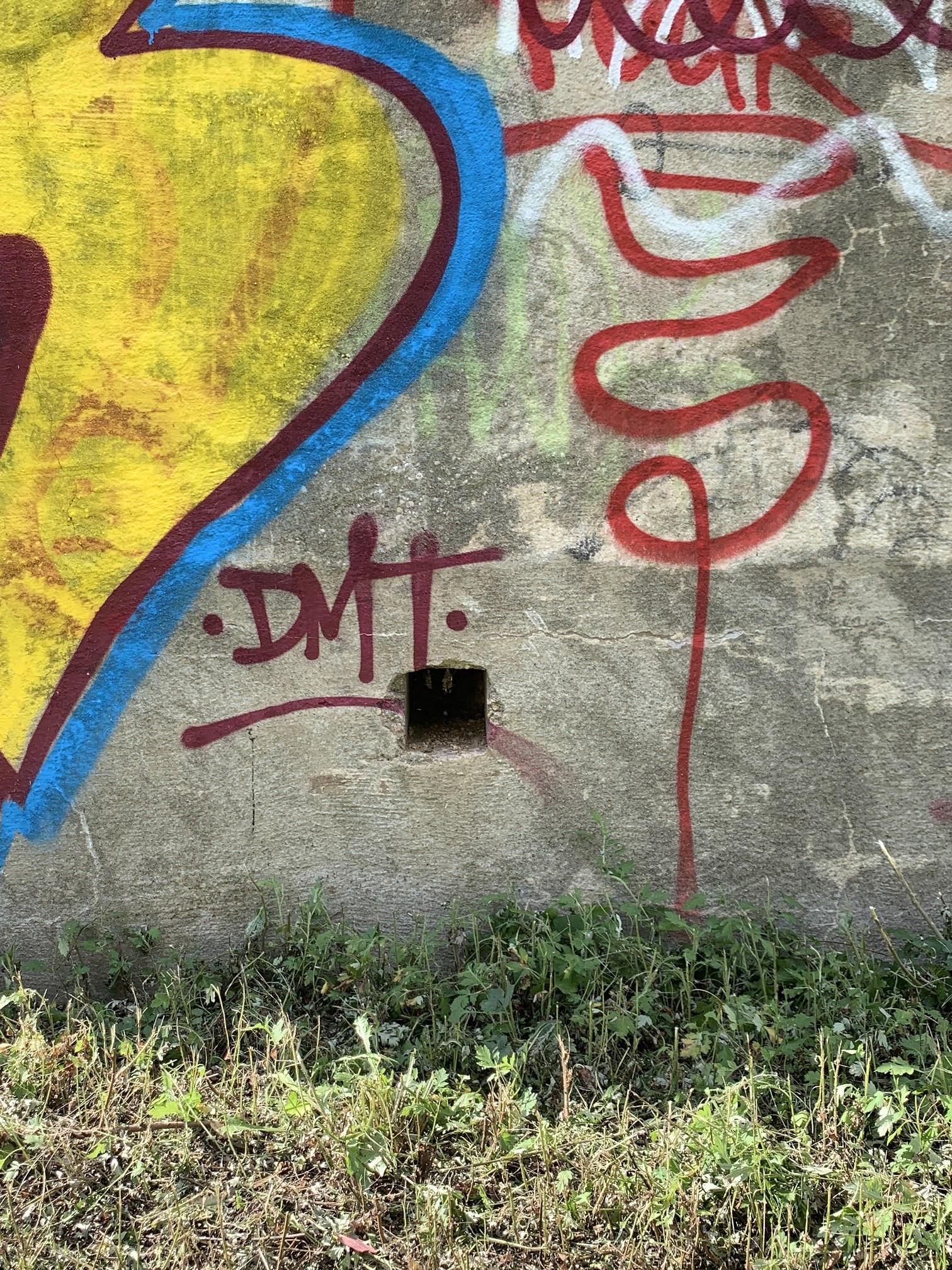
At the bottom of the north abutment are three holes similar to this and which are not on the south abutment. Might be for drainage purposes- any other ideas?


Comments
I’m fairly certain that the square openings towards the base of the abutment were for drainage. Too bad we didn’t check this out in 2005 when most of the dirt was cleared away, possible there was a stub of old drain pipe on the back side. Below are some LIMP bridges with square openings.
My favorite drainage image : )
I too, have been curious about the Lower Melville Schoolhouse that was on the S/E corner of Duryea & Maxess Rd that is witnessed as late on a 1984 aerial.Very obvious on the older aerials that a path was north from Ruland Rd, across the bridge towards the school. An image of the school was captured by Ron Ridolph around 1980, I then came across an older image, maybe from the 1970’s. Below is 3 images ( 2 from the site here in 2010, when none of us ‘met’ Maureen Standish yet. The 3rd one courtesy of Half Hollow Hills Library )
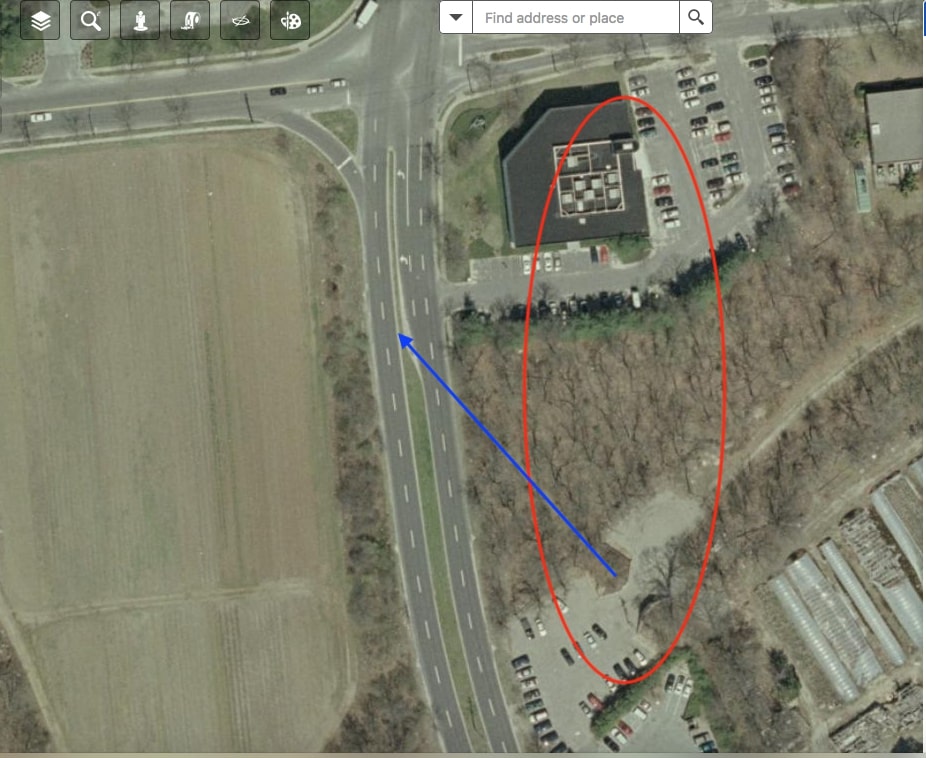
And here’s the 1984 aerial, and a current road map showing the location as a - School/Historic? There’s been the white office building there at least since 1994. Sure a few businesses operate within the building. Don’t think school administration offices operate within?
Great Drainage Brian! I’ve blatantly overlooked this fine detail in all the photos provided thus far. It now makes sense. A round opening would’ve been more appropriate for drainage. Why square? Aesthetics? Quite possibly with Vanderbilt’s high standards. It looks more like an electrical junction box. I believe you are right! I never tire of the Motor Parkway. Glad all these historical photos have been preserved for future generations to learn from.
Hello Art,
Great column; lots of good info; Looks like the start of a really nice series. The reference to Patchogue in the Sept. 1907 newspaper article caught my attention so I thought I would attach a photo of Judge Jaycox’s home at that time. It was on East Main Street near the corner of Route 112, currently occupied by a strip mall, TD Bank, and BP gas station. Looks like being a judge paid well even then.
Thanks Steve, let me know if there’s any other areas you want me to highlight over time. And yes, guess judges did ratther well back then!
Hello to All,
The white building (circa 1980) is the school house I first attended (kindergarten) in 1951. There were two rooms on the first floor and two in the basement. Classes were held on a half day basis. I lived in the Melville toll house (1949-1953) after it was moved from the LIMP. I think the school was called Sweet Hollow School. I sent some pictures to Howard a few years ago of both these buildings. Will dig out the old box of pics and see if I can find anymore pics. Just love this. It pulls at my heart strings each and every time this area is featured. I want to go back and just walk this area. Have made a few google map trips but the is a close to coming back. Thank you. 😊
P.S.
As the map of 1941 indicates, we did own four acres of land and my parents did by the farm from the Zapf family.
Some historical background at <http://sbiii.com/limpbrdg.html#duryea>. Sep and Oct 1999 photos at <http://sbiii.com/limpkwy4.html#crossng2> and (right after it) <http://sbiii.com/limpkwy4.html#duryea-x> (those blurs are BAD thumbnails - click on them for better pix - gotta fix that). Lastly, Jun 2002 through May 2005 pix at <http://sbiii.com/limpopen.html>. Sam, III
Regarding the schoolhouse on Duryea Rd., it is not from 1872. That schoolhouse was located on the southeast corner of Duryea and Maxess Roads. The Motor Parkway purchased the Smith property from his heirs in April 1910. In June that year the Parkway sold one acre of land on the east side of the school to district 15 for $300. It was on this land a new schoolhouse was built and has survived to this day.
Al Velocci - Okay, so I guess the schoolhouse that Ron Ridolph captured in the early 1980’s wasn’t built in 1872. Below are Images A - Lower Melville School & Outhouse built in 1863 etc, and B - New Lower Melville School built in 1872 etc. I wanted you to see these next to each other. Whom ever captioned these images were wrong about Image B. I’ll post another comment with images afterwards.
Al Velocci - You mention that the schoolhouse survives to this day. Below are 2 images - Current Historical Aerial Road Map displaying this area, still with ‘Lower Melville School’ ( Historical ), on the S/E side like we all understand. The school is definitely not at this location anymore, wether demolished or moved. The other is the ‘Tax Map’ for #88 Maxess Rd, public record of this location since 1995. One would have to visit the County Clerk in Riverhead for earlier than 1995. I visited once for my family history. If the schoolhouse we know of survives today, I don’t know where it went.
Brian, Thanks for the update, the last time I visited the area was when I wrote the book on the Parkway, getting careless and sloppy in my old age. Good to have a number of folks involved.
Here’s the office building on the corner.
Please Al, don’t be negative on yourself. The schoolhouse was such a nifty looking building. When I noticed the property was marked as ‘Historical’ on the base map, I was hoping that the building was re-located to be restored, etc. It was likely demolished. Glad you were paying attention and that “as usual”, you were aware of info that most of don’t : ) Thanks
Hello Edith,
By any chance, did you ever attend the Sweet Hollow Elementary School and if so, what time period? I attended from 1951 through 1953. It is the same building as shown (circa 1980 Ron Ridolph) and has the same windows on the other side. My class room was on the right side, ground floor of the building with very large windows.
Also, when you lived on the corner of Route 110 and Ruland, was it a large white wood sided farm house with green shudders on the windows? There was a porch that ran the width of the house and the house set far back from the roads. It was also directly across from the Farmingdale road intersection. In January of 1953, my family was in a terrible auto accident at that intersection and were shoved across rte. 110 and pushed into the trees on your side of the property. We were lucky we were not killed, as paint from the sides of the vehicle was left on a tree trunk and utility pole we went between.
Hope to hear from you.
Thanks.
Maureen Schimkat Standish