Update: Greg O’s Discovery: Then & Now- The Hidden Section Of the Motor Parkway in Cunningham Park, Queens

Dee and Greg Oreiro last April decided to duplicate the 1970 Queens walking tour of J.J. Conroy. Fifty years after Conroy's tour, Dee and Greg rediscovered a hidden section of the Motor Parkway.
August 4, 2020: My favorite co-author Al Velocci has forwarded photos of the hidden Fresh Meadows Motor Parkway section from 1998 and 2007.
Enjoy,
Howard Kroplick
.
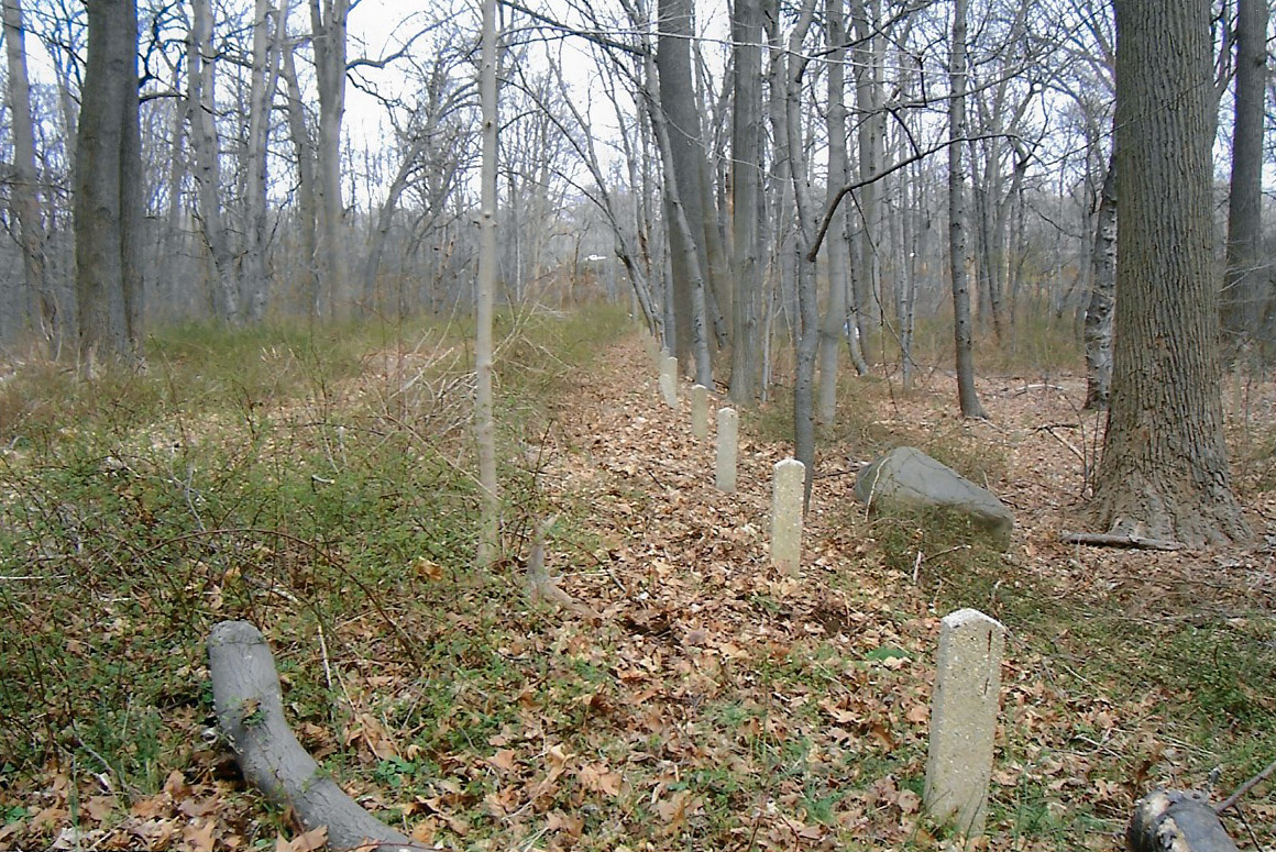
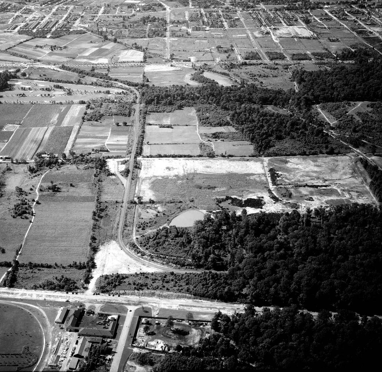
1998- Courtesy of Al Velocci
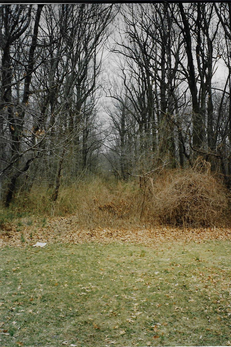
Al Velocci: Looking east from the east side of Frances Lewis Boulevard.
Al Velocci: Looking west towards Frances Lewis Boulevard. A line of concrete posts can be seen on the south side of the right-of-way.
Close-Up of the concrete posts.
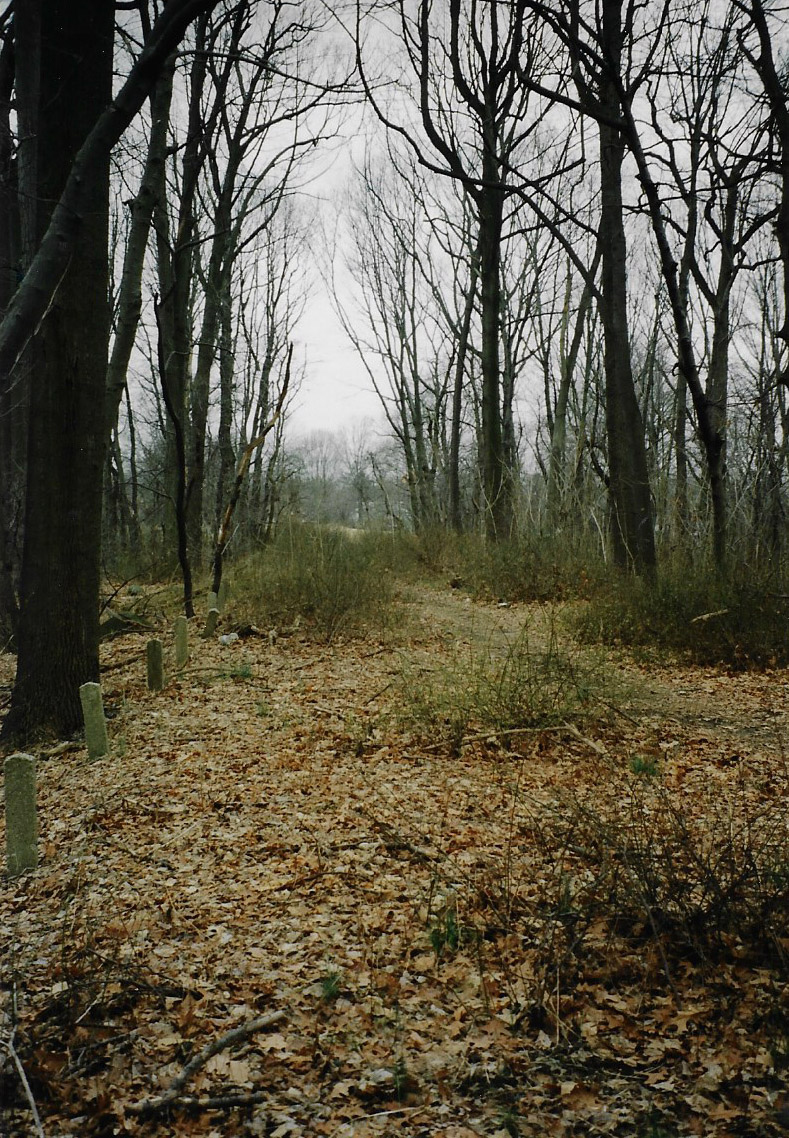
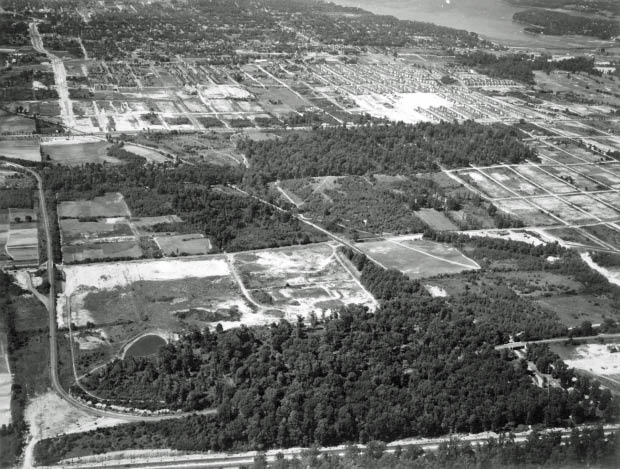
2007- Courtesy of Al Velocci
Al Velocci: Right-of-way in Cunningham Park in the same spot as in 1998.This section is between Frances Lewis Boulevard and the Clearview Expressway.
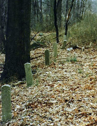
Al Velocci: The line of concrete posts on the south side of the right-of-way. The Clearview Expressway can be seen in the distance.
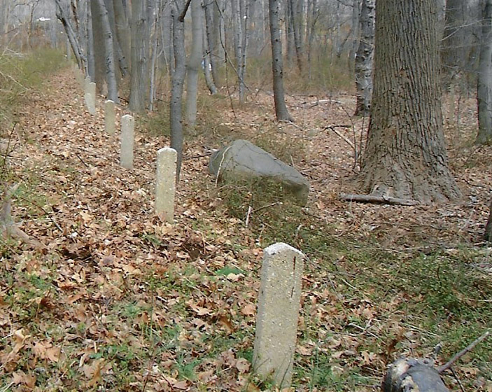
Close-Up of the concrete posts.
2020 Tour-Dee and Greg O.
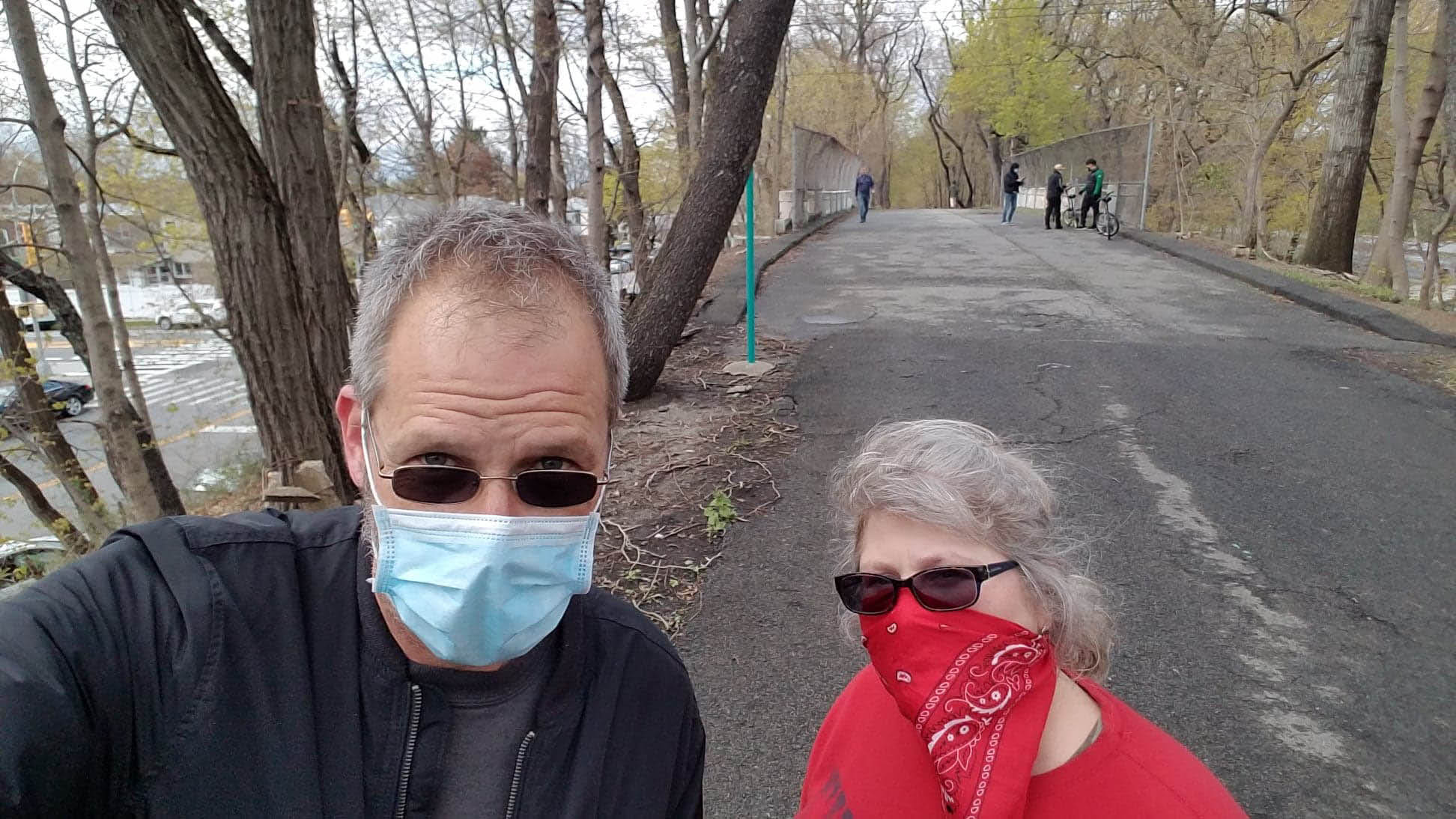
Last year, VanderbiltCupRaces.com re-posted images of J.J. Conroy's Queens 1970 walking tour of the Motor Parkway. These photos were first seen in Sam Berliner's LIMP History Page. In April 2020, during the COVID-19 pandemic, Dee and Greg O. decided to duplicate the tour from Creedmoor Hospital to the Fresh Meadows Terminus.
The first highlight in this series is a hidden section of the Motor Parkway located east of Francis Lewis Boulevard to the Clearview Expressway.
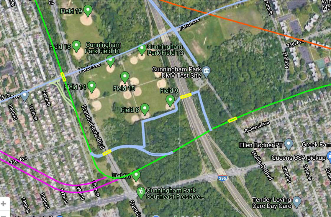
Greg O.: The green line represents the original LIMP Right-Of-Way. The light blue denotes the current pathway through Cunningham Park.The trail through Cunningham Park does not follow the original section at this point and original pavement is difficult to find with all the current overgrowth, but it's under there! Map image courtesy of Frank Femenias.
1938 Aerials
1970 Photos by J.J. Conroy of Sea Cliff Courtesy of Sam Berliner III
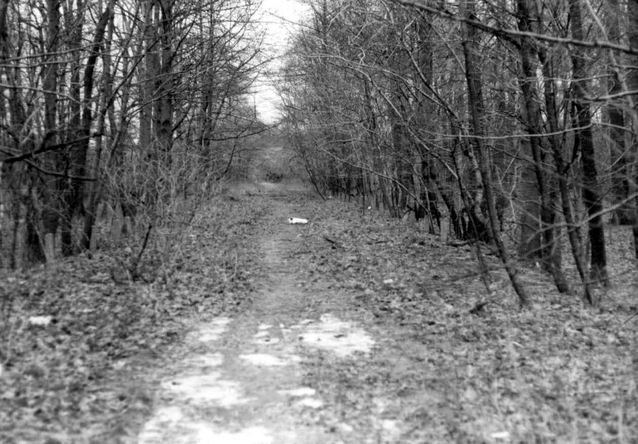
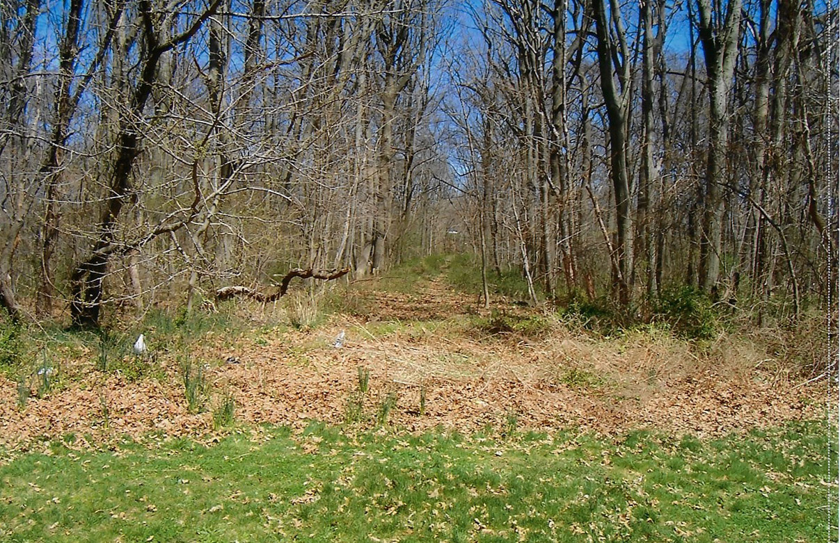
Greg O.: Looking West down the hidden original section of the parkway. The trail through Cunningham does not follow the original section at this point and original pavement is difficult to find with all the current overgrowth, but it's under there!
Now: 2020 Courtesy of Greg O.
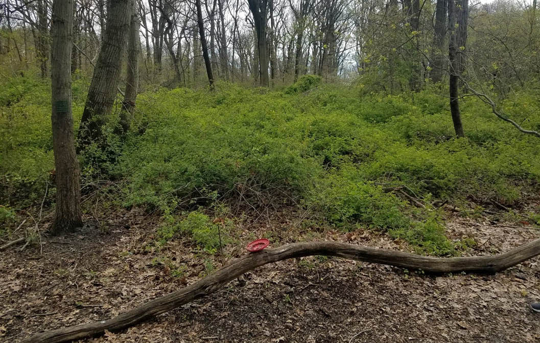
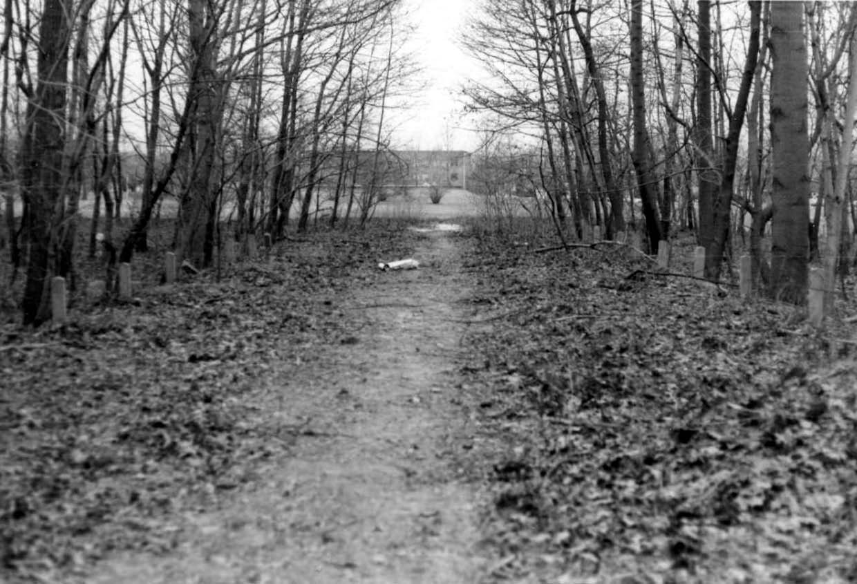
Greg O: This is the view looking directly West down what would be the straightaway before the original turn North at Francis Lewis Blvd. This original ROW does eventually meetup with the correct ROW on the West side of Francis Lewis Blvd. This point is almost impossible to follow now 50 years later.
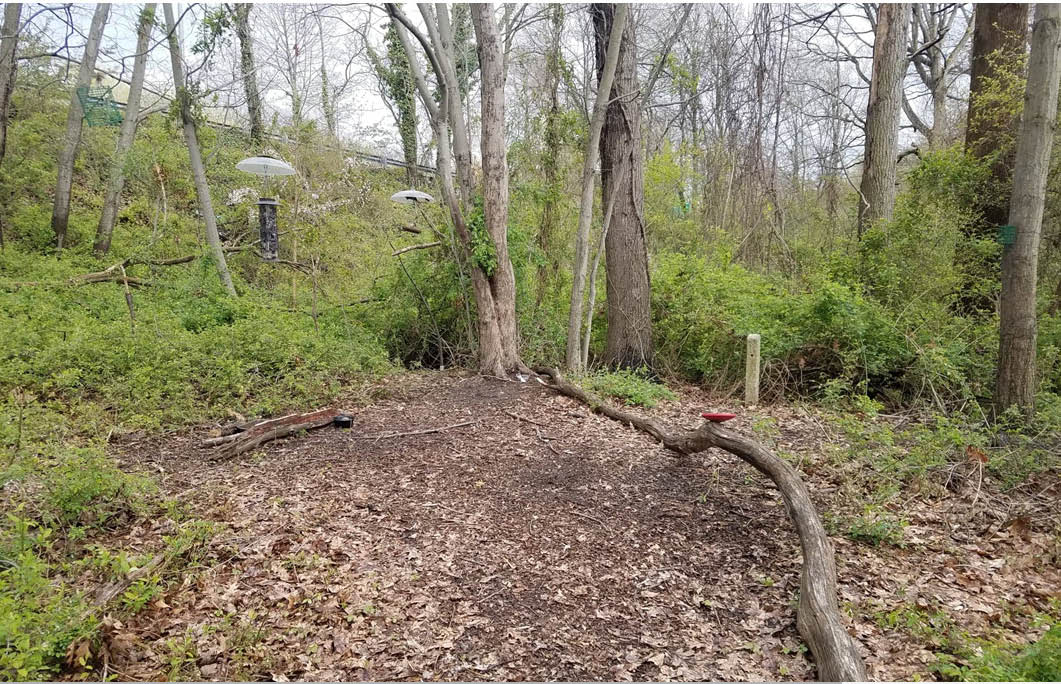
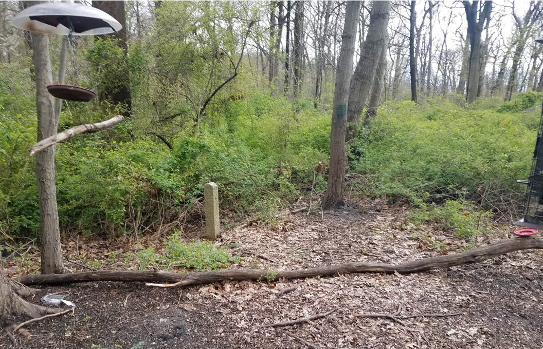
Greg O:This view is on the immediate West side of the Clearview where the original LIMP ROW exists. This current view is looking West with the Clearview Expressway at the top of the embankment in the upper left. It would appear that aside from all the obvious signs kids hang out back there after hours, there appears to be a few full bird feeders in some clearings. Note the post towards the center of the photo.


Comments
Good captures, Greg and Dee. As much as I appreciated our last mild winter, it also didn’t allow for the usual taming of foliage etc.
No so hidden from me. My friends and I would ride on it BEFORE the Clearview Expressway came in. Indeed, when the Clearview was under construction, we’d climb the earthen embankments with our bikes in hand and cross over.
In the 1938 aerials, PS 162, which was built in 1936, can be seen; 53rd Ave & 201st. Street. I grew up in a new 1953 house on 199th St. on the other side of Francis Lewis Blvd between 53rd Ave and the future 51st Ave and 199th St.; the area can be seen as a large grove of trees.
This is just GREAT! After all these years, more keeps on turning up! Thanks, Dee and Greg. Sam, III
I live in Hollis Hills and use the motor parkway every single day. I would love to organize a team to clear this old abandoned section of the parkway so it could be used as a trail. Thoughts?
Emmett- It is extremely overgrown there. At this point, you’d need some fairly sizable machinery to clear out what’s there.
Let’s do it Greg! Rent a tractor for the day!
Although harder to find since invasive species have taken over the forest, there is surviving roadway in the area Greg documents. Greg’s pictures shows a bikeway post, often mistaken for a parkway feature.
There is another hidden section that was the southern approach to the North Hempstead Tpke bridge. Today, the bikeway runs west of the parkway there. One can discover parkway by going north from the 73rd Ave bridge and finding the line of posts pictured or going south from the Holy Cow playground and climbing the “hill,” the remains of the southern bridge embankment. (This hidden area is even more impenetrable than Greg’s and contains spiky vines and poisonous plants.)
Nice work Greg and Dee! If Emmett’s clean up day should come up, count me in. As Greg hinted, heavy machinery will be required to clear out large toppled trees, and others still planted (lots of weight) in the area. A few years ago, the RoW was impossible to follow in some spots, and that was in late winter when foliage/insects were low. Brian and I found some posts still standing (roadway and RoW) on both sides of the roadway. This would be a great nature trail to preserve
I have been in contact with NYC parks regarding clearing out that area to make it a trail. I am going to reach out to the city again. Would be a nice trail if it connected to the Brooklyn Queens greenway somehow. It would be a days work with the right equipment and would make good use of the space. They are going to be start repaving and renovating other portions of the parkway soon. See some pics from spring.
I walked this this back in 2000 and took pics. Actually went back this spring and took pics , but it’s overgrown. I have a Lost Long Island FB page on the LIMP. The pics are there
Great post. Love finding this stuff. Great work Greg and Dee!
Back in 2016 Sam and I discovered this section. Click on this link to see some good pics and video from this location. It is really tough to see this stuff in summer w the vegetation, it’s much better to go in Feb or early March for optimum visibility.
https://www.vanderbiltcupraces.com/blog/article/sam_daves_excellent_lost_motor_parkway_adventure_i_clearview_expressway_que
Emmett - I agree with you reusing the unused historic space for a nature bike/trail. Though only 900 ft in length from Cunningham’s Field 6 to the Clearview Expwy, this achievement would benefit everyone, and easily accessed from Union Tpke. A simple northward spur from the Clearview Expwy dead end towards the existing Brooklyn/Queens Greenway would complete the circuit.
Sam Berliner III’s website reveals J.J. Conroy’s 1970s photos of this area was much clearer back then. Photos Conroy07 and Conroy08 is the same area in question. Link here - http://sbiii.com/limphst1.html
900 ft of wasted historic space is waiting for action. Let’s do it!
Thank Greg and Dee - always good to go back and compare. Here’s my exploration of the area from 2009.
https://www.freewebs.com/limparkway/cunninghampark.htm
For those not familiar with the posts (vertical concrete, not messages!), Art’s 2009 pix show the difference clearly. I’ve taken the liberty of attaching two; the heavy rectangular cross-section is a roadway safety-wire post (these held the wire in clips) alongside the pavement (others had through holes for twist-wire), while the thin triangular cross-section posts marked the RoW boundary (usually 50’ ). More posts on posts are posted at <http://sbiii.com/limposts.html> (where I see I’ll have to post more post posts, post-haste!). Sam, III
Dave - WOW 2016! Time continues to slip away, with no sign of slowing. You and Sam exploring the area that day was the same day Brian and I were there. You guys arrived earlier and we missed each other.
Frank—-equally as shocking as seeing old LIMP pictures is seeing your son/kid change from a tiny little dude in 2016 who loves hanging w his dad to a normal crazy teenager in 2020 who makes no sense! We were all there. It’s no surprise.
Yes Dave, I ditto that on this end as well. Best bet is to spend as much time as possible with kids, that will best guide them towards their future. I have three, one successful, and two struggling through this pandemic. They’ll make it. I’m here to see through it. Stick with them like glue, but don’t show as so
Howard, Regarding my photos of cement posts, when I took the photos I first had to clear a great deal of vegetation from them, I urge anyone visiting Parkway sections today to carry a pair of pruning shears with them and clear any growth around any remaining posts and cut back any new vegetation infringing on the ROW.
Surprised that no one picked up that the posts are not in their original alignment or height. The holes for the wires should be should in an east west not facing north south. ??? Also, at the time I took these photos, I cleared a large section of the Parkway’s surface at the west side of Francis Lewis Blvd. My guess is that it’s still there.
Al, I have a rep. to defend here! I actually did note the 90° alignment but got so involved in the rest of the material that I forgot to mention it. Excuses, excuses! Height didn’t catch me because so many posts are no longer at their original heights. When dug out for preservation (purloining?), those babies are LONG (and HEAVY)! Speaking of which, *IF* I can recover the post (from near the Commack Spur intersection) which I gave away, what should we do with it? As to clearing the RoW; you, Howard, and I are the practiced experts (ouch, ouch, ouch)! Sam, III
Sam, I’ve had my share of poison ivy, ticks, thorns while exploring. It’s a tough job out there but someone’s got to do it!
Art’s comment reminded me that when I lived in Mineola, I rode the nearby east-west LIMP segments on my bicycle and got numerous punctures from the broken glass (mostly beer bottles) that littered the RoW then! Dave and Sam(my) - how’d you make out in that regard? Sam (the Elder), III
Great clear photos and descriptions with this post! “Post”, a popular topic. (smile)
This area must of been cleaned up and maintained by someone during that time. The area is considerably overgrown now and it is only 13 years later. If this area was left untouched since the 1930s it would be much worse.
I have reached out to the city. I am going to reach out to local Queens council members as well. If you have any other suggestions to get this done please reach out to me.
Side note, does anyone have pictures or information about the construction of the two bridges going over Francis Lewis Blvd and Bell Blvd that were added at a later time? Would be something cool to see.
Thank you,
Sam, Your question regarding what to do with recovered posts. Yes they are heaving weighting 125 pounds with a height of 6 feet,6 inches. I donated one to the Wiliston Park Historical Society who attached a commemorating sign to it and placed it on the Parkway ROW near the Village swimming pool complex. I’m sure like organizations, perhaps with some encouragement, would love to have one and do something similar.
Good to see and very interesting