Kleiner’s Korner - Nassau County Surveys: Stewart Avenue & The Motor Parkway in Westbury and East Meadow
Surveys obtained from the Nassau County Dept. of Public Works indicate improvements to Stewart Avenue between Merrick Avenue and Carmen Avenue were planned during the decades that followed the 1938 closing of the Motor Parkway
Improvements required parcels of land, including the Motor Parkway ROW, to be retained or acquired and to be used to widen or extend current roads or for other public purposes.
1940
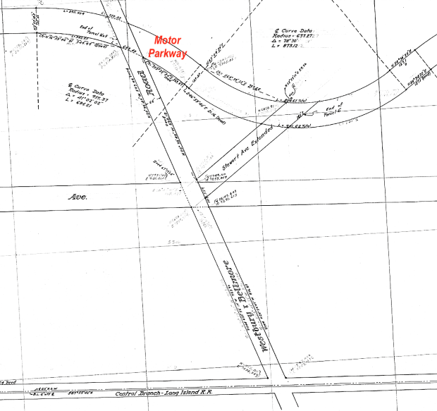
This 1940 survey details one set of parcels slated for improvements, including the extension of Stewart Avenue between Merrick and Carmen Avenues.
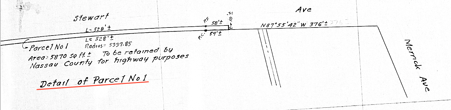
Starting from the west, parcel No. 1 on the south side of Stewart Avenue just west of Merrick Avenue was to be retained for "highway purposes".
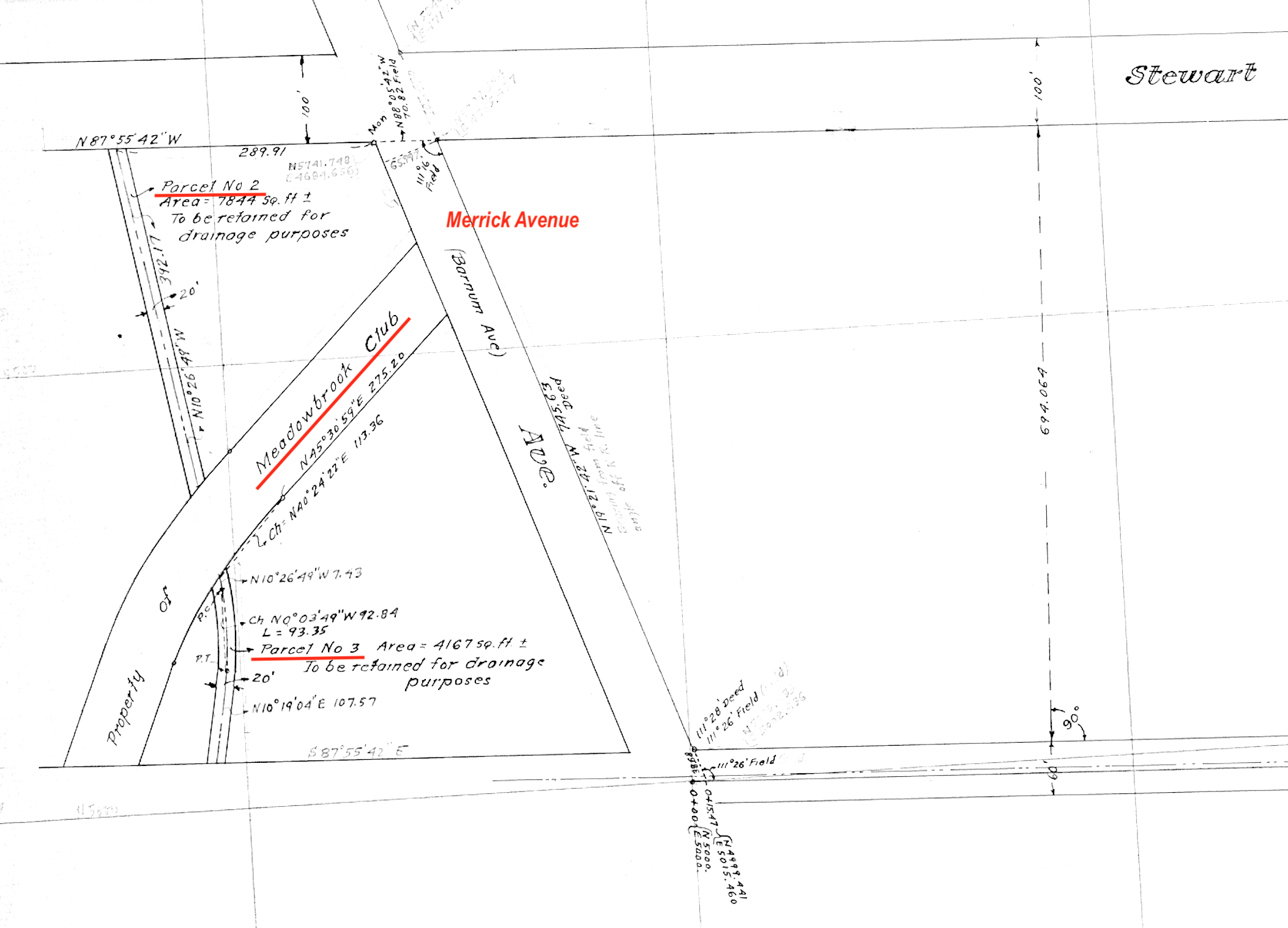
Parcels No. 2 and 3 included the area near the Meadowbrook Club also west of Merrick Avenue that were retained for "drainage purposes". Can anyone identify what those parcels were?
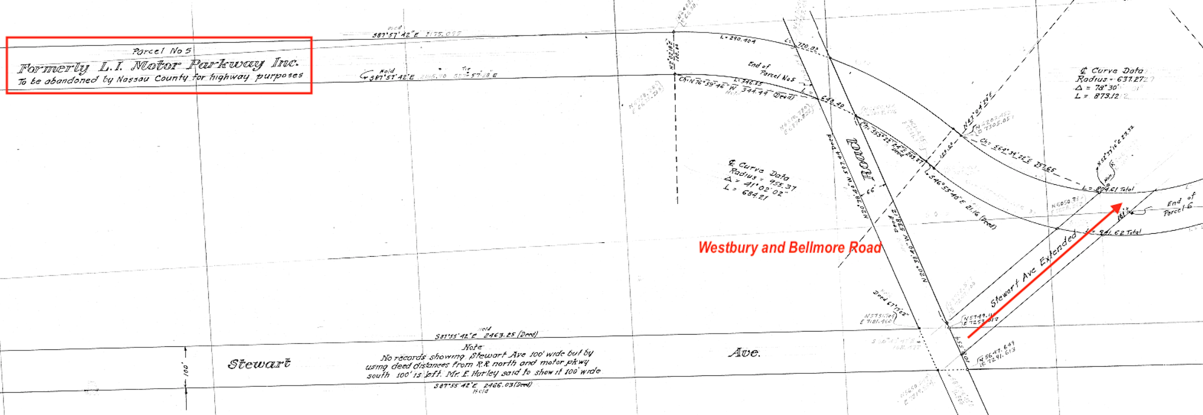
Parcel No. 5, the Motor Parkway ending at Westbury and Bellmore Roads (also known as Newbridge Avenue), was to be "abandoned for highway purposes".
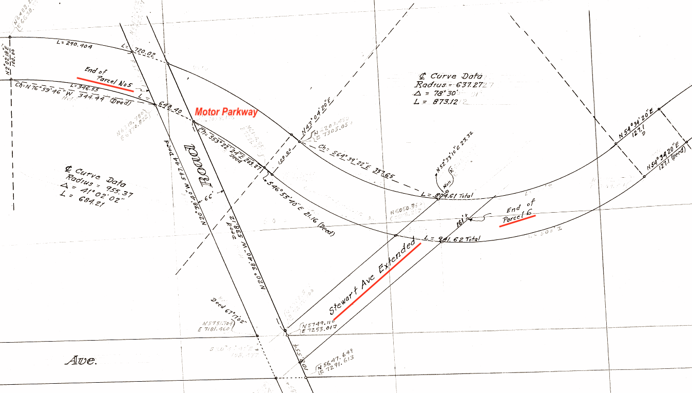
Detail showing parcel No. 6 including the Stewart Avenue extension to the Motor Parkway.
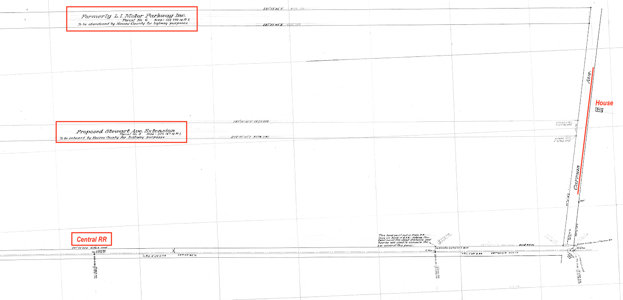
This is a wider view of parcels No. 4 (the Motor Parkway) and 6 (proposed Stewart Avenue extension) and the Central RR. Wonder whose house that is on the east side of Carmen Avenue.
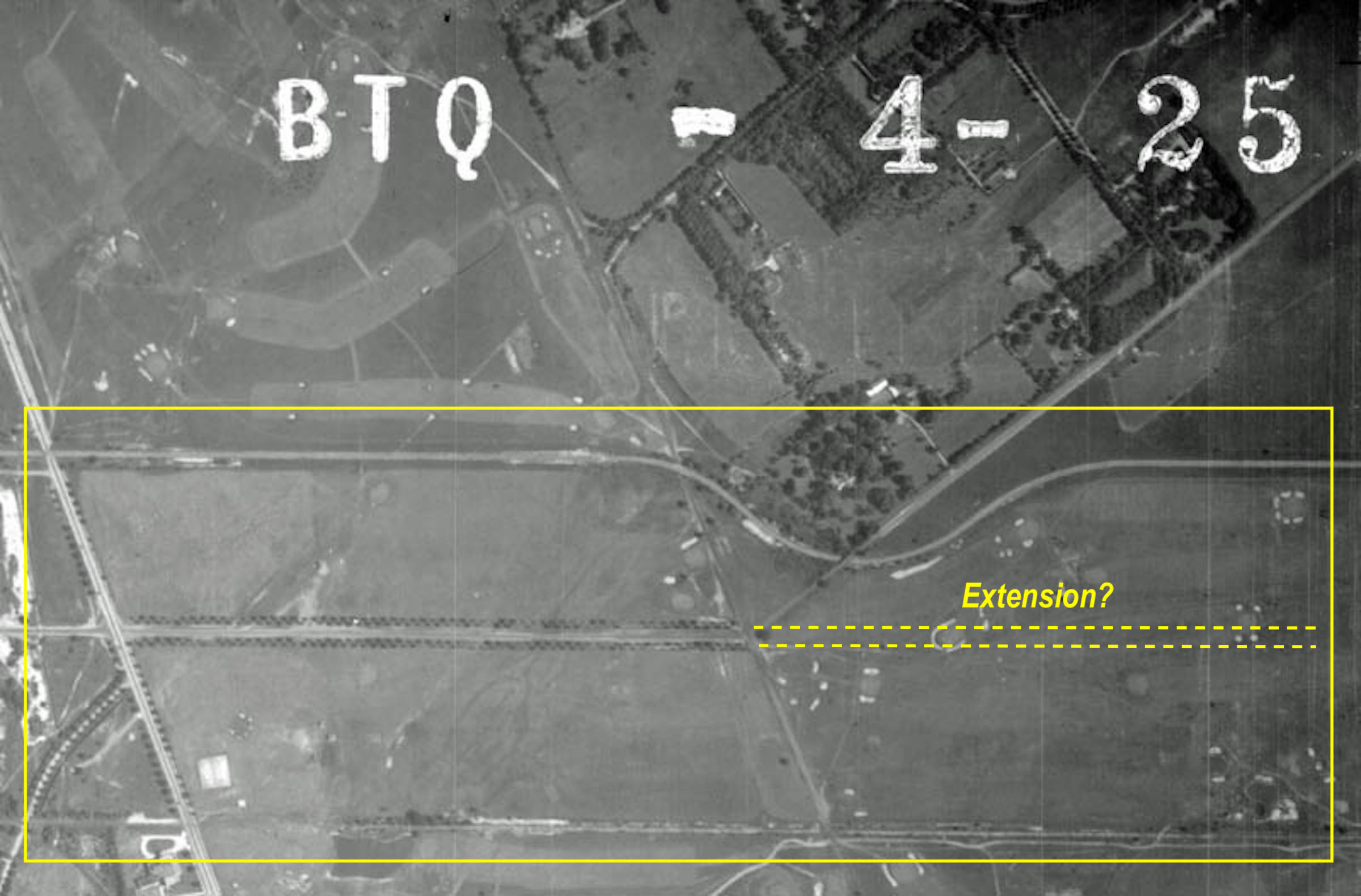
The area two years earlier in 1938.
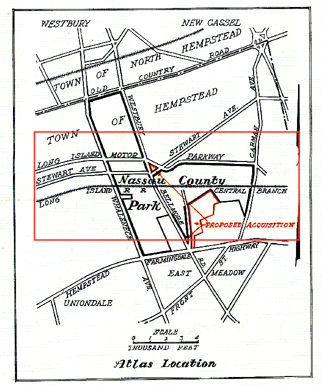
From a 1944 Nassau County booklet concerning the planned Salisbury Park (today's Eisenhower Park). The extension outlined above didn't occur in its planned location.
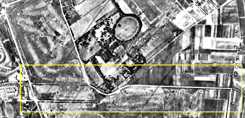
1946
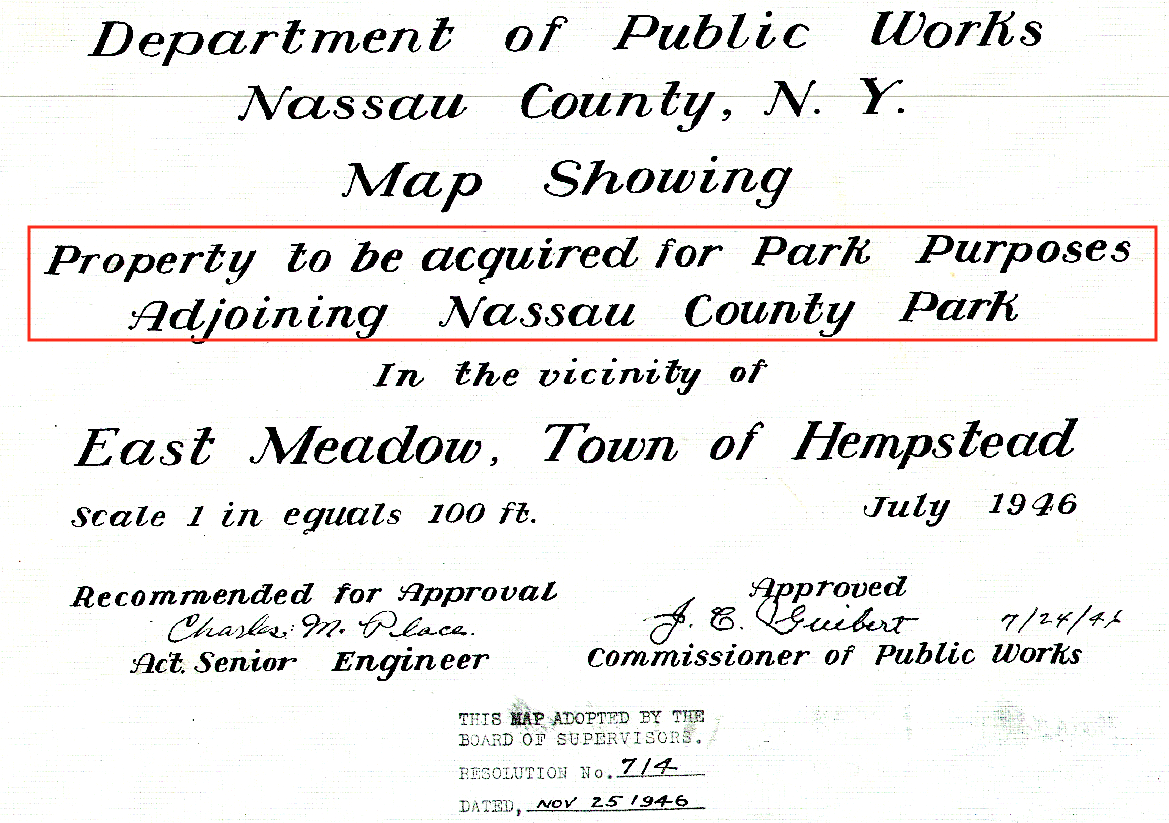
Many of the land acquisitions were intended for building or enlarging Salisbury Park.
This acquisition included a triangular parcel of land bordering the Motor Parkway, Westbury-Bellmore Road and Stewart Avenue.
1947
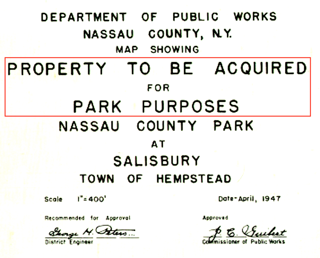
Additional property was bought for park purposes in 1947.
1952
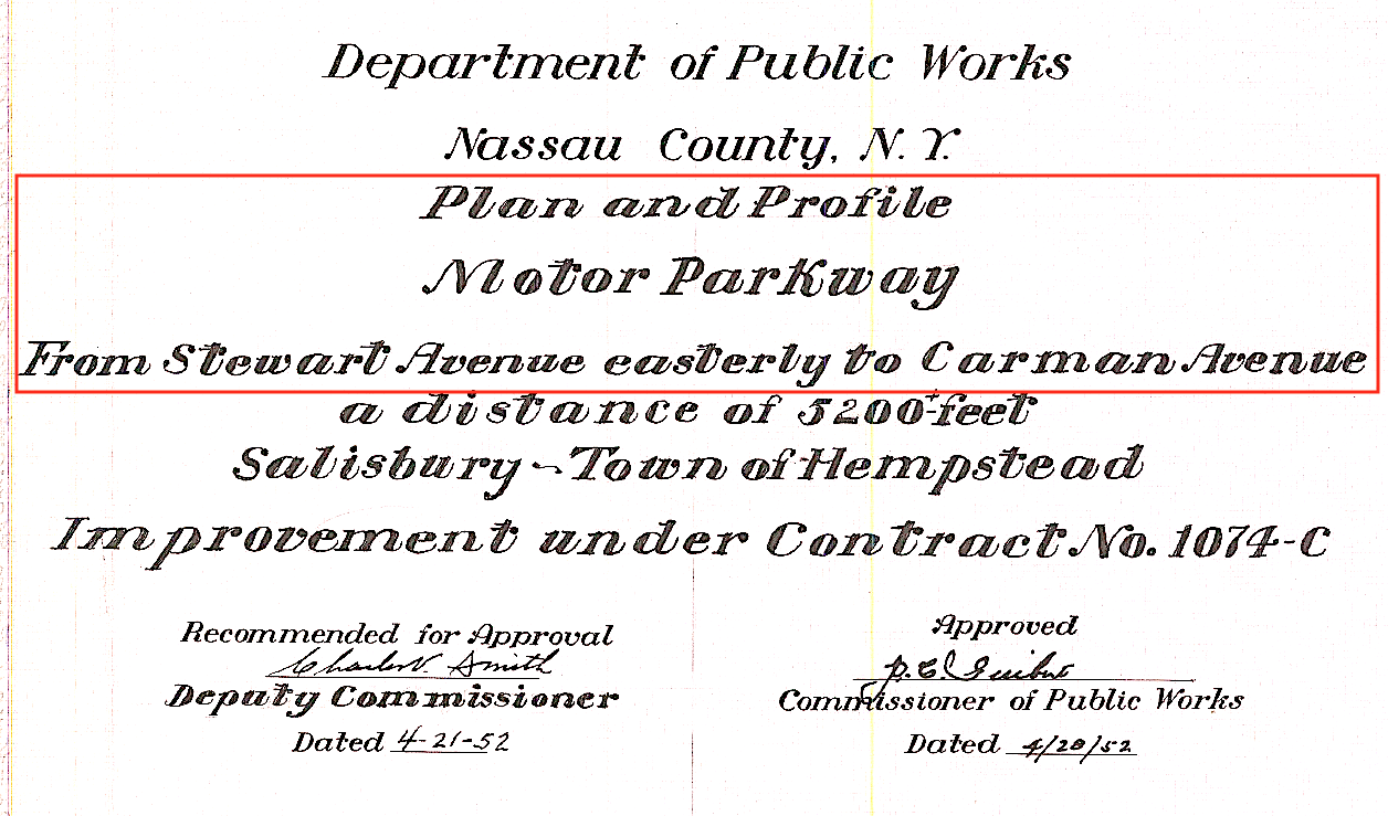
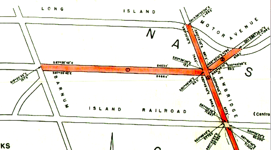
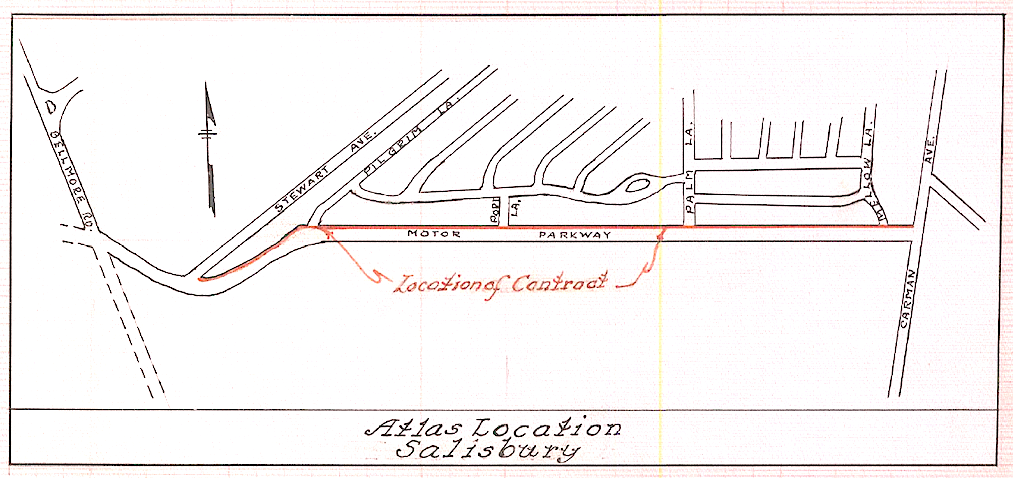
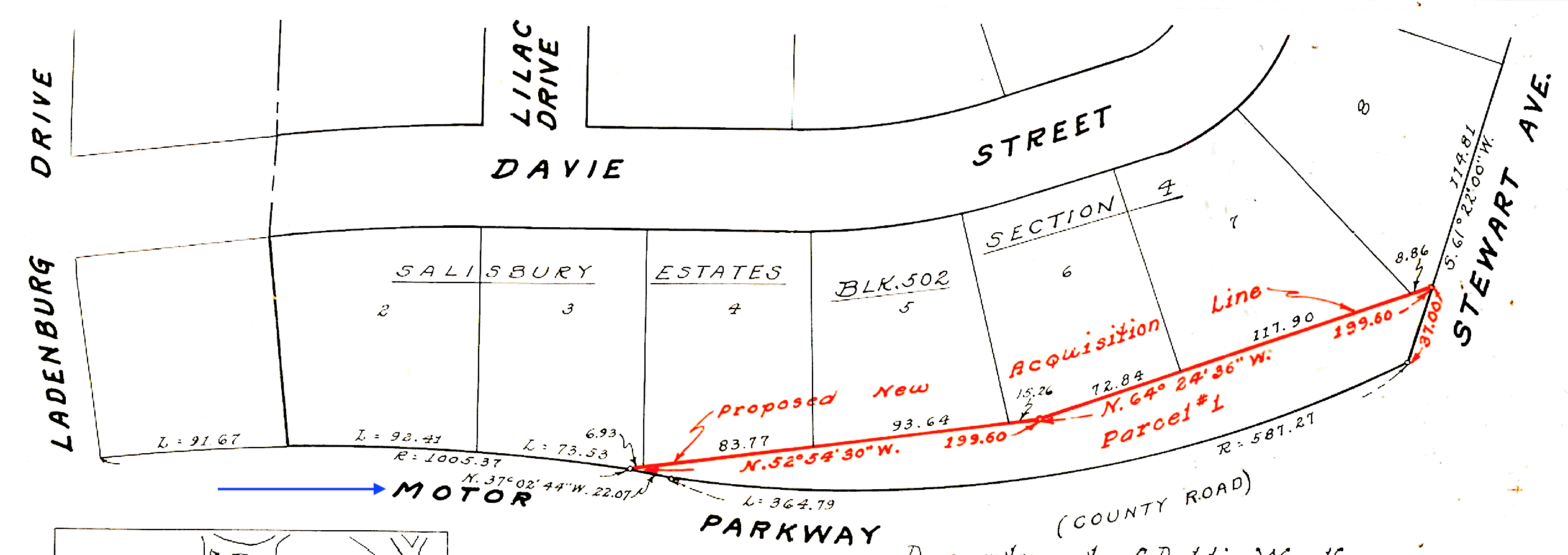
This 1952 survey details the improvements to the Motor Parkway between Stewart Avenue and Carmen Avenue.
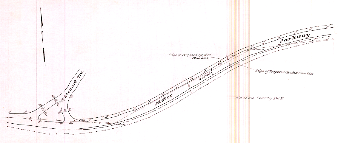
The Nassau County Park as noted on the survey is Salisbury Park.
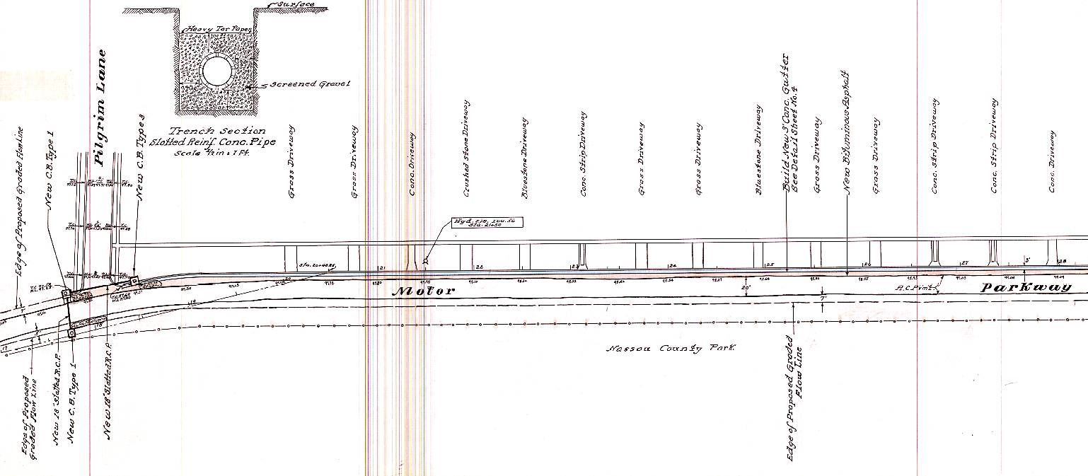
I find it interesting the survey notes the different materials used for each driveway along the Motor Parkway (i.e., grass, blueston, concrete).
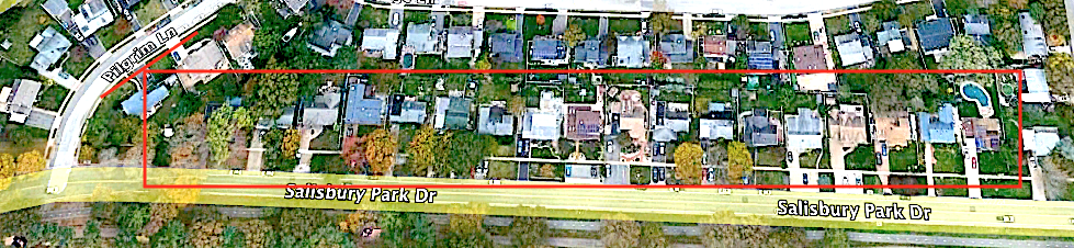
The driveways along the road today (Salisbury Park Drive).
1953
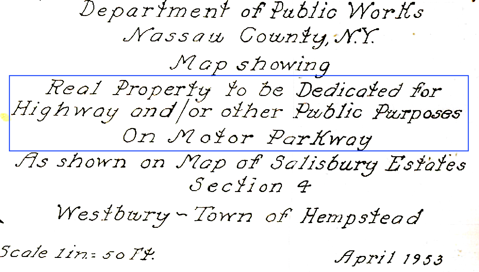
Improvements continued to the Motor Parkway in 1953.
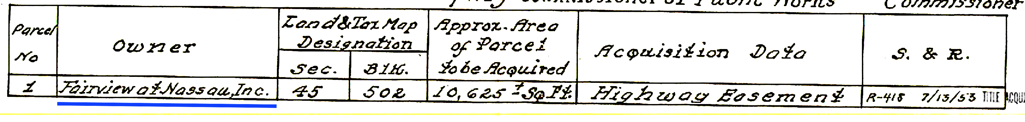
This parcel was purchased from Fairview at Nassau, Inc., the developer of the non-incorporated area of Westbury named Salisbury (which at times was also called South Westbury).
Encompassinmg 10,625 sq. feet the addition of the parcel appears to try to straighten the curve between Westbury-Bellmore Road and Stewart Avenue.
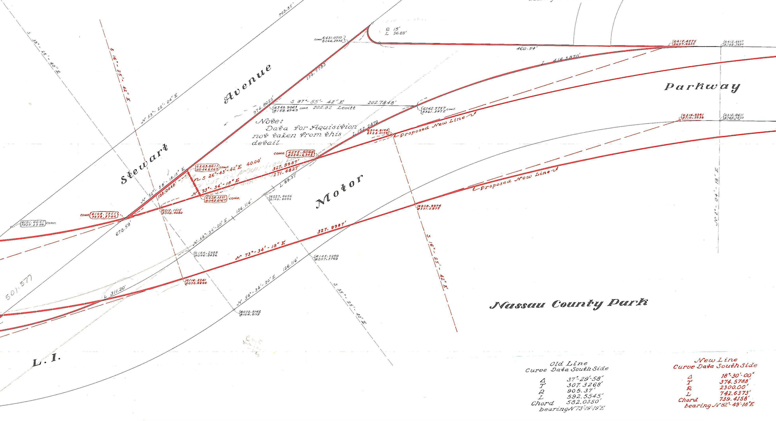
Rerouting of the Motor Parkway
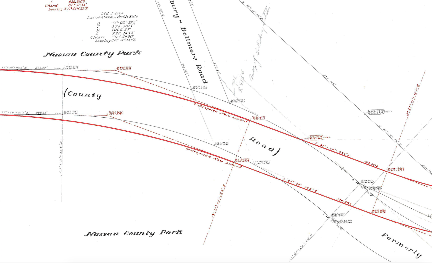
At some point during the same timeframe as the previous improvements, Nassau County rerouted the Motor Parkway near Salisbury Park slightly north from its original location as shown on these surveys. The red lines outline the proposed rerouting.
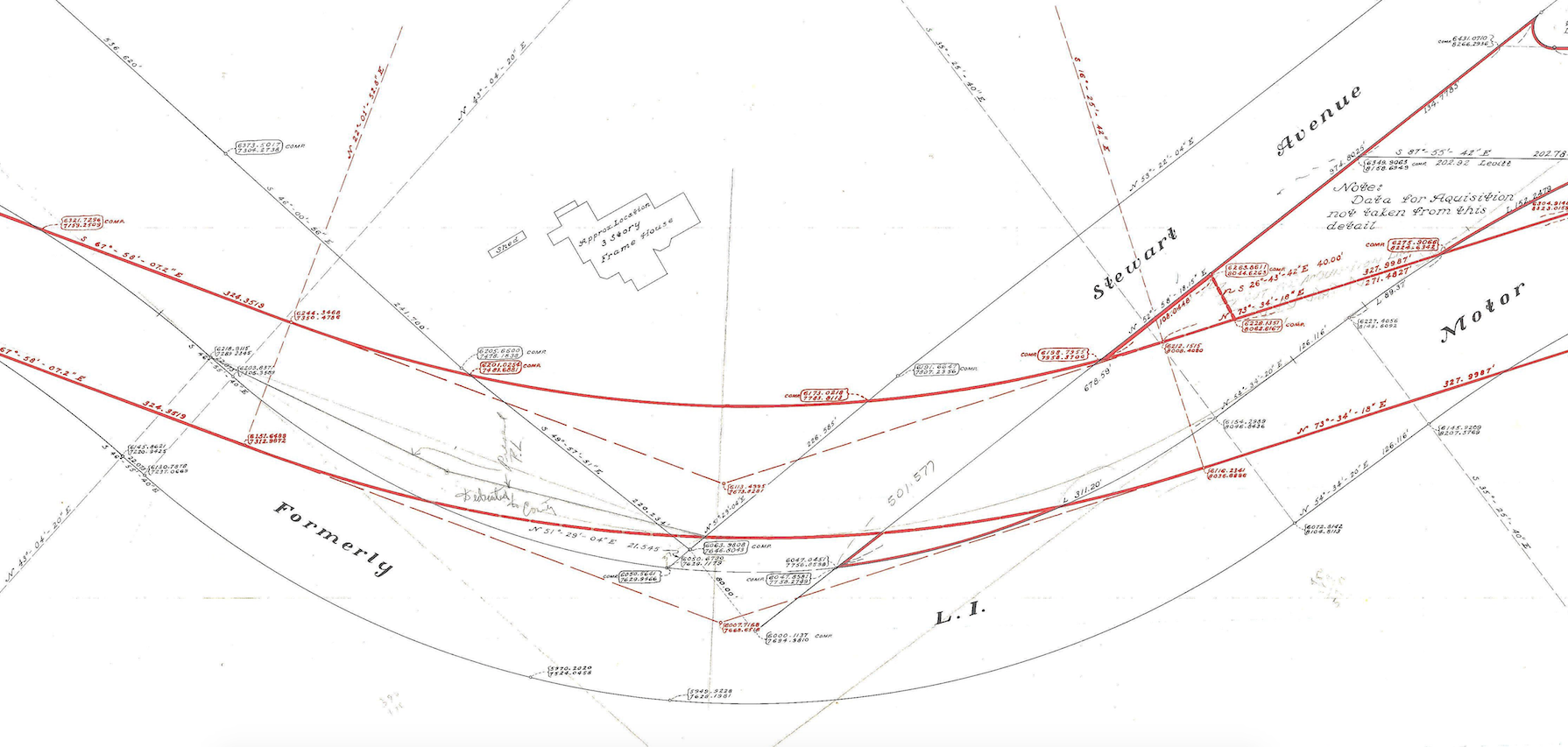
The rerouting appears to smooth out the degree of the curve near where the Motor Parkway intersected Stewart Avenue.
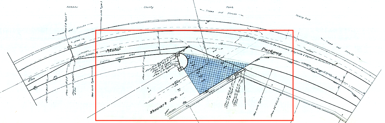
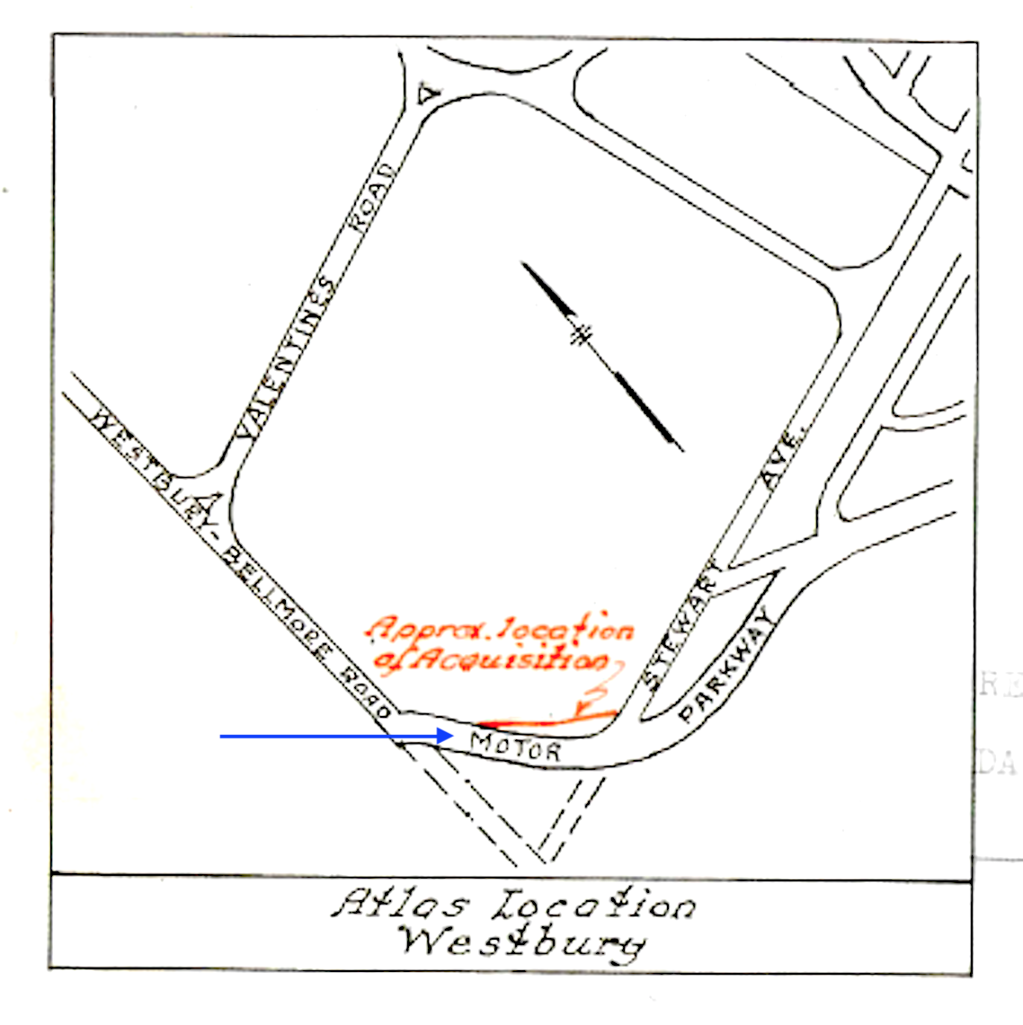
The intersection of Stewart Avenue and the Motor Parkway. Notice the Nassau County Park and parking field on the north side of the Parkway.
Any further information from the readership regarding the rerouting of this section of the Motor Parkway would be appreciated.


Comments
The second-last map appears to be inverted (north is at the bottom), so the Nassau County Park and parking field would be on the south side of the Parkway.
I think the drainage area that’s shown was always a drainage/ponding because of the streams north & south of Stewart Ave. Believe the water source of the pond in Eisenhower Park are the streams. There’s also the pond nearby within the Meadowbrook Parkway that’s connected. The water flows to the south shore.
Below are 2 - 1950 maps that basically ditto Arts maps. LRV map shows the current and past roads. You can see how the curve was eased like Arts map shows. Also the home on the east side of Carman Ave is there. Census map names the property- Schneider. We know now today that’s the NC Corrections Facility.
Thanks Al, the inverted map as you point out clarifies where the park is. Makes absolute sense!
And Brian, I’m always ready to hear your answers to my questions. Thanks.
On the 1950 census map, the stretch of the Motor Parkway parallel to Gasser Road did not become Salisbury Park Drive. Instead, Salisbury Park Drive occupies that stretch of Gasser Road south to where the Parkway curved to the left. South of that curve, the road is now called Old Westbury Road. A small part of Gasser Road (renamed Bob Reed Lane) remains, intersecting with Carman Avenue at the firehouse. That part of the Parkway is now occupied by the Knolls apartments. I’d be interested in the history of land transactions on this stretch of the Parkway.
Fun Fact: The Salisbury Steak was named after Salisbury Park, after J.H. Salisbury’s application for a permit to sell a gravy-covered hamburger in what is now Eisenhower Park was vehemently rejected.
Howard Kroplick: Real fact: Salisbury Steak was named for Dr. James Henry Salisbury who first described it in 1888 https://www.smithsonianmag.com/arts-culture/salisbury-steak-civil-war-health-food-18584973/
Howard, I was hoping everyone got the joke and could use the laugh. Thanks for the information because I actually didn’t know. Still not going to order it though…
Howard Kroplick: Thanks, Frank. Funny, but it is oddly believable.
Frank Drebin, if you’re interested in the history of the Long Island Motor Parkway, consider joining as a member of the Long Island Motor Parkway Preservation Society (LIMPPS), free of charge. There’s much left to uncover this amazing history of early Long Island.
1940 - Parcels 2 & 3 - ‘To be retained for drainage purposes’. Could this be a clue as to the disappearance of the second CRRLI train trestle once located very close to the extant one which ran over Meadow Brook Club Road?
Could improvements of drainage in the area have allowed the removal of the second trestle as standing water might not have been a concern to the same degree it had been previously?
Lee, great find of the 1940 map! The Meadow Brook on the map clearly reaches Merrick Av, but also appears to be designated as a boundary line as well, perhaps separating properties. Not sure.
It’s more clear now that a culvert was necessary under the Motor Pkwy’s bridge over Merrick Av. There was obviously a drainage problem.
Amazing how this 1940 map omitted the then defunct Motor Pkwy just two years earlier, yet the roadway and bridge was still intact!
Lee, as I understood in an earlier post, the extant bridge that once carried CRR over the Meadow Brook Club Road was the second bridge built in the area, after the original bridge just to the west was deemed unnecessary after its flooding problems were resolved. I’m not sure.
All comments are appreciated.
Frank, Re; Meadow Brook… The name of the creek was always East Meadow Creek and it’s southern terminus was the Freeport Canal. When the City of Brooklyn built the water conduit system in Nassau County, East Meadow Creek was tapped to supply 5,000,000 gallons per day to that end. Those bodies of water along the Meadowbrook Parkway are part of the East Meadow Creek.
Great info Al!
I was unaware that Brooklyn’s water source stretched as far east to Freeport. The pumping stations along the Conduit have all been
removed
Frank Femenias, Actually the pumping stations, gaging buildings, and much of the “Brooklyn Waterworks” infrastructure still exist out through Massapequa, running along Sunrise Highway, although overgrown in many areas. Some is owned by Nassau County, some by the Town of Hempstead, and some of the gaging stations are still maintained by the USGS. For example, the TOH Twin Lakes Preserve still contains some of these structures. The building at the entrance to Nassau County’s Massapequa Preserve still retains the inscription “City of New York / Massapequa No. 1 Pumping Sta.”
Two pictures of what Gary is referring. Massapequa (Sunrise Highway) and Wantagh (Twin Lakes). I had taken pictures of the structures but can’t find them anymore. But I think you get the idea.
Amazing facts Gary! I ride my bike often through the preserve and never connected the conduit and pumping station this far east into Massapequa. Thank you for clarifying.
Art, It appears that the revised route of the Motor Parkway at Stewart Ave. is quite substantial. The drawing with the three story frame house has the new route more than 100 feet north of the original ROW.
Frank Femenias, If you have an interest in Nassau’s Water Supply, I would suggest reading the late Richard A. Winsche’s article “When Nassau Supplied Brooklyn’s Water”, published in “Nassau County: From Rural Hinterland to Suburban Metropolis”, ed. Joann P. Krieg & Natalie A. Naylor, Empire State Books, 2000. Richard had served as Nassau Co. Museum (NCM) System’s Historian for nearly 3 decades. In addition, back in 1990 a report was created by the NCM on the “Brooklyn Water Supply Buildings in Nassau County Preserves” with the goal of preserving these historic structures. Unfortunately, economic downturns and staff layoffs prevented this from happening. Actually, N.Y.C. still used Nassau Co. wells as late as the mid-1950’s. although parts of the watershed properties had been transferred to the LISPC in 1925. Nassau Co. purchased its parts in 1981 & 1986. In 1990 there were still one Gate House, 3 Pumping Stations, and 2 Gaging Stations under NC control, located at Massapequa Preserve, Wantagh Preserve, Merioke Preserve, and Roosevelt South Preserve. Other ones still exist on the north and south sides of Sunrise Highway, hidden away. Here’s a few postcards from my collection of the reservoir and Gate House at Bellmore (looking west with LIRR on left), and Wantagh (so I’ve been told Wantagh, where the Parkway now runs) or possibly also Bellmore looking east with LIRR on right. These were ornate structures built in the 1890’s - notice the ornate cast-iron bridge, and the stone faced reservoir walls, typical of all the waterworks properties.
Frank, And here’s the long demolished Milburn or Baldwin Pumping Station, designed by well-known architect Henry H. Richardson in the Romanesque style, also at one time owned by Nassau County, until deemed surplus property. Notice the LIRR tracks in the foreground, between the Pumping Station and Gate House, prior to the elevation projects of the mid-20th century. This was a great vaulted building in red sandstone and terra cotta work.
Frank, thank you for the invite and information. I’ve been a follower on here for quite a long time.
Wow, much thanks Gary!