A 1923 Property Map of Nassau County Highlighting the Motor Parkway
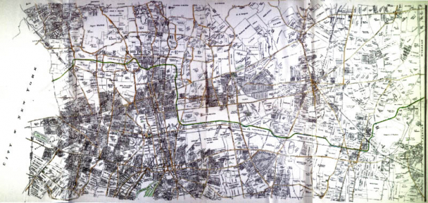
This unique 1923 map featured the property owners of Nassau County.
In the following close-ups, I have highlighted the Long Island Motor Parkway from the borders of Queens and Suffolk County.
Enjoy,
Howard Kroplick
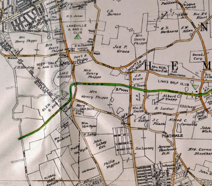
Lake Success and Searingtown. Note the lost village of Platsdale and the estates of the Phipps and Grace families.
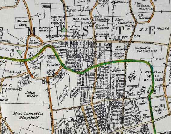
Searingtown and East Williston. Note the large amount of propery owned by the Motor Parkway in Searingtown.
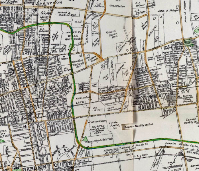
Mineola and Garden City. The Lannin Realty Company was owned by Joseph Lannin. From 1913 to 1916, Lannin and a group of investors owned the Boston Red Sox and signed a promising lefthander named Babe Ruth. The Intercollegiate Golf Club became the Old Westbury Club.
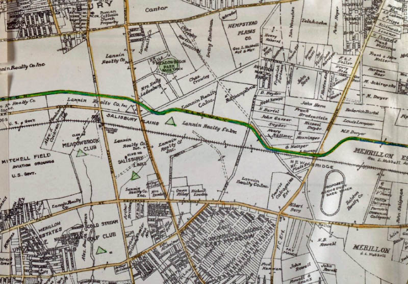
East Meadow and Hempstead Plains (Later Levittown). Note the "Proposed Acqueduct Race Track".
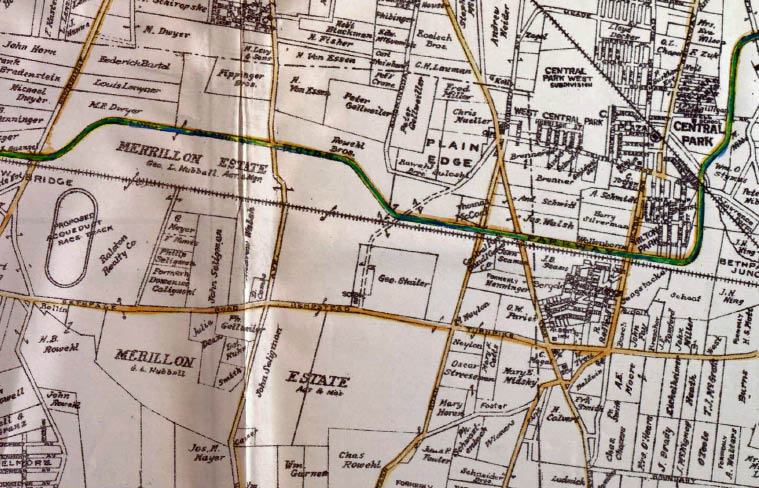
Hempstead Plains, Plainedge and Central Park (later Bethpage). The Merillon Estate was one of several real estate firms formed in 1893 by the heirs of A.T. Stewart.
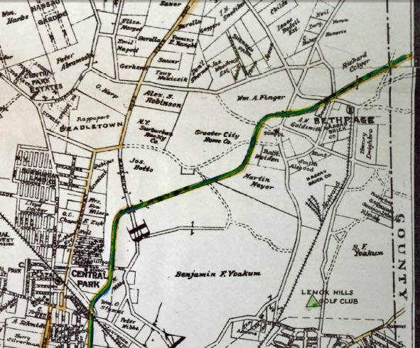
Central Park (later Bethpage) and Bethpage (later Old Bethpage).


Comments
It’s nice to have these maps in this format, thanks Howard. I’m thinking of St George lake near Herricks Rd and Shelter Rock Rd. Is it dried up? I remember a depression on the ground in this area. Maybe it was linked with the “swamp” just on the w/s of Shelter, near the LIMP. I’ll have to poke around to find a Suffolk County LIMP map like this one.
Fantastic pre-parkway map Howard, the established roads make this easy to figure out where the present day stuff is. Wouldn’t it be cool to see some overlays with present day locations, Mike.
Cool
Mike LaBarbera reminds me of one of our original Motor Parkway Panel goals, to coordinate all these maps over a current USGS Topo Map (or, at least, over the latest Hagstroms) as overlays. We never got that far, although the Nassau County Parks proposal maps:
http://sbiii.com/limpnass/limpncpk.html
and the Nassau County aerial series of 1926, 1950, and 2000 were sure a good start. If I ever posted the latter, I can’t find it, so I think I’ll do so next - stay tuned here! Sam, III
In response to Brian McCarthy’s question regarding St. George Lake. Happy to report the lake is well and always has water. The Town of North Hempstead recently cleared the surrounding areas of overgrowth, enclosed the lake with a lovely wrought iron fence and provided benches. The low lying areas north of the lake on both sides of Searingtown Road drain into the lake. If you wish to see what the area looked like before Searingtown Road was built, (Previously Manhasset Ave.), stop in at the Shelter Rock Library and ask to see the photos I donated to the Library a couple of years ago. Al Velocci
Mike LaBarbera reminds me of one of our original Motor Parkway Panel goals, to coordinate all these maps over a current USGS Topo Map (or, at least, over the latest Hagstroms) as overlays. We never got that far, although the Nassau County Parks proposal maps:
http://sbiii.com/limpnass/limpncpk.html
and the Nassau County aerial series of 1926, 1950, and 2000 were sure a good start. If I ever posted the latter, I can’t find it, so I think I’ll do so next - stay tuned here! Sam, III
Oh, dear! I was VERY disappointed in what I turned up (so far) but I posted it anyway:
http://sbiii.com/limpnaer.html
At the very least, you’ll get the idea.
Sam, III
Thankyou, Mr. Velocci. That’s good news. I would come across this area during work, (Lilco, National Grid). I don’t have the ability to get around as in the past with my parkinsonism. Libraries are one of my favorite places, and one you spoke of is in LIMP territory.
The correct spelling of the realty company’s owner was “Lannin”.